
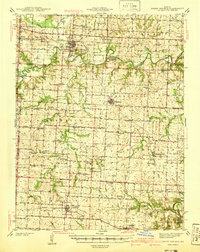
1941 Map of Sweet Springs
USGS Topo · Published 1941About this map
The Blackwater River and its numerous tributaries, including the South Fork Blackwater River and Davis Creek, define the agricultural landscape across the border of Saline, Pettis, Lafayette, and Johnson Counties. In the late 1930s, the Missouri Pacific railroad anchored the southern portion of the region, serving the towns of La Monte, Dresden, and Hughesville. The survey reveals a dense network of rural infrastructure, with one-room schoolhouses like Sunny Dell Sch, Rose Valley Sch, and Elder Ridge Sch positioned to serve the farming families of the Salt Pond and Houstonia townships. Notable local landmarks include the Pumping Station near the Heath Creek and the High Hill Cem in the east. This era shows the transition of local travel onto early state routes like Highway 40 and Highway 127, which began to parallel the older rail and river corridors that originally dictated settlement patterns at Sweet Springs and McAllister Springs.
Find a feature on this map
77 named features on this map. Tap any name to fly to it.
Don’t see what you’re looking for? This feature index may not catch every label — zoom into the map to look around manually.
Map Details
Editions of this 1941 Sweet Springs Map
2 editions found
Other maps of this area

1885 · Warrensburg
USGS Topo · 1:125,000

1887 · Sedalia
USGS Topo · 1:125,000

1887 · Warrensburg
USGS Topo · 1:125,000

1889 · Lexington
USGS Topo · 1:125,000

1890 · Marshall
USGS Topo · 1:125,000

1892 · Marshall
USGS Topo · 1:125,000

1894 · Sedalia
USGS Topo · 1:125,000

1894 · Warrensburg
USGS Topo · 1:125,000

1901 · Marshall
USGS Topo · 1:125,000

1917 · Knobnoster
USGS Topo · 1:62,500