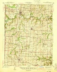
1941 Map of Sweet Springs
USGS Topo · Published 1941About this map
The Blackwater River and its numerous tributaries, including Davis Creek and Wolf Creek, define the central Missouri landscape at the end of the 1930s. This survey captures a dense network of rural infrastructure, with small communities like Sweet Springs, Houstonia, and La Monte serving as anchors for the surrounding farmsteads. The southern portion of the map is dominated by the Missouri Pacific railroad corridor, while the north is marked by family-named schools such as Armentrout Sch and Weber Sch, reflecting a time when localized education and worship were the cornerstones of county life.
Find a feature on this map
75 named features on this map. Tap any name to fly to it.
Don’t see what you’re looking for? This feature index may not catch every label — zoom into the map to look around manually.
Map Details
Editions of this 1941 Sweet Springs Map
2 editions found

Other maps of this area

1885 · Warrensburg
USGS Topo · 1:125,000

1887 · Sedalia
USGS Topo · 1:125,000

1887 · Warrensburg
USGS Topo · 1:125,000

1889 · Lexington
USGS Topo · 1:125,000

1890 · Marshall
USGS Topo · 1:125,000

1892 · Marshall
USGS Topo · 1:125,000

1894 · Sedalia
USGS Topo · 1:125,000

1894 · Warrensburg
USGS Topo · 1:125,000

1901 · Marshall
USGS Topo · 1:125,000

1917 · Knobnoster
USGS Topo · 1:62,500