1980s Maps of Polk County, Missouri
Explore 4 historic maps of Polk County from the 1980s. These maps offer a rare glimpse into what life looked like during the 1980s — showing old roads, neighborhoods, homes, and landmarks that have changed or disappeared over time.
Whether you're researching your family's past, planning a metal detecting trip, or studying how Polk County's landscape evolved across the 1980s, these high-resolution maps are a powerful tool for exploring the history of this region.
- Focus on a specific era: All maps on this page are from the 1980s, giving you a focused view of this time period.
- See what’s changed: Compare century-old streets, trails, and buildings to today's modern landscape using overlays and satellite layers.
- Research with precision: Use these maps for genealogy, historical research, land use analysis, or educational projects.
- View, download, or print: Maps are fully viewable online in high resolution, and can be downloaded or printed for your own records.
Start exploring Polk County's history through authentic maps from the 1980s. This is your window into the past.
Polk County, MO maps
(4)- 1980 Map of Elkton, 1982 Print
 1980 Elkton1982 Print · USGSHickory County's rural landscape is captured here in the early 1980s as the regional topography transitions from river valley to reservoir. Genealogists and land researchers can trace the small settlements of Elkton and Rondo alongside the banks of Weaubleau Creek.
 - 1980 Map of Sentinel, 1982 Print
 1980 Sentinel1982 Print · USGSHickory County's winding lakefront and rural crossroads are captured in high detail in the early eighties. Trace the fingers of Pomme De Terre Lake near settlements like Pittsburg and Adonis or the remote junction at Mohawk Corner.
 - 1982 Map of Springfield, 1983 Print
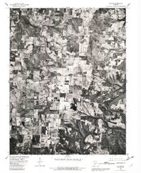
 1982 Springfield1983 Print · USGSSpringfield and the surrounding Ozark plateau are captured in the early eighties as the region balanced urban growth with its agricultural roots. Genealogists and researchers can trace the locations of White Chapel, the State Sanatorium, and older rail stops like Brookline.
 - 1984 Map of Bolivar
 1984 Bolivar1984 Print · USGSWestern Missouri in the mid-eighties shows a landscape shaped by large-scale water management and rail commerce. Genealogists and historians can trace the development of towns like Bolivar and El Dorado Springs alongside the massive Stockton Lake.
End of results
Showing maps 1-4 of 4
Top cities of Polk County
- Bolivar historical maps
- Humansville historical maps
- Pleasant Hope historical maps
- Fair Play historical maps
- Morrisville historical maps
- Halfway historical maps
See more
Frequently asked questions
- What are the different types of historical maps available for Polk County?
- What is the oldest map of Polk County?
- Where can I purchase historical maps of Polk County for my home or office?
- Where can I download high-res historical maps of Polk County?
- Are there historical topographic maps available for Polk County?
- Is there historical aerial imagery available for Polk County?
- Where are historical maps of Polk County sourced from?