Old Maps of Polk County, Missouri for Hiking & Exploration
Hike through history with 119 historic maps of Polk County. Explore old trails, ghost towns, and forgotten backroads — perfect for outdoor adventurers and local explorers.
- Rediscover forgotten places: Map out old mining camps, roads, and footpaths that no longer exist on modern maps.
- Layer with modern tools: Combine with LiDAR or satellite views to plan hikes through historical terrain.
- Made for exploration: Popular among hikers, overlanders, and local history lovers.
Use these maps to find adventure and explore the hidden past of Polk County.
Polk County, MO maps
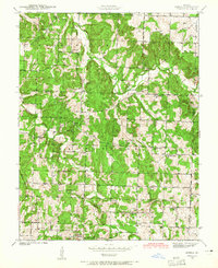
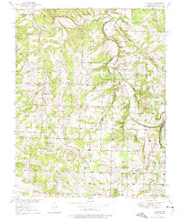
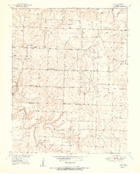
(119)- 1884 Map of Springfield
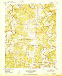
 1884 Springfield1884 Print · USGSSpringfield emerged as a critical railroad junction in Southwest Missouri during the 1880s. Local researchers can trace the early layouts of Springfield, Willard, and Republic as they developed along the St. Louis and San Francisco Railroad.
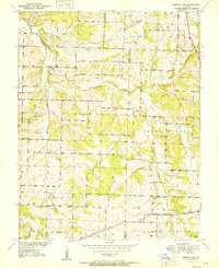
 - 1884 Map of Bolivar
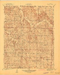
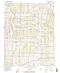
 1884 Bolivar1884 Print · USGSSouthwestern Missouri in the mid-1880s is documented here at a time when river drainage and ridge-top travel dictated the growth of local townships. Researchers can trace early rural post offices and communities like Hermitage, Half Way, and Parks Mill.
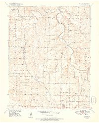
 - 1886 Map of Stockton
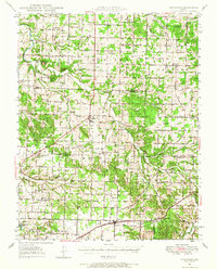
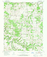
 1886 Stockton1886 Print · USGSSouthwest Missouri in the mid-1880s was a landscape of river-bottom farms and emerging rail towns along the Kansas City Clinton and Springfield R. R. Trace vanished post offices and local landmarks like Johnson's Mill, Dunnegan Springs, and the early streets of Stockton.3 unique versions available
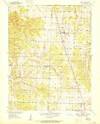
 - 1886 Map of Greenfield
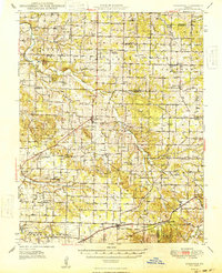
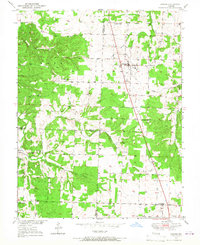
 1886 Greenfield1886 Print · USGSSouthwest Missouri was undergoing a rail-driven transformation in the 1880s, as new lines connected established county seats to outlying farm towns. Genealogists can trace family roots through numerous small settlements like Paris Springs, Dadeville, and the thriving rail hub at Ash Grove.4 unique versions available
 - 1886 Map of Springfield, 1896 Print
 1886 Springfield1896 Print · USGSSouthwest Missouri thrived as a regional rail hub in the 1880s, centering on the growth of Greene and Christian counties. Researchers can trace early rural settlements and rail stops like Springfield, Fair Grove, and Republic before the turn of the century.5 unique versions available
 - 1888 Map of Greenfield, 1898 Print
 1888 Greenfield1898 Print · USGSSouthwest Missouri thrived as a budding rail and agricultural hub in the 1880s. Local researchers can trace the early footprints of Greenfield and Mount Vernon, alongside smaller settlements like Paris Springs and Everton.
 - 1892 Map of Bolivar, 1898 Print
 1892 Bolivar1898 Print · USGSMissouri's central Ozarks borderlands are captured here in the 1880s, showcasing the early layout of Polk and Hickory counties. Genealogists can trace family roots through localized sites like Parks Mill, the early street grids of Bolivar and Buffalo, and the settlement at Hermitage.5 unique versions available
 - 1939 Map of Arnica, 1965 Print
 1939 Arnica1965 Print · USGSCedar County at the end of the 1930s shows a landscape filled with small school districts and rural crossroads. Local historians can trace early community hubs like Williams Store, the hamlet of Arnica, and numerous country schools such as Shady Hill Sch.2 unique versions available
 - 1941 Map of Arnica
 1941 Arnica1941 Print · USGSRural Cedar and St. Clair counties are mapped here just before the Second World War, showing a landscape defined by small farmsteads and creek valleys. Researchers can trace family history through a high density of rural schools and churches like Harvard Sch, Sheek Cem, and Hickory Grove Ch.2 unique versions available
 - 1942 Map of Elkton, 1982 Print
 1942 Elkton1982 Print · USGSHickory and Polk Counties are captured here during a period of transition as the river valley was reshaped by new infrastructure. Genealogists can trace family roots through the Round Tree Cem, Mission Chapel, and many rural schoolhouses like Elkton Sch.
 - 1944 Map of Humansville
 1944 Humansville1944 Print · USGSNear the intersection of three counties in the mid-1940s, this area centered on a thriving rail and agricultural landscape. Local historians can trace family roots through numerous country schoolhouses like Elm Grove Sch and cemeteries such as Richardson Cem.3 unique versions available
 - 1947 Map of Strafford, 1967 Print
 1947 Strafford1967 Print · USGSMissouri's Ozark plateau comes alive in the mid-forties, showing the rural school districts and crossroads towns of Greene and Dallas counties. Trace family roots at Mission Chapel, find the old roadbed of U. S. 66, or locate Tin Town.
 - 1948 Map of Strafford
 1948 Strafford1948 Print · USGSMid-century Greene and Webster Counties center on the rail-aligned town of Strafford and the rural crossroads of Fair Grove. Genealogists can locate family landmarks including Mullinx Cem, Hickory Barren Sch, and the old Whitlock Ch.2 unique versions available
 - 1949 Map of Elkton, 1969 Print
 1949 Elkton1969 Print · USGSMid-century Hickory and Polk counties are defined by the winding Pomme De Terre River and a quiet network of rural settlements. Genealogists can trace family footprints through a remarkable density of local schools like Royal Sch and churches including Durnell Chapel.2 unique versions available
 - 1949 Map of Sentinel, 1973 Print
 1949 Sentinel1973 Print · USGSThe Pomme de Terre River valley in Hickory and Polk Counties is shown here just after the war, before modern development altered the rural landscape. Researchers can locate numerous vanished landmarks and family sites like Pittsburg Ch, Stewart Cem, and the Rose Hill Sch.2 unique versions available
 - 1950 Map of Elkton
 1950 Elkton1950 Print · USGSHickory County's rural townships are captured here at mid-century, just before large-scale reservoir projects altered the regional landscape. Researchers can trace family history through a remarkable density of local sites, from Round Tree Cem and McCracken Cem to a dozen neighborhood schools like Mashburn Sch and Royal Sch.2 unique versions available
 - 1950 Map of Sentinel
 1950 Sentinel1950 Print · USGSHickory and Polk counties are shown here at the start of the 1950s, a period when the river valley remained a landscape of rural schools and creek-side settlements. Genealogists can trace family roots at Chamberlain Cem or locate lost landmarks like Mohawk Corner and Rose Hill Sch.2 unique versions available
 - 1950 Map of Buffalo NW, 1963 Print
 1950 Buffalo NW1963 Print · USGSNorthwestern Polk County at mid-century remained a landscape of dispersed family farms and small rural community centers. Genealogists and local historians can trace the foundations of this area through named schools like Concord Sch and churches such as Reynolds Chapel.2 unique versions available
 - 1950 Map of Polk, 1966 Print
 1950 Polk1966 Print · USGSMid-century Polk County was a landscape of small farmsteads and rural social hubs connected by the Pomme de Terre River. Researchers can trace old family lines through landmarks like Payne Cem and several community centers including Huron Ch and Black Oak Sch.2 unique versions available
 - 1950 Map of Urbana, 1967 Print
 1950 Urbana1967 Print · USGSThe crossroads of Hickory, Dallas, and Polk counties come alive in the mid-1950s around the settlements of Urbana and Louisburg. Genealogists and historians can trace the foundations of this rural community through Star Ridge Sch, Bower Chapel, and Rimby.2 unique versions available
 - 1950 Map of Cliquot, 1975 Print
 1950 Cliquot1975 Print · USGSPolk County life at mid-century is centered on the St Louis San Francisco railroad and the winding Pomme de Terre River. Researchers can trace old family roots at Morgan Cem or locate former rural hubs like Cliquot and Flint Sch.2 unique versions available
 - 1951 Map of Buffalo NW
 1951 Buffalo NW1951 Print · USGSThe Polk and Dallas county border comes alive in the early fifties, showing a rural landscape organized around namesake schools and small country chapels. Genealogists can locate family landmarks such as Reynolds Chapel, Lindley Ch, and the Breshears Cem.2 unique versions available
 - 1951 Map of Cliquot
 1951 Cliquot1951 Print · USGSPolk County, Missouri, in the early fifties shows a landscape of small family farms connected by a dense network of schoolhouses and rural churches. Genealogists and local historians can trace family roots through numerous sites like Union Grove Cem, Watson Sch, and the community at Cliquot.2 unique versions available
 - 1951 Map of Urbana
 1951 Urbana1951 Print · USGSMid-century Dallas and Hickory Counties are captured here as a network of small farm towns and country parishes. Genealogists can trace family footprints near Urbana, Rimby, and the Star Ridge Sch, or locate the Cussington Cem near Louisburg.2 unique versions available
 - 1951 Map of Polk
 1951 Polk1951 Print · USGSMid-century Polk County is captured here during a period of established rural settlement before major landscape alterations. Researchers can locate specific family landmarks such as Payne Cem, local schools like Eidson Sch, and the winding course of the Pomme De Terre River.2 unique versions available
Showing maps 1-25 of 119
Top cities of Polk County
- Bolivar historical maps
- Humansville historical maps
- Pleasant Hope historical maps
- Fair Play historical maps
- Morrisville historical maps
- Halfway historical maps
See more
Frequently asked questions
- What are the different types of historical maps available for Polk County?
- What is the oldest map of Polk County?
- Where can I purchase historical maps of Polk County for my home or office?
- Where can I download high-res historical maps of Polk County?
- Are there historical topographic maps available for Polk County?
- Is there historical aerial imagery available for Polk County?
- Where are historical maps of Polk County sourced from?