Old Maps of Unionville, Missouri for Genealogy
Trace your family roots with 18 historic maps of Unionville. These high-res maps reveal old neighborhoods, homesites, landmarks, and streets — helping you uncover where your ancestors lived and how the area evolved over time.
- Explore historic neighborhoods: Identify where your relatives may have lived in the 1800s or 1900s.
- Compare maps over time: Trace the changes in streets, buildings, and landmarks for multi-generational research.
- Perfect for genealogy & ancestry research: Used by family historians and researchers to map out lineage and migration.
These maps are an incredible resource for exploring your personal connection to Unionville's past.
Unionville, MO maps
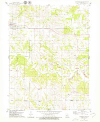
(18)- 1912 Map of Green City, 1968 Print
 1912 Green City1968 Print · USGSNorthern Missouri at the dawn of the twentieth century reveals a landscape shaped by rural education and early rail lines. Local historians can trace dozens of country schools like Boon Hill School and vanished stops along the Quincy Omaha and Kansas City railroad.
 - 1914 Map of Green City
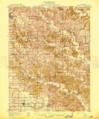 1914 Green City1914 Print · USGSNorth-central Missouri thrived as a patchwork of small townships and family farms during the early twentieth century. Genealogists can trace rural life through dozens of local landmarks like Unionville, Shibley Point School, and the Kansas City and Omaha rail line.2 unique versions available
 - 1954 Map of Centerville, 1967 Print
 1954 Centerville1967 Print · USGSThe Iowa-Missouri borderlands at mid-century reveal a landscape shaped by river valleys and the height of the regional rail network. Genealogists and historians can trace the paths of the Wabash railroad and locate old townsites like Mystic, Moulton, and Greentop.3 unique versions available
 - 1957 Map of Centerville
 1957 Centerville1957 Print · USGSThe Iowa-Missouri borderlands in the mid-fifties reveal a landscape of river-valley agriculture and vital rail corridors. Genealogists and historians can trace family-named landmarks and small-town growth in Centerville, Kirksville, and along the Wabash railroad line.
 - 1958 Map of Centerville
 1958 Centerville1958 Print · USGSThe Iowa-Missouri borderlands come into focus during the mid-fifties, showing a landscape defined by river valleys and intersecting rail lines. Genealogists and local historians can trace family roots through dozens of rural hubs like Bloomfield, Unionville, and Corydon.
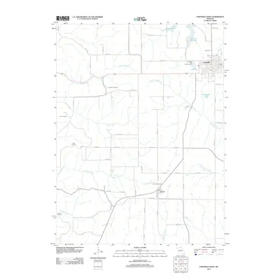
 - 1964 Map of Unionville West, 1965 Print
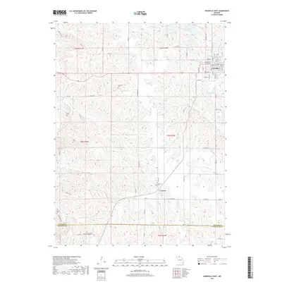
 1964 Unionville West1965 Print · USGSPutnam County's rural landscape is captured here in the mid-1960s, showing the agricultural and transport networks that defined the region. You can trace the Chicago Burlington and Quincy rail line through Lemons and locate local landmarks like Triumph Sch and Cutter Cem.2 unique versions available
 - 1974 Map of Green City NW, 1975 Print
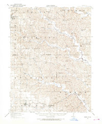
 1974 Green City NW1975 Print · USGSThe northern Missouri landscape near the Iowa border comes into focus in the mid-1970s, revealing a detailed agricultural grid. Genealogists and local historians can trace the exact footprint of farmsteads and the streets of Unionville.
 - 1979 Map of Unionville East
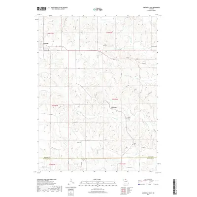
 1979 Unionville East1979 Print · USGSNorthern Missouri agriculture meets industrial change in the late seventies as local roads connect farming townships with new extractive sites. Genealogists can trace family names through numerous landmarks, including Christian Home Ch, Thompson Cem, and Rosewood.
 - 1981 Map of Trenton
 1981 Trenton1981 Print · USGSNorthern Missouri in the early eighties remains a landscape defined by its river valleys and intersecting rail lines. Genealogists and local historians can trace the development of riverside towns like Trenton and Princeton or locate smaller rural junctions such as Humphreys and Brimson.
 - 1981 Map of Kirksville, 1982 Print
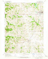
 1981 Kirksville1982 Print · USGSNortheast Missouri in the early eighties was a landscape of rail-connected trade towns and significant river valleys. Researchers can trace the legacy of medical education at the Kirksville College of Osteopathic Med or locate family roots in Unionville, Edina, and Bible Grove.
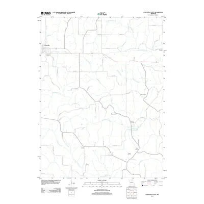
 - 2012 Map of Unionville West, 2012 Print
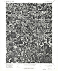
 2012 Unionville West2012 Print · USGSCovers Unionville, including Lemons, Putnam County, and other nearby areas
 - 2012 Map of Unionville East, 2012 Print
 2012 Unionville East2012 Print · USGSCovers Unionville, including Rosewood, Putnam County, and other nearby areas
 - 2014 Map of Unionville West, 2014 Print
 2014 Unionville West2014 Print · USGSCovers Unionville, including Lemons, Putnam County, and other nearby areas
 - 2015 Map of Unionville East, 2015 Print
 2015 Unionville East2015 Print · USGSCovers Unionville, including Rosewood, Putnam County, and other nearby areas
 - 2017 Map of Unionville West, 2017 Print
 2017 Unionville West2017 Print · USGSCovers Unionville, including Lemons, Putnam County, and other nearby areas
 - 2017 Map of Unionville East, 2017 Print
 2017 Unionville East2017 Print · USGSCovers Unionville, including Rosewood, Putnam County, and other nearby areas
 - 2021 Map of Unionville East, 2021 Print
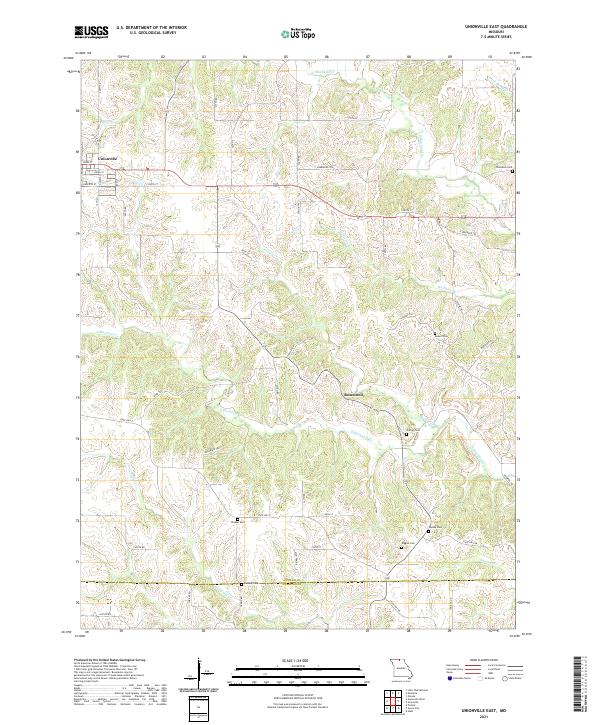 2021 Unionville East2021 Print · USGSThe eastern edges of Unionville meet the Missouri uplands in the early twenty-first century, revealing a landscape etched by the Blackbird Creek system. Researchers can trace numerous family-named burial sites like Thompson Cem and Pherigo Cem near the small settlement of Rosewood.
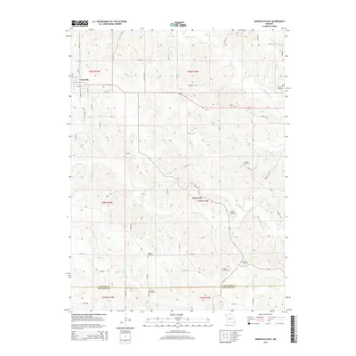
 - 2021 Map of Unionville West, 2021 Print
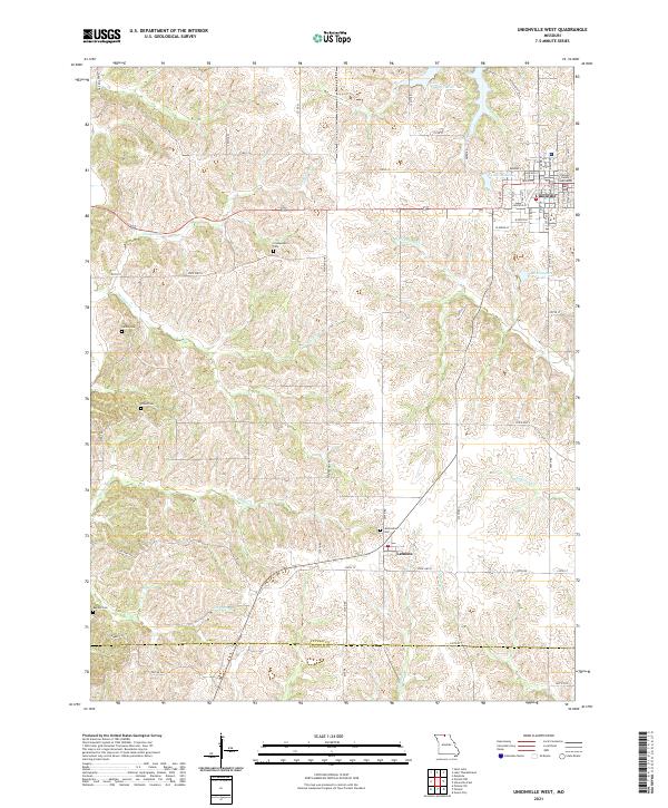 2021 Unionville West2021 Print · USGSThe northern Missouri highlands of Putnam County are captured here just as the modern era met historical rural roots. Researchers can trace ancestral sites through numerous country burial grounds like Cullor Cem and Dixon Cem, or explore the seat of local government at the Putnam County Courthouse in Unionville.
End of results
Showing maps 1-18 of 18
Top cities near Unionville
- Green City historical maps
- Seymour historical maps
- Cincinnati historical maps
- Exline historical maps
- Pollock historical maps
- Numa historical maps
Frequently asked questions
- What are the different types of historical maps available for Unionville?
- What is the oldest map of Unionville?
- Where can I purchase historical maps of Unionville for my home or office?
- Where can I download high-res historical maps of Unionville?
- Are there historical topographic maps available for Unionville?
- Is there historical aerial imagery available for Unionville?
- Where are historical maps of Unionville sourced from?