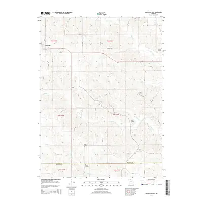
2015 Map of Unionville East
USGS Topo · Published 2015About this map
Unionville serves as the primary hub in this portion of Putnam County, situated at the intersection of local routes like Union St and S 10th St. The surrounding landscape is defined by the branching waterways of N Blackbird Cr and S Blackbird Cr, which carve through the terrain and dictate the winding paths of rural roads such as Mallow Trl and Geranium Trl. Further south, the small settlement of Rosewood sits near the headwaters of Kinney Cr.
Find a feature on this map
62 named features on this map. Tap any name to fly to it.
Don’t see what you’re looking for? This feature index may not catch every label — zoom into the map to look around manually.
Map Details
Editions of this 2015 Unionville East Map
This is the sole edition of this map. No revisions or reprints were ever made.
Other maps of this area
1912 · Green City
USGS Topo · 1:62,500
1914 · Green City
USGS Topo · 1:62,500
1939 · Centerville
USGS Topo · 1:62,500
1941 · Centerville
USGS Topo · 1:62,500
1942 · Seymour
USGS Topo · 1:62,500
1944 · Seymour
USGS Topo · 1:62,500

1954 · Centerville
USGS Topo · 1:250,000
1957 · Centerville
USGS Topo · 1:250,000
1958 · Centerville
USGS Topo · 1:250,000
1964 · Unionville West
USGS Topo · 1:24,000