1970s Maps of Saline County, Missouri
Explore 9 historic maps of Saline County from the 1970s. These maps offer a rare glimpse into what life looked like during the 1970s — showing old roads, neighborhoods, homes, and landmarks that have changed or disappeared over time.
Whether you're researching your family's past, planning a metal detecting trip, or studying how Saline County's landscape evolved across the 1970s, these high-resolution maps are a powerful tool for exploring the history of this region.
- Focus on a specific era: All maps on this page are from the 1970s, giving you a focused view of this time period.
- See what’s changed: Compare century-old streets, trails, and buildings to today's modern landscape using overlays and satellite layers.
- Research with precision: Use these maps for genealogy, historical research, land use analysis, or educational projects.
- View, download, or print: Maps are fully viewable online in high resolution, and can be downloaded or printed for your own records.
Start exploring Saline County's history through authentic maps from the 1970s. This is your window into the past.
Saline County, MO maps
(9)- 1971 Map of Glasgow, 1972 Print
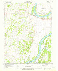
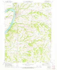 1971 Glasgow1972 Print · USGSThe Missouri River town of Glasgow is captured in the early seventies at a vital crossroads of three counties and major rail lines. Genealogists and local historians can trace the paths of the Gulf Mobile and Ohio railroad through Steinmetz or locate the Richland Ch and Pleasant Green Cem.
 - 1971 Map of Arrow Rock, 1973 Print
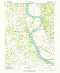 1971 Arrow Rock1973 Print · USGSIn the early seventies, the Missouri River bluffs near the Saline and Howard county lines retained their rural character. Researchers can trace historic riverfront communities like Arrow Rock and Lisbon, or locate family sites such as Rose Hill Cem and Townsend Cem.2 unique versions available
 - 1971 Map of Marshall North, 1973 Print
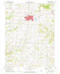
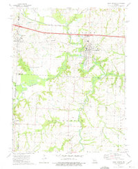
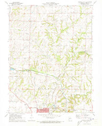 1971 Marshall North1973 Print · USGSSaline County agricultural lands and the northern growth of Marshall are captured here in the early seventies. Genealogists and local historians can trace the paths of the GULF MOBILE AND OHIO railroad and locate landmarks like Fairville, Mt Carmel Ch, and the Odell Cem.2 unique versions available
 - 1971 Map of Napton, 1973 Print
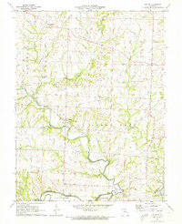 1971 Napton1973 Print · USGSSaline County’s river-carved landscape is shown here in the early seventies, centered on the meeting of the Blackwater River and Salt Fork. Researchers can trace old family roots and community sites at Sappington Cem, Smith Chapel, and the settlement of Napton.
 - 1971 Map of Saline City, 1973 Print
 1971 Saline City1973 Print · USGSThe Missouri River valley at the start of the 1970s reveals a landscape defined by its floodplains and rail corridors. Trace family history through Sappington Cem and Fish Creek Ch or follow the route of the Mobile and Ohio railroad.
 - 1971 Map of Slater, 1973 Print
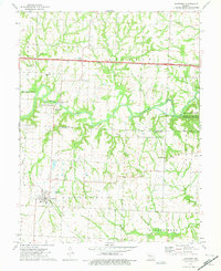
 1971 Slater1973 Print · USGSSaline County in the early seventies centers on the growing hub of Slater and its vital Gulf Mobile and Ohio rail connection. Genealogists can trace local roots at the Mt Horeb Cem, the Orearville community, and Gilliam.
 - 1971 Map of Marshall South, 1973 Print
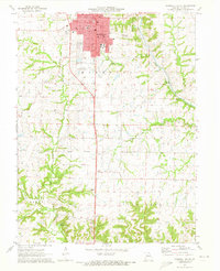 1971 Marshall South1973 Print · USGSSaline County, Missouri, is captured in the early seventies during a period of steady civic growth around the county seat. Genealogists and historians can trace the foundations of Marshall through sites like Missouri Valley College, Blue Lick Springs, and Ridge Park Cemetery.
 - 1973 Map of Houstonia, 1975 Print
 1973 Houstonia1975 Print · USGSHoustonia and the Blackwater River valley are captured here in the early seventies during a period of rural transition. Genealogists and local historians can trace family sites like Corinth Christ Ch, the Oak Grove Cem, and the path of an Old Railroad Grade.
 - 1973 Map of Sweet Springs, 1975 Print
 1973 Sweet Springs1975 Print · USGSSweet Springs and the surrounding Blackwater River valley are captured in the early 1970s during a period of rural stability. Researchers can trace family roots at Mt Zion Ch and Fairview Cem, or locate landmarks like Emma and the R-1 Sch.
End of results
Showing maps 1-9 of 9
Top cities of Saline County
- Marshall historical maps
- Slater historical maps
- Sweet Springs historical maps
- Malta Bend historical maps
- Gilliam historical maps
- Nelson historical maps
See more
Frequently asked questions
- What are the different types of historical maps available for Saline County?
- What is the oldest map of Saline County?
- Where can I purchase historical maps of Saline County for my home or office?
- Where can I download high-res historical maps of Saline County?
- Are there historical topographic maps available for Saline County?
- Is there historical aerial imagery available for Saline County?
- Where are historical maps of Saline County sourced from?