Old Maps of St. Clair County, Missouri for Academic Research
Study the evolution of St. Clair County with 159 high-resolution historic maps. Whether you're teaching, researching, or modeling changes in land use, these maps provide essential visual documentation of urban, environmental, and geographic change.
- Analyze long-term change: Track patterns in development, transportation, and natural features.
- Ideal for environmental or urban studies: Support academic projects with primary historical map data.
- Use in the classroom or lab: Educators and researchers rely on these maps to bring historical context to life.
These maps are a powerful tool for teaching, research, and visualizing how St. Clair County has changed over the decades.
St. Clair County, MO maps
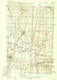
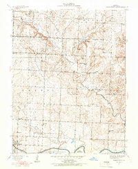
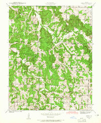
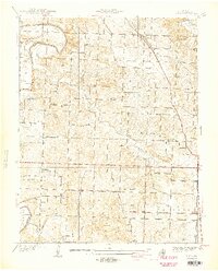
(159)- 1886 Map of Nevada
 1886 Nevada1886 Print · USGSRailroads and river valleys define southwestern Missouri in the late nineteenth century, as the landscape transitions into a series of organized townships and trade centers. Genealogists and local historians can trace early settlements like Moundville, Montevallo, and El Dorado Springs along the Missouri Pacific Railroad.
 - 1886 Map of Stockton
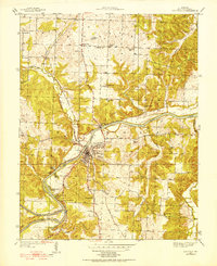
 1886 Stockton1886 Print · USGSSouthwest Missouri in the mid-1880s was a landscape of river-bottom farms and emerging rail towns along the Kansas City Clinton and Springfield R. R. Trace vanished post offices and local landmarks like Johnson's Mill, Dunnegan Springs, and the early streets of Stockton.3 unique versions available
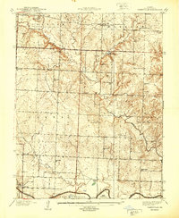
 - 1887 Map of Clinton
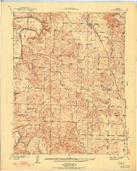
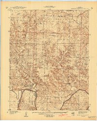
 1887 Clinton1887 Print · USGSWest-Central Missouri is captured during a period of rapid railroad expansion in the 1880s, centered on the growing junction at Clinton. Researchers can trace early township developments and find established settlements like Chalk Level, Iconium, and Brownington along the winding Osage River.
 - 1887 Map of Warsaw
 1887 Warsaw1887 Print · USGSBenton County was a land of river junctions and railheads in the late 1880s. Local historians can trace the early footprints of Warsaw, the winding Missouri Pacific Railroad, and riverside settlements like Fairfield and Duroc.
 - 1887 Map of Butler
 1887 Butler1887 Print · USGSBates County is captured here in the 1880s as the rail and river economies converged. Researchers can trace the early footprints of Butler and Rich Hill, or locate smaller disappeared locales like Carbon Centre and Crescent Hill.
 - 1894 Map of Warsaw
 1894 Warsaw1894 Print · USGSBenton County and its neighbors are shown here in the mid-1880s, centered on the river junctions that shaped early Missouri commerce. Genealogists can trace family roots through old rural centers like Fairfield, Boylers Mills, and Cross Timbers before the river valleys were transformed.4 unique versions available
 - 1894 Map of Butler
 1894 Butler1894 Print · USGSBates County is captured here in the late nineteenth century as the railroad began to redefine its rural economy. Genealogists can trace family roots through the grids of Butler and Rich Hill, or locate smaller centers like Papinsville and Crescent Hill.4 unique versions available
 - 1894 Map of Nevada
 1894 Nevada1894 Print · USGSWestern Missouri at the end of the nineteenth century is defined here by its emerging rail towns and expansive prairie townships. Genealogists and local historians can trace the early development of Nevada and Lamar alongside smaller settlements like Montevallo and El Dorado Springs.5 unique versions available
 - 1894 Map of Clinton
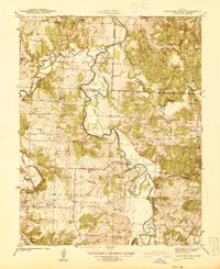
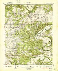
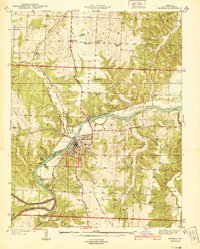
 1894 Clinton1894 Print · USGSHenry County and St. Clair County thrive during the peak of the railroad era in the 1890s. Genealogists and historians can trace the early rail stops at Clinton and Brownington, or locate vanished post offices like Chalk Level and Huntingdale.4 unique versions available
 - 1934 Map of Rockville
 1934 Rockville1934 Print · USGSMid-Missouri river life in the 1930s is centered on the shifting currents of the Osage River and the small-town hubs of the Kansas and Texas railroad. Trace the locations of rural schoolhouses like Mc Davitt Sch or find family roots at Spring Grove Cem.
 - 1937 Map of Tiffin
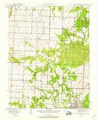
 1937 Tiffin1937 Print · USGSSt. Clair County in the 1930s is a landscape of scattered family farms and quiet crossroads. Genealogists can trace rural life through numerous landmarks like Tiffin, Union Point Ch, and family burial sites including Landers Cem and Preston Cem.2 unique versions available
 - 1938 Map of Monegaw Springs
 1938 Monegaw Springs1938 Print · USGSSt. Clair County's river bluffs and rural townships are captured here in the late thirties as the Osage River winds past Monegaw Springs. Researchers can trace early family sites at Terry Cem or locate lost schoolhouses like Lewis Sch and Motley Sch.2 unique versions available
 - 1938 Map of Roscoe, 1952 Print
 1938 Roscoe1952 Print · USGSThe confluence of the Osage River and Sac River dominates this Missouri landscape in the late 1930s. Genealogists can trace early family sites across dozens of local landmarks, from the Mt. Olive Ch to the Fraley Cem and Green Valley Sch.
 - 1938 Map of Vista, 1952 Print
 1938 Vista1952 Print · USGSSt. Clair County's rural townships are captured in the late 1930s, showing a landscape of small family farms and community hubs before major modernization. Researchers can trace the path of the St Louis-San Francisco railroad or locate family burial sites at Doyal Cem and Allen Cem.2 unique versions available
 - 1938 Map of Taberville, 1966 Print
 1938 Taberville1966 Print · USGSSt. Clair County in the late 1930s shows a landscape of small Missouri townships tied to the winding waters of the Osage River. Researchers can trace the rural school and church network of the day, from Hoover Sch to Green Valley Ch, or locate ancestral burial sites like Ridgeway Cem.
 - 1939 Map of Caplinger Mills, 1941 Print
 1939 Caplinger Mills1941 Print · USGSThe Sac River valley in Cedar County was a landscape of small schools and family cemeteries just before the Second World War. Researchers can locate family landmarks like Leila Store, the Old Union Ch, and the many rural schools including Spring Valley Sch.4 unique versions available
 - 1939 Map of Osceola, 1952 Print
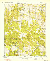
 1939 Osceola1952 Print · USGSOsceola and the Osage River valley are captured in the late 1930s, showing a landscape of river camps, railroad crossings, and rural school districts. Genealogists can trace family locations near Springstude Cem, the County Home, or the Damascus Store.3 unique versions available
 - 1939 Map of Eldorado Springs North, 1959 Print
 1939 Eldorado Springs North1959 Print · USGSMissouri's western borderlands come to life in the late 1930s, showing a landscape of small school districts and creekside farms. Genealogists can trace family roots at Lefler Cem, Oak Grove Ch, and schools like Jackson Sch or Union Sch.2 unique versions available
 - 1939 Map of Arnica, 1965 Print
 1939 Arnica1965 Print · USGSCedar County at the end of the 1930s shows a landscape filled with small school districts and rural crossroads. Local historians can trace early community hubs like Williams Store, the hamlet of Arnica, and numerous country schools such as Shady Hill Sch.2 unique versions available
 - 1940 Map of Taberville
 1940 Taberville1940 Print · USGSSettled along the northern banks of the Osage River just before the mid-century, this area of St. Clair County shows a landscape of small mines and rural schoolhouses. Genealogists can trace family landmarks like Ridgeway Cem or the sites of Gray's Mine and Johnson City.
 - 1940 Map of Roscoe
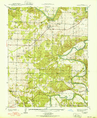
 1940 Roscoe1940 Print · USGSThe Osage and Sac rivers meet in this late 1930s Missouri survey, capturing the rural riverfront settlements of St. Clair and Cedar counties. Genealogists can trace family footprints at Roscoe Cem, Hardyville, and country schools like Motley Sch.2 unique versions available
 - 1940 Map of Osceola
 1940 Osceola1940 Print · USGSOsceola and the Osage River valley are captured in the late 1930s, showing a landscape of riverfront camps and remote country schools. Researchers can locate the County Home, trace the St Louis - San Francisco rail line, or find family roots at Springstude Cem and Dunkard Ch.
 - 1940 Map of Vista
 1940 Vista1940 Print · USGSSt. Clair County was a landscape of small school districts and railroad stops just before the 1940s. Genealogists can trace family footprints through sites like Doyal Cem, Tower Grove Sch, and the St Louis-San Francisco rail line through Vista.2 unique versions available
 - 1940 Map of Monegaw Springs
 1940 Monegaw Springs1940 Print · USGSSt. Clair County's rural townships are shown here in the late 1930s, documenting a landscape of small farmstead schools and country chapels. Researchers can trace family history at Benton Green Cem or locate the old Washington Sch and Monegaw Springs.2 unique versions available
 - 1940 Map of Weaubleau, 1954 Print
 1940 Weaubleau1954 Print · USGSThe St. Clair and Hickory county line area comes into focus in the 1940s, showing a landscape of rail-linked towns and local school districts. Trace family roots at Robinson Cem or explore the old routes through Gerster, Collins, and Weaubleau.2 unique versions available
Showing maps 1-25 of 159
Top cities of St. Clair County
- Appleton City historical maps
- Osceola historical maps
- Lowry City historical maps
- Collins historical maps
- Roscoe historical maps
- Vista historical maps
See more
Frequently asked questions
- What are the different types of historical maps available for St. Clair County?
- What is the oldest map of St. Clair County?
- Where can I purchase historical maps of St. Clair County for my home or office?
- Where can I download high-res historical maps of St. Clair County?
- Are there historical topographic maps available for St. Clair County?
- Is there historical aerial imagery available for St. Clair County?
- Where are historical maps of St. Clair County sourced from?