1940s Maps of St. Clair County, Missouri
Explore 24 historic maps of St. Clair County from the 1940s. These maps offer a rare glimpse into what life looked like during the 1940s — showing old roads, neighborhoods, homes, and landmarks that have changed or disappeared over time.
Whether you're researching your family's past, planning a metal detecting trip, or studying how St. Clair County's landscape evolved across the 1940s, these high-resolution maps are a powerful tool for exploring the history of this region.
- Focus on a specific era: All maps on this page are from the 1940s, giving you a focused view of this time period.
- See what’s changed: Compare century-old streets, trails, and buildings to today's modern landscape using overlays and satellite layers.
- Research with precision: Use these maps for genealogy, historical research, land use analysis, or educational projects.
- View, download, or print: Maps are fully viewable online in high resolution, and can be downloaded or printed for your own records.
Start exploring St. Clair County's history through authentic maps from the 1940s. This is your window into the past.
St. Clair County, MO maps
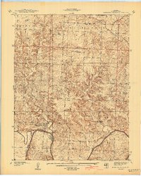
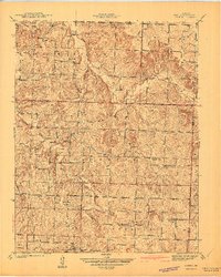
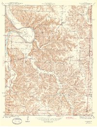
(24)- 1940 Map of Taberville
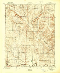 1940 Taberville1940 Print · USGSSettled along the northern banks of the Osage River just before the mid-century, this area of St. Clair County shows a landscape of small mines and rural schoolhouses. Genealogists can trace family landmarks like Ridgeway Cem or the sites of Gray's Mine and Johnson City.
 - 1940 Map of Roscoe
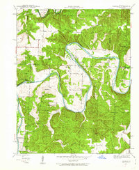
 1940 Roscoe1940 Print · USGSThe Osage and Sac rivers meet in this late 1930s Missouri survey, capturing the rural riverfront settlements of St. Clair and Cedar counties. Genealogists can trace family footprints at Roscoe Cem, Hardyville, and country schools like Motley Sch.2 unique versions available
 - 1940 Map of Osceola
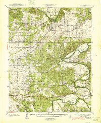
 1940 Osceola1940 Print · USGSOsceola and the Osage River valley are captured in the late 1930s, showing a landscape of riverfront camps and remote country schools. Researchers can locate the County Home, trace the St Louis - San Francisco rail line, or find family roots at Springstude Cem and Dunkard Ch.
 - 1940 Map of Vista
 1940 Vista1940 Print · USGSSt. Clair County was a landscape of small school districts and railroad stops just before the 1940s. Genealogists can trace family footprints through sites like Doyal Cem, Tower Grove Sch, and the St Louis-San Francisco rail line through Vista.2 unique versions available
 - 1940 Map of Monegaw Springs
 1940 Monegaw Springs1940 Print · USGSSt. Clair County's rural townships are shown here in the late 1930s, documenting a landscape of small farmstead schools and country chapels. Researchers can trace family history at Benton Green Cem or locate the old Washington Sch and Monegaw Springs.2 unique versions available
 - 1940 Map of Weaubleau, 1954 Print
 1940 Weaubleau1954 Print · USGSThe St. Clair and Hickory county line area comes into focus in the 1940s, showing a landscape of rail-linked towns and local school districts. Trace family roots at Robinson Cem or explore the old routes through Gerster, Collins, and Weaubleau.2 unique versions available
 - 1940 Map of Iconium, 1963 Print
 1940 Iconium1963 Print · USGSNear the bend of the Osage River just before the war, this rural landscape reveals a network of Missouri hollows and prairie lands. Genealogists can trace early homesteads and community hubs like Iconium, Liberty Sch, and the Boy Scout Camp.2 unique versions available
 - 1941 Map of Caplinger Mills
 1941 Caplinger Mills1941 Print · USGSThe rural landscape of Cedar County and St. Clair County is meticulously detailed in the early 1940s, centered on the winding Sac River. Researchers can trace the heritage of local families through landmarks like Caplinger Mills, Old Union Ch, and numerous country schools such as Flatrock Sch.
 - 1941 Map of Tiffin
 1941 Tiffin1941 Print · USGSThe rural borderlands of St. Clair and Cedar County come into focus in the years before World War II. Local researchers can trace the locations of numerous vanished schoolhouses like Arrarat Sch and early cemeteries including Union Point Cem and Preston Cem.2 unique versions available
 - 1941 Map of Eldorado Springs North
 1941 Eldorado Springs North1941 Print · USGSSouthwestern Missouri is captured here in the late thirties and early forties, showing the rural landscapes of St. Clair and Cedar Counties. Researchers can trace the rail-era footprint of Eldorado Springs and locate local landmarks like Lefler Cem and Forest Grove Sch.
 - 1941 Map of Arnica
 1941 Arnica1941 Print · USGSRural Cedar and St. Clair counties are mapped here just before the Second World War, showing a landscape defined by small farmsteads and creek valleys. Researchers can trace family history through a high density of rural schools and churches like Harvard Sch, Sheek Cem, and Hickory Grove Ch.2 unique versions available
 - 1941 Map of Valhalla, 1963 Print
 1941 Valhalla1963 Print · USGSThe Osage River valley in the early 1940s was a landscape of sharp bends and small riverside outposts. Researchers can trace rural life through family-named landmarks like McGuiness Bend, local gathering spots like the Valhalla Store, and the Peaceful Home Cem.2 unique versions available
 - 1941 Map of Lowry City, 1965 Print
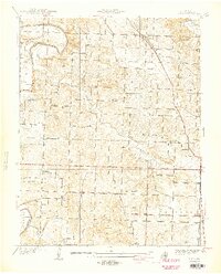
 1941 Lowry City1965 Print · USGSLowry City and Brownington are captured at the start of the 1940s, showing a Missouri landscape defined by the St Louis San Francisco RR and family farms. Genealogists can locate numerous rural schools and landmarks like Diamond Point Sch, Mount Zion Ch, and Park Grove Cem.3 unique versions available
 - 1944 Map of Humansville
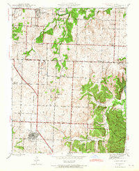
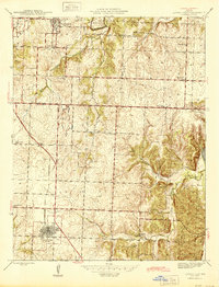
 1944 Humansville1944 Print · USGSNear the intersection of three counties in the mid-1940s, this area centered on a thriving rail and agricultural landscape. Local historians can trace family roots through numerous country schoolhouses like Elm Grove Sch and cemeteries such as Richardson Cem.3 unique versions available
 - 1944 Map of Weaubleau
 1944 Weaubleau1944 Print · USGSHickory and St. Clair Counties come into focus during the early 1940s as the railroad and rural school districts defined local life. Researchers can trace family-named landmarks and early homesteads near Weaubleau, Gerster, and Robinson Cem.2 unique versions available
 - 1944 Map of Iconium
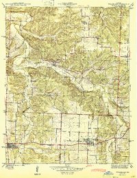
 1944 Iconium1944 Print · USGSThe Osage River bends through the St. Clair County hills in the early 1940s, revealing a landscape of steep hollows and upland farms. Trace local family roots at Iconium, Corbin Ch, and several rural schoolhouses like Square Prairie Sch.2 unique versions available
 - 1945 Map of Fristoe
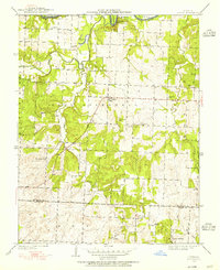
 1945 Fristoe1945 Print · USGSBenton and Hickory Counties appear here in the mid-1940s, showing a landscape of Ozark ridges and river bottomlands before major mid-century changes. Researchers can trace ancestral locations through numerous rural schools and river crossings like Evening Shade Sch and Little Mill Creek Ford.3 unique versions available
 - 1945 Map of Lowry City
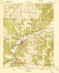
 1945 Lowry City1945 Print · USGSMissouri's rural heartland comes alive in the mid-forties, showing the dense network of schools and churches between the Grand River and the rail lines. Genealogists can trace family roots through several landmarks like Denny Cem, Park Grove Ch, and the St Louis San Francisco railroad.
 - 1945 Map of Valhalla
 1945 Valhalla1945 Print · USGSThe Osage River valley in the mid-1940s is captured here just as rural life began to shift away from old river fords and camp settlements. Genealogists can locate Peaceful Home Cem, Valhalla P O, and family-named schools like Wright Creek Sch.
 - 1947 Map of Jefferson City, 1949 Print
 1947 Jefferson City1949 Print · USGSCentral Missouri and the northern Ozarks come into focus in this late 1940s survey of the river-and-rail landscape. Genealogists and historians can trace the growth of Jefferson City and Sedalia or locate family roots near Bagnell Dam and the Lake of the Ozarks.
 - 1947 Map of Lawrence, 1954 Print
 1947 Lawrence1954 Print · USGSEastern Kansas and western Missouri thrive in the late 1940s, showing a landscape defined by major river valleys and a dense railway network. Genealogists can trace family settlements from Lawrence to Greenwood and locate landmarks like Olathe Navy and Lake Lotawana.
 - 1947 Map of Joplin, 1954 Print
 1947 Joplin1954 Print · USGSThe borderlands of Missouri, Kansas, and Oklahoma are shown here during the late 1940s, a period of heavy industrial and military activity. Researchers can trace the extensive Tri-State Mining District, the layout of Camp Crowder, and local landmarks like Mount Hope Cem.
 - 1949 Map of Joplin
 1949 Joplin1949 Print · USGSThe Kansas-Missouri borderlands thrive in the late 1940s, showing a robust network of railroad towns and river valleys. Researchers can trace historic rail lines like the Missouri Pacific RR and locate rural centers such as Chanute, Iola, and Fort Scott.
 - 1949 Map of Tiffin, 1955 Print
 1949 Tiffin1955 Print · USGSThe Osage River country in the late 1940s reveals a landscape of isolated farmsteads and rural school districts across the St. Clair and Cedar county line. Genealogists can trace family roots through several landmarks like Landers Cem, Pape Ch, and Arrarat Sch.2 unique versions available
End of results
Showing maps 1-24 of 24
Top cities of St. Clair County
- Appleton City historical maps
- Osceola historical maps
- Lowry City historical maps
- Collins historical maps
- Roscoe historical maps
- Vista historical maps
See more
Frequently asked questions
- What are the different types of historical maps available for St. Clair County?
- What is the oldest map of St. Clair County?
- Where can I purchase historical maps of St. Clair County for my home or office?
- Where can I download high-res historical maps of St. Clair County?
- Are there historical topographic maps available for St. Clair County?
- Is there historical aerial imagery available for St. Clair County?
- Where are historical maps of St. Clair County sourced from?