2000s (21st Century) Maps of Mitchells Corner, Missouri
Explore 5 historic maps of Mitchells Corner from the 2000s (21st Century). These maps offer a rare glimpse into what life looked like during the 2000s — showing old roads, neighborhoods, homes, and landmarks that have changed or disappeared over time.
Whether you're researching your family's past, planning a metal detecting trip, or studying how Mitchells Corner's landscape evolved across the 2000s, these high-resolution maps are a powerful tool for exploring the history of this region.
- Focus on a specific era: All maps on this page are from the 2000s, giving you a focused view of this time period.
- See what’s changed: Compare century-old streets, trails, and buildings to today's modern landscape using overlays and satellite layers.
- Research with precision: Use these maps for genealogy, historical research, land use analysis, or educational projects.
- View, download, or print: Maps are fully viewable online in high resolution, and can be downloaded or printed for your own records.
Start exploring Mitchells Corner's history through authentic maps from the 2000s. This is your window into the past.
Mitchells Corner, MO maps
(5)- 2004 Map of Success, 2006 Print
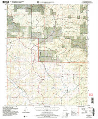 2004 Success2006 Print · USGSTexas County, Missouri, is shown at the start of the twenty-first century within the sprawling timberlands of the Ozarks. Researchers can trace the legacy of rural settlements through landmarks like Old Success, the Success PO, and the Limestone Quarry.
 - 2012 Map of Success, 2012 Print
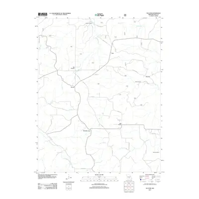 2012 Success2012 Print · USGSCovers Mitchells Corner, including Ellsworth, Ellis Prairie, and other nearby areas
 - 2015 Map of Success, 2015 Print
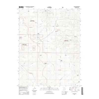 2015 Success2015 Print · USGSCovers Mitchells Corner, including Ellsworth, Ellis Prairie, and other nearby areas
 - 2017 Map of Success, 2017 Print
 2017 Success2017 Print · USGSCovers Mitchells Corner, including Ellsworth, Ellis Prairie, and other nearby areas
 - 2021 Map of Success, 2021 Print
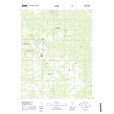
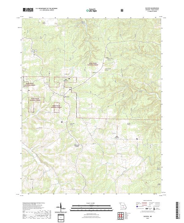 2021 Success2021 Print · USGSTexas County, Missouri, at the start of the 2020s shows a landscape of deep timbered hollows and established rural crossroads. Researchers can trace local heritage and land use near Old Success, the Vada Tower, and the remote reaches of Steam Mill Hollow.
End of results
Showing maps 1-5 of 5
Top cities near Mitchells Corner
- Sherrill historical maps
- Houston historical maps
- Roubidoux historical maps
- Licking historical maps
- Upton historical maps
- Raymondville historical maps
See more
Frequently asked questions
- What are the different types of historical maps available for Mitchells Corner?
- What is the oldest map of Mitchells Corner?
- Where can I purchase historical maps of Mitchells Corner for my home or office?
- Where can I download high-res historical maps of Mitchells Corner?
- Are there historical topographic maps available for Mitchells Corner?
- Is there historical aerial imagery available for Mitchells Corner?
- Where are historical maps of Mitchells Corner sourced from?