1960s Maps of Vernon County, Missouri
Explore 7 historic maps of Vernon County from the 1960s. These maps offer a rare glimpse into what life looked like during the 1960s — showing old roads, neighborhoods, homes, and landmarks that have changed or disappeared over time.
Whether you're researching your family's past, planning a metal detecting trip, or studying how Vernon County's landscape evolved across the 1960s, these high-resolution maps are a powerful tool for exploring the history of this region.
- Focus on a specific era: All maps on this page are from the 1960s, giving you a focused view of this time period.
- See what’s changed: Compare century-old streets, trails, and buildings to today's modern landscape using overlays and satellite layers.
- Research with precision: Use these maps for genealogy, historical research, land use analysis, or educational projects.
- View, download, or print: Maps are fully viewable online in high resolution, and can be downloaded or printed for your own records.
Start exploring Vernon County's history through authentic maps from the 1960s. This is your window into the past.
Vernon County, MO maps
(7)- 1961 Map of Lawrence
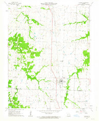
 1961 Lawrence1961 Print · USGSThe Kansas-Missouri borderland shows its mid-century transition from a rail-dependent agricultural region to a suburbanizing landscape. Genealogists can trace family footprints through numerous Cem sites and distinctive terrain landmarks like Graves Mound and Summers Mound.
 - 1962 Map of Sheldon, 1963 Print
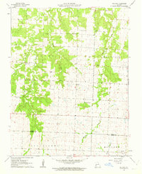
 1962 Sheldon1963 Print · USGSThe Missouri prairie around Sheldon is captured here in the early sixties, a landscape defined by the Missouri Pacific rail line and family farming. Genealogists can locate several rural landmarks including Birkett Cem, Shanghi Ch, and Prairie View Sch.2 unique versions available
 - 1962 Map of Bellamy, 1963 Print
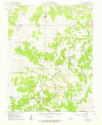
 1962 Bellamy1963 Print · USGSWestern Missouri farmland at the Vernon and Barton county line comes into focus in the early sixties. Genealogists can locate family names at the Tolson Cemetery and Warwick Cemetery, or trace the rural routes connecting Bellamy and Rousertown.2 unique versions available
 - 1962 Map of Montevallo, 1963 Print
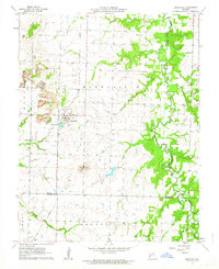
 1962 Montevallo1963 Print · USGSThe tri-county borderlands of southwest Missouri come into focus in the early sixties, showing the rural landscapes of Montevallo and Olympia. Genealogists can trace family footprints at Walnut Grove Cem and Glade Springs Ch along the winding Horse Creek.2 unique versions available
 - 1962 Map of Bronaugh, 1964 Print
 1962 Bronaugh1964 Print · USGSVernon and Barton Counties appear here in the early sixties, centered on the railroad town of Bronaugh. Researchers can trace the Missouri Pacific line to old sites like Hannon, rural churches like Fairview Ch, and local Strip Mines.2 unique versions available
 - 1963 Map of Rich Hill
 1963 Rich Hill1963 Print · USGSThe confluence of the Osage and Little Osage rivers dominates this Bates County landscape in the mid-1930s. Researchers can locate vanished rural schools like Diamond Sch and Panama Sch or trace the early industrial footprint of Monnum Mines near Carbon Center.
 - 1963 Map of Papinsville
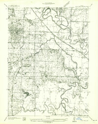
 1963 Papinsville1963 Print · USGSBates County, Missouri, is captured in the mid-1930s as a landscape of winding river bends and small rural hubs. Genealogists and local researchers can locate the Old Harmony Mission Site, Greenlawn Cem, and several one-room schoolhouses like Fairmont Sch.
End of results
Showing maps 1-7 of 7
Top cities of Vernon County
- Nevada historical maps
- Sheldon historical maps
- Schell City historical maps
- Walker historical maps
- Montevallo historical maps
- Bronaugh historical maps
See more
Frequently asked questions
- What are the different types of historical maps available for Vernon County?
- What is the oldest map of Vernon County?
- Where can I purchase historical maps of Vernon County for my home or office?
- Where can I download high-res historical maps of Vernon County?
- Are there historical topographic maps available for Vernon County?
- Is there historical aerial imagery available for Vernon County?
- Where are historical maps of Vernon County sourced from?