Old Maps of Vernon County, Missouri for Metal Detecting
Plan your next treasure hunt with 158 historic maps of Vernon County. Find old homesites, ghost towns, trails, and gathering spots that may be lost to time — perfect for identifying promising metal detecting locations.
- Locate forgotten sites: Uncover places like long-lost settlements, abandoned rail lines, or gathering spots.
- Plan better hunts: Use map overlays combined with LiDAR or satellite views to narrow in on historically rich areas.
- Made for detectorists: Thousands of hobbyists use these maps to discover relics, coins, and hidden history.
Use these historic maps to boost your research and find new opportunities beneath the surface of Vernon County.
Vernon County, MO maps
(158)- 1884 Map of Fort Scott, 1954 Print
 1884 Fort Scott1954 Print · USGSSoutheast Kansas is documented here in the late nineteenth century as a booming railroad hub centered on Fort Scott. Researchers can trace the early townships and rail sidings at Hiattville, Uniontown, and along the banks of the Marmaton River.
 - 1886 Map of Nevada
 1886 Nevada1886 Print · USGSRailroads and river valleys define southwestern Missouri in the late nineteenth century, as the landscape transitions into a series of organized townships and trade centers. Genealogists and local historians can trace early settlements like Moundville, Montevallo, and El Dorado Springs along the Missouri Pacific Railroad.
 - 1886 Map of Fort Scott
 1886 Fort Scott1886 Print · USGSSoutheast Kansas comes alive in the mid-1880s as Fort Scott emerges as a powerful railroad junction connecting the prairie to the world. Genealogists and historians can trace old property boundaries and rail stops like Uniontown, Hiattville, and the remote Timber Hill.
 - 1887 Map of Butler
 1887 Butler1887 Print · USGSBates County is captured here in the 1880s as the rail and river economies converged. Researchers can trace the early footprints of Butler and Rich Hill, or locate smaller disappeared locales like Carbon Centre and Crescent Hill.
 - 1887 Map of Mound City
 1887 Mound City1887 Print · USGSLinn and Miami counties are captured here in the 1880s, showcasing a landscape of river-valley agriculture and rapid railroad growth. Researchers can trace the path of the Kansas City Fort Scott and Gulf Railroad through Pleasanton or locate early settlements like Trading Post and Wall Street.
 - 1893 Map of Fort Scott
 1893 Fort Scott1893 Print · USGSSoutheast Kansas at the end of the nineteenth century was a bustling nexus of competing rail lines and river valley settlements. Genealogists and historians can trace the early footprints of Fort Scott and rural communities like Zenia (Hay) or Cato along the Marmaton River.7 unique versions available
 - 1893 Map of Mound City
 1893 Mound City1893 Print · USGSEastern Kansas at the close of the nineteenth century is defined here by its rail-and-river network and early township boundaries. Genealogists and historians can trace the early growth of Mound City, Pleasanton, and La Cygne along the Kansas City Osage and Gulf Railroad.4 unique versions available
 - 1894 Map of Butler
 1894 Butler1894 Print · USGSBates County is captured here in the late nineteenth century as the railroad began to redefine its rural economy. Genealogists can trace family roots through the grids of Butler and Rich Hill, or locate smaller centers like Papinsville and Crescent Hill.4 unique versions available
 - 1894 Map of Nevada
 1894 Nevada1894 Print · USGSWestern Missouri at the end of the nineteenth century is defined here by its emerging rail towns and expansive prairie townships. Genealogists and local historians can trace the early development of Nevada and Lamar alongside smaller settlements like Montevallo and El Dorado Springs.5 unique versions available
 - 1933 Map of Camp Clark
 1933 Camp Clark1933 Print · USGSVernon County is captured in the early 1930s as a bustling railroad and institutional hub centered on the city of Nevada. Genealogists can trace family landmarks like the State Insane Asylum, Deepwood Cemetery, and numerous rural schoolhouses including Mapledale Sch.3 unique versions available
 - 1934 Map of Papinsville
 1934 Papinsville1934 Print · USGSBates and Vernon counties are captured here in the mid-1930s, revealing a landscape defined by the winding Mariais Des Cygnes and Osage rivers. Genealogists can trace early landmarks like the Old Harmony Mission Site and various family-named features such as Helem Lake and Maus Cem.2 unique versions available
 - 1934 Map of Rockville
 1934 Rockville1934 Print · USGSMid-Missouri river life in the 1930s is centered on the shifting currents of the Osage River and the small-town hubs of the Kansas and Texas railroad. Trace the locations of rural schoolhouses like Mc Davitt Sch or find family roots at Spring Grove Cem.
 - 1936 Map of Rich Hill
 1936 Rich Hill1936 Print · USGSRich Hill and the surrounding river bottoms are captured here in the mid-1930s, during an era of transition for Missouri's coal country. Genealogists and local historians can trace rural school districts like Stone Gate Sch and Panama Sch, or locate family-named sites such as Philbrick Hills and the Jonnum Mines.
 - 1938 Map of Metz, 1954 Print
 1938 Metz1954 Print · USGSVernon County farmland surrounds the town of Metz in the late 1930s, showing a landscape defined by meandering rivers and rural school districts. Genealogists can trace family roots through numerous local landmarks like Rinehart Cem, Otterbein Chapel, and Roundtop Sch.2 unique versions available
 - 1938 Map of Horton, 1966 Print
 1938 Horton1966 Print · USGSVernon County rural life comes into focus in the late 1930s as the river valleys were still defined by small rail sidings and one-room schools. Researchers can trace family sites near Horton, the County Farm, or the isolated Wales Siding stop.2 unique versions available
 - 1939 Map of Metz
 1939 Metz1939 Print · USGSVernon County farmland is meticulously detailed in the late thirties as rural life centered on the local schoolhouse and river crossings. Genealogists can trace family roots through numerous sites like Pryor Creek Cem, Rinehart Sch, and Bean Ford.2 unique versions available
 - 1939 Map of Horton
 1939 Horton1939 Print · USGSVernon County is captured in the late 1930s at the critical junction where the river systems converge. Researchers can trace the early settlement of Horton and the meandering banks of the Little Osage River and the Marmaton River.
 - 1939 Map of Deerfield, 1953 Print
 1939 Deerfield1953 Print · USGSVernon County at the end of the thirties was a region defined by its river valleys and a dense network of local schoolhouses. Genealogists and historians can trace family roots through numerous sites like Sunny Slope Sch, Bunnville, and the rail junction at Eve.3 unique versions available
 - 1939 Map of Dederick, 1954 Print
 1939 Dederick1954 Print · USGSVernon County as it appeared just before the Second World War shows a landscape defined by the Missouri Kansas and Texas railroad. Genealogists can trace a remarkable network of rural schools and family cemeteries, from Green Springs Sch to the Stepp Cem.2 unique versions available
 - 1939 Map of Eldorado Springs North, 1959 Print
 1939 Eldorado Springs North1959 Print · USGSMissouri's western borderlands come to life in the late 1930s, showing a landscape of small school districts and creekside farms. Genealogists can trace family roots at Lefler Cem, Oak Grove Ch, and schools like Jackson Sch or Union Sch.2 unique versions available
 - 1939 Map of Harwood, 1960 Print
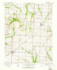 1939 Harwood1960 Print · USGSVernon County in the late thirties remained a landscape of scattered rural schoolhouses and family-named landmarks connected by the Missouri Kansas Texas railroad. Researchers can trace the exact locations of Harwood, Walker, and numerous country schools like Coal Creek Sch and Moss Sch.2 unique versions available
 - 1939 Map of Moundville, 1962 Print
 1939 Moundville1962 Print · USGSVernon County at the end of the Depression era reveals a landscape of independent school districts and dual railroad lines. Genealogists can trace the rural community through the St Francis Convent, Wilburn Cem, and vanished school sites like Hackberry Sch.3 unique versions available
 - 1939 Map of Eldorado Springs South, 1966 Print
 1939 Eldorado Springs South1966 Print · USGSMissouri's southwestern borderlands are captured here in the late thirties, showing a landscape defined by small-town life and rural school districts. Genealogists can locate Mt Pleasant Cem and local landmarks like Nine Wonders Sch or White Hall Ch.2 unique versions available
 - 1940 Map of Harwood
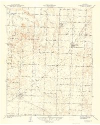 1940 Harwood1940 Print · USGSVernon County farmland and rural rail towns are captured here at the end of the thirties, anchored by the Missouri Kansas Texas line. Trace early school locations like Robinson Sch and Lowe Sch alongside the historic town plats of Walker and Fair Haven.
 - 1940 Map of Hume, 1954 Print
 1940 Hume1954 Print · USGSThe Missouri-Kansas borderlands come to life in this late-depression era survey centered on Hume. Genealogists and local historians can trace family roots through numerous rural landmarks like Hume Cem, Union Chapel, and the settlement of Amos.3 unique versions available
Showing maps 1-25 of 158
Top cities of Vernon County
- Nevada historical maps
- Sheldon historical maps
- Schell City historical maps
- Walker historical maps
- Montevallo historical maps
- Bronaugh historical maps
See more
Frequently asked questions
- What are the different types of historical maps available for Vernon County?
- What is the oldest map of Vernon County?
- Where can I purchase historical maps of Vernon County for my home or office?
- Where can I download high-res historical maps of Vernon County?
- Are there historical topographic maps available for Vernon County?
- Is there historical aerial imagery available for Vernon County?
- Where are historical maps of Vernon County sourced from?