2020s Maps of Wright County, Missouri
Explore 18 historic maps of Wright County from the 2020s. These maps offer a rare glimpse into what life looked like during the 2020s — showing old roads, neighborhoods, homes, and landmarks that have changed or disappeared over time.
Whether you're researching your family's past, planning a metal detecting trip, or studying how Wright County's landscape evolved across the 2020s, these high-resolution maps are a powerful tool for exploring the history of this region.
- Focus on a specific era: All maps on this page are from the 2020s, giving you a focused view of this time period.
- See what’s changed: Compare century-old streets, trails, and buildings to today's modern landscape using overlays and satellite layers.
- Research with precision: Use these maps for genealogy, historical research, land use analysis, or educational projects.
- View, download, or print: Maps are fully viewable online in high resolution, and can be downloaded or printed for your own records.
Start exploring Wright County's history through authentic maps from the 2020s. This is your window into the past.
Wright County, MO maps
(18)- 2021 Map of Duncan, 2021 Print
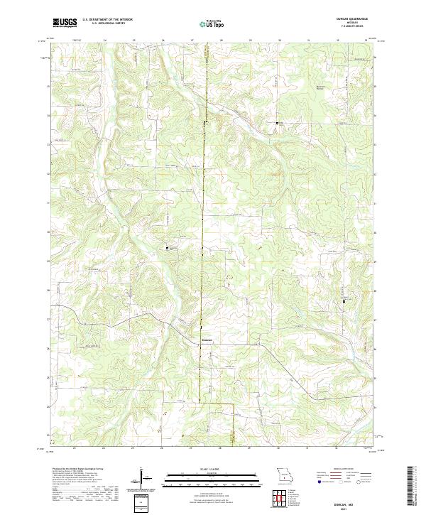 2021 Duncan2021 Print · USGSWright and Webster counties meet along this high Ozark plateau during the early twenty-first century. Genealogists and local historians can trace rural family plots at Sixteenth Cemetery and Mount Olive Cemetery or follow the waters of Cantrell Creek.
 - 2021 Map of Mountain Grove South, 2021 Print
 2021 Mountain Grove South2021 Print · USGSThe southern outskirts of Mountain Grove meet the Ozark timberlands in the early 2020s, revealing a landscape of winding creek prongs and high ridges. Genealogists can locate several rural burial grounds including Strunk Cem and Livingston Cem near the headwaters of Fox Cr.
 - 2021 Map of Rader, 2021 Print
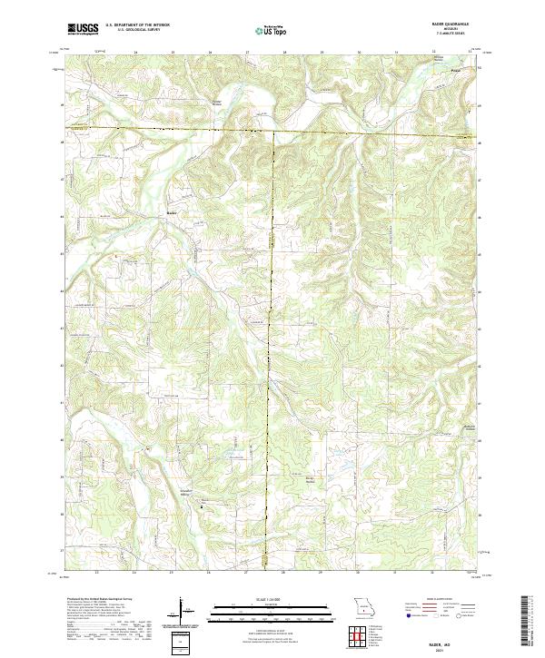 2021 Rader2021 Print · USGSThe rural borderlands of Laclede, Webster, and Wright counties are shown here as they appeared in the early twenty-first century. Genealogists and local historians can trace the paths to Weaver Cem, the small community of Rader, and the banks of the Osage Fork Gasconade River.
 - 2021 Map of Hartville, 2021 Print
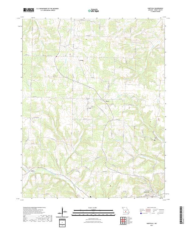 2021 Hartville2021 Print · USGSWright County, Missouri, is shown in this recent survey as a landscape of rural settlements and winding waterways. Researchers can trace the heritage of Hartville and Loring or find family landmarks like Little Creek Cem and Krause Cem.
 - 2021 Map of Competition, 2021 Print
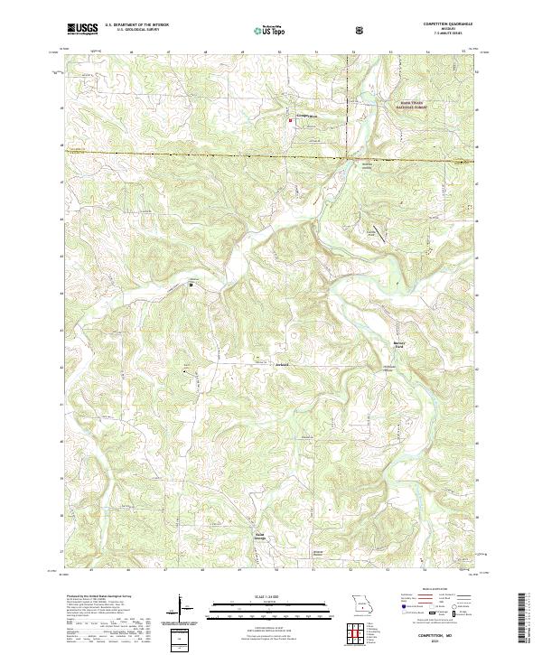 2021 Competition2021 Print · USGSWright and Laclede counties are shown here in the 2020s, featuring the Ozark highlands and the winding Gasconade River. Researchers can trace family sites at Emerson Cem or locate the old river crossing at Burney Ford.
 - 2021 Map of Mansfield NE, 2021 Print
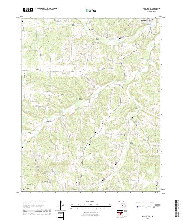 2021 Mansfield NE2021 Print · USGSWright County in the early twenty-first century reveals a landscape of high ridges and deep hollows north of Mansfield. Genealogists can trace family heritage at Pea Ridge Cem, Elmwood Cem, and Boatright Cem while following the winding Woods Fork Gasconade River.
 - 2021 Map of Grovespring, 2021 Print
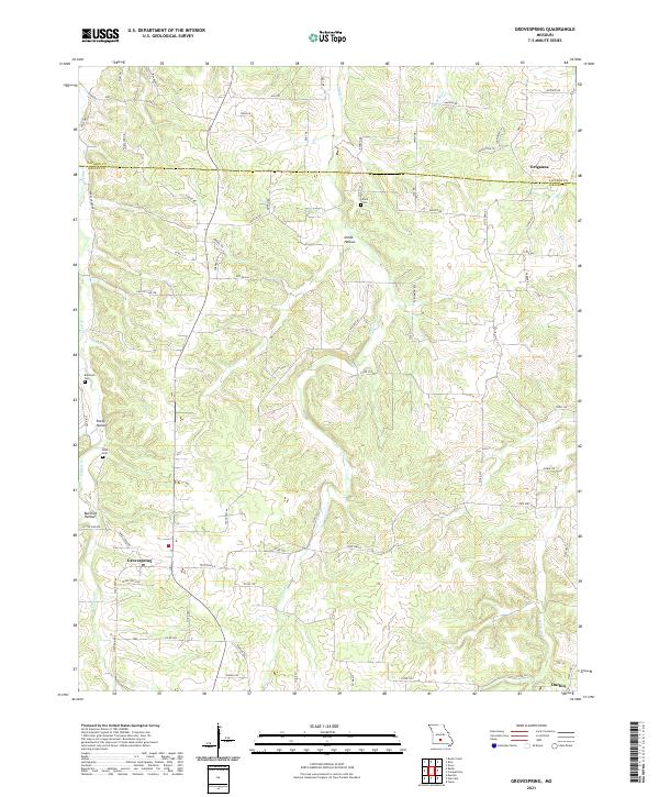 2021 Grovespring2021 Print · USGSThe rural landscapes of Wright and Laclede Counties come into focus in this recent survey. Local historians can trace the drainages of the Born River and Steins Cr to find family landmarks like Davis Cem and the settlement at Origanna.
 - 2021 Map of Dawson, 2021 Print
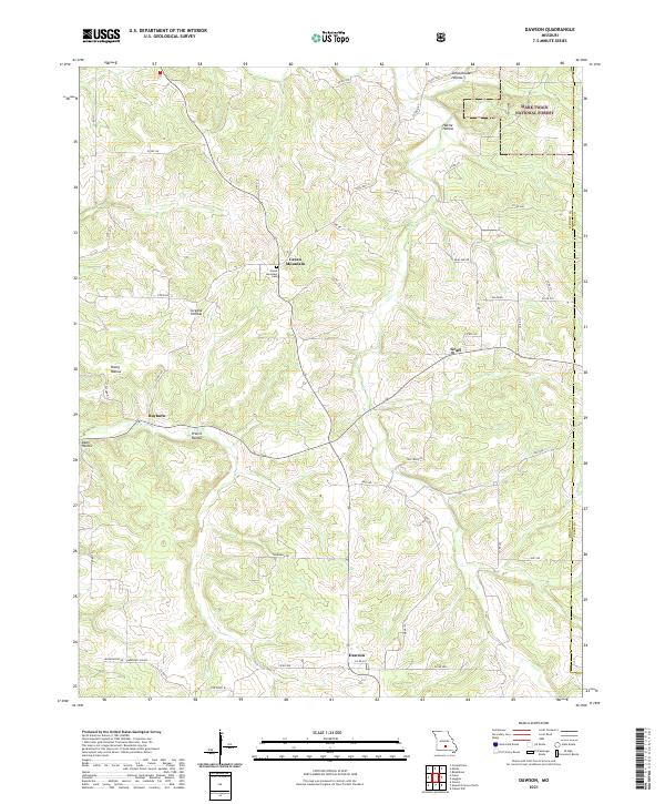 2021 Dawson2021 Print · USGSWright County in the early 2020s remains defined by its deep hollows and high ridges near the national forest boundary. Researchers can trace rural property lines and local landmarks from Green Mountain Cem to the small settlements at Rayborn and Graff.
 - 2021 Map of Owens, 2021 Print
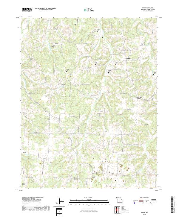 2021 Owens2021 Print · USGSWright County’s rural uplands are captured here in the 2020s, revealing a landscape of family-named hollows and karst geology. Genealogists and local historians can locate more than a dozen historic burial sites, including Mount Zion Cem, Frog Knob Cem, and Cox Cem.
 - 2021 Map of Norwood, 2021 Print
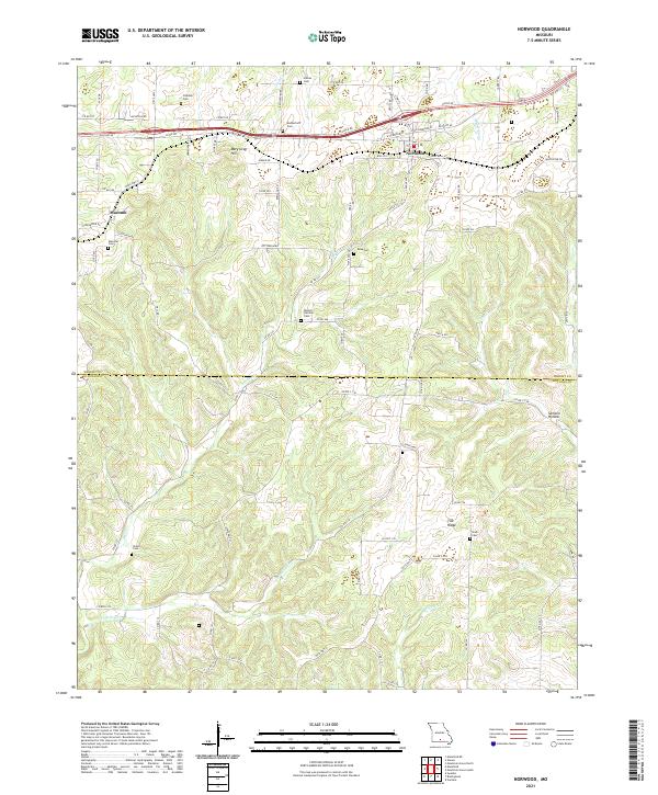 2021 Norwood2021 Print · USGSThe Missouri Ozarks are captured here at the Wright and Douglas county line as they appeared in recent years. Genealogists and local historians can locate many family burial sites, including Rutherford Cem, Ryan Cem, and Stark Cem across the ridge-and-hollow terrain.
 - 2021 Map of Manes, 2021 Print
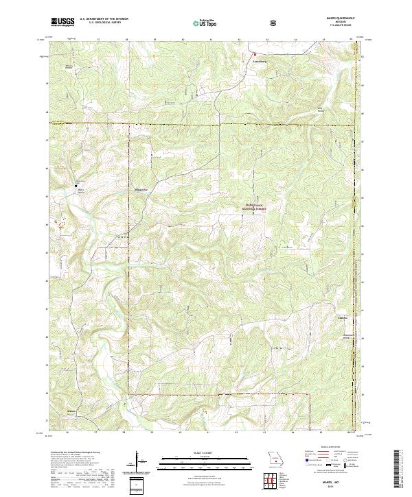 2021 Manes2021 Print · USGSWright County, Missouri, at the start of the 2020s remains a landscape of deep timber and Ozark hollows. Genealogists can trace family roots at Blankenship Cem or locate old community centers like Mingsville, Embree, and the northern village of Lynchburg.
 - 2021 Map of Mansfield, 2021 Print
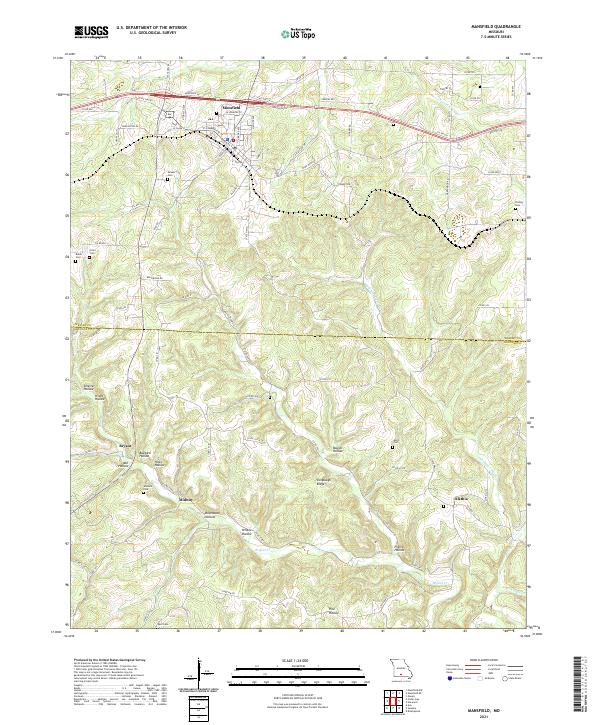 2021 Mansfield2021 Print · USGSThe Wright and Douglas County borderlands are documented here in the early 2020s, showing the Ozark settlement of Mansfield and its outlying rural communities. Genealogists can locate family burial sites like Deaker Cem and Findley Cem or trace the hollows of Bryant Cr.
 - 2021 Map of Cedar Gap, 2021 Print
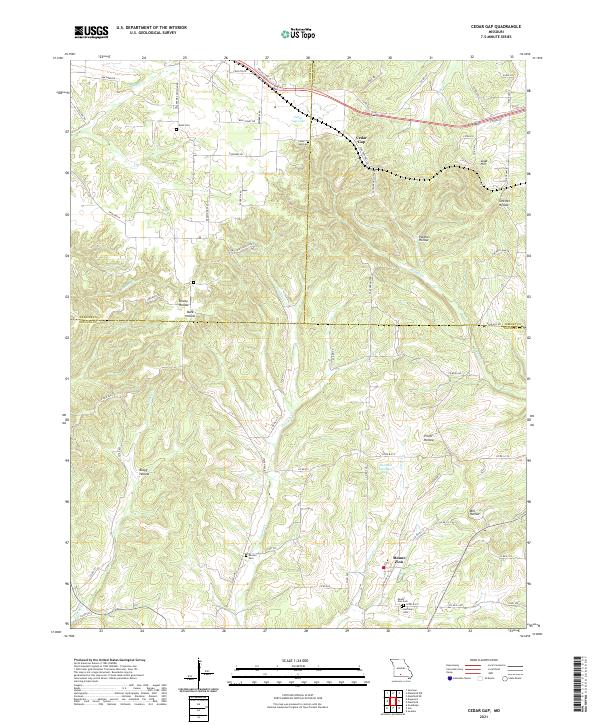 2021 Cedar Gap2021 Print · USGSThe Missouri Ozark highlands are captured here at the triple-border of Webster, Wright, and Douglas counties in the early 2020s. Researchers can locate numerous family burial grounds like Huffman Cemetery and Rush Cemetery alongside rural centers like Mount Zion.
 - 2021 Map of Cabool NW, 2021 Print
 2021 Cabool NW2021 Print · USGSTexas and Wright counties are captured here in 2021, showing the rural landscape between the regional hubs of Mountain Grove and Cabool. Researchers can locate family landmarks such as Canada Cem and Stubbs Cem or trace the winding course of the Big Piney River.
 - 2021 Map of Huggins, 2021 Print
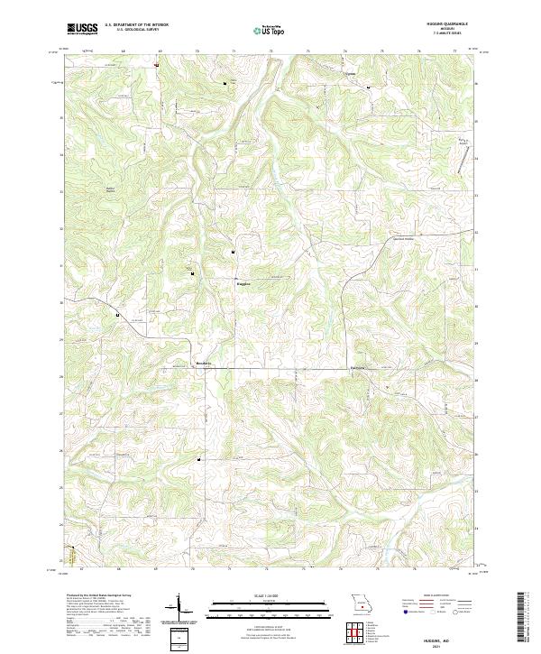 2021 Huggins2021 Print · USGSTexas County, Missouri, is shown here as it appears today, featuring the rural settlements of Huggins and Bendavis amidst the Ozark hills. Genealogists can locate family landmarks like Tuttle Cemetery and trace the winding course of N Fork Beaver Creek.
 - 2021 Map of Mountain Grove North, 2021 Print
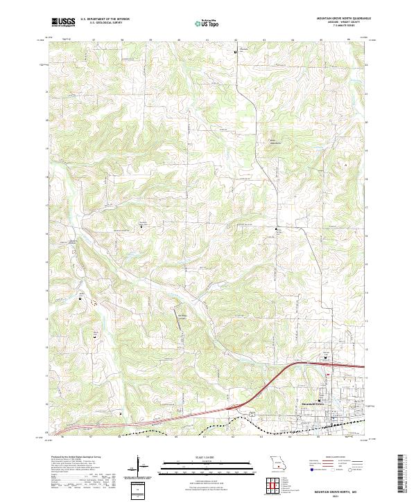 2021 Mountain Grove North2021 Print · USGSWright County in the early twenty-first century reveals a landscape where the northern reaches of Mountain Grove give way to a network of ancestral burial grounds. Genealogists can trace family footprints at Hillcrest Cem, Swede Cem, or the remote Friendship Cem.
 - 2021 Map of Mansfield NW, 2021 Print
 2021 Mansfield NW2021 Print · USGSWebster and Wright counties are shown here as they appeared in the early twenty-first century, marked by winding rivers and rural settlements. Genealogists can trace local landmarks like Smith Cem, Newton Cem, and the community of New Grove.
 - 2021 Map of Fuson, 2021 Print
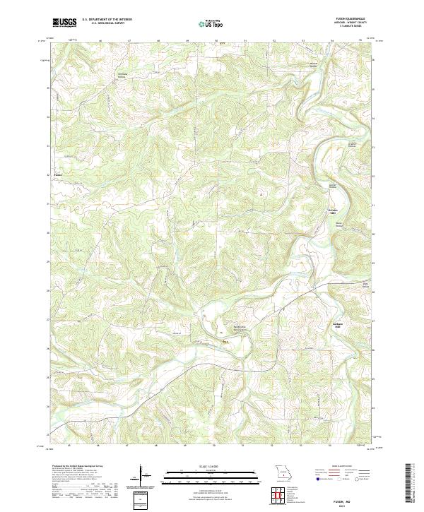 2021 Fuson2021 Print · USGSWright County, Missouri, is mapped here in its modern rural character, defined by the winding Gasconade River and the small settlement of Fuson. Genealogists and local historians can trace legacy sites like Grimes Mill, Latham Mill, and the Needles Eye Natural Arch.
End of results
Showing maps 1-18 of 18
Top cities of Wright County
Frequently asked questions
- What are the different types of historical maps available for Wright County?
- What is the oldest map of Wright County?
- Where can I purchase historical maps of Wright County for my home or office?
- Where can I download high-res historical maps of Wright County?
- Are there historical topographic maps available for Wright County?
- Is there historical aerial imagery available for Wright County?
- Where are historical maps of Wright County sourced from?