Old Maps of Elkhorn Hot Springs, Montana for Genealogy
Trace your family roots with 15 historic maps of Elkhorn Hot Springs. These high-res maps reveal old neighborhoods, homesites, landmarks, and streets — helping you uncover where your ancestors lived and how the area evolved over time.
- Explore historic neighborhoods: Identify where your relatives may have lived in the 1800s or 1900s.
- Compare maps over time: Trace the changes in streets, buildings, and landmarks for multi-generational research.
- Perfect for genealogy & ancestry research: Used by family historians and researchers to map out lineage and migration.
These maps are an incredible resource for exploring your personal connection to Elkhorn Hot Springs's past.
Elkhorn Hot Springs, MT maps
(15)- 1955 Map of Dillon, 1978 Print
 1955 Dillon1978 Print · USGSSouthwest Montana at the dawn of the interstate era reveals a landscape of high-mountain ranching and historic mining camps. Trace the routes of the Union Pacific through Dillon and Armstead, or locate early settlements like Bannack and Wisdom.2 unique versions available
 - 1957 Map of Dillon
 1957 Dillon1957 Print · USGSSouthwest Montana and Idaho in the mid-fifties reveal a high-country landscape of mountain ranges and ranching valleys. Genealogists can trace family holdings and rail stops along the Union Pacific Railroad, from Dillon to historic Virginia City and Twin Bridges.
 - 1958 Map of Dillon
 1958 Dillon1958 Print · USGSSouthwestern Montana during the late fifties reveals a high-country landscape defined by the Continental Divide and a legacy of mountain mining. Genealogists and historians can trace rail lines like the Union Pacific or locate early industrial sites including the Hecla Mine and Ermont Mine.
 - 1959 Map of Polaris, 1961 Print
 1959 Polaris1961 Print · USGSBeaverhead County in the late fifties shows a mountain landscape balancing mining heritage with early recreation. Genealogists and historians can locate family landmarks like the Old Pinkerton Homestead, the Polaris Sch, and remote sites like Swanson Cabin.3 unique versions available
 - 1962 Map of Dillon
 1962 Dillon1962 Print · USGSSouthwest Montana in the early sixties is defined by its high mountain ranges and the winding rivers that carved its settlement patterns. Trace the rail routes of the Union Pacific through Dillon or locate mining activity near Butte and Argenta.
 - 1965 Map of Dillon
 1965 Dillon1965 Print · USGSSouthwest Montana in the mid-1960s is defined by its rugged river valleys and high mountain passes along the Continental Divide. Researchers can trace the path of the Union Pacific through Dillon and Armstead, or locate early mining activity near Melrose and Wise River.
 - 1981 Map of Salmon, 1982 Print
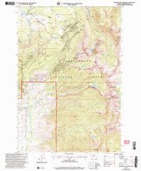
 1981 Salmon1982 Print · USGSThe high mountain border between Idaho and Montana comes alive in the early 1980s as a landscape of remote mines and river junctions. Researchers can trace the heritage of the Beaverhead Mountains through sites like Elkhorn Mine, Silver King Mine, and the settlement of Wisdom.
 - 1988 Map of Elkhorn Hot Springs, 1989 Print
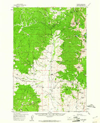
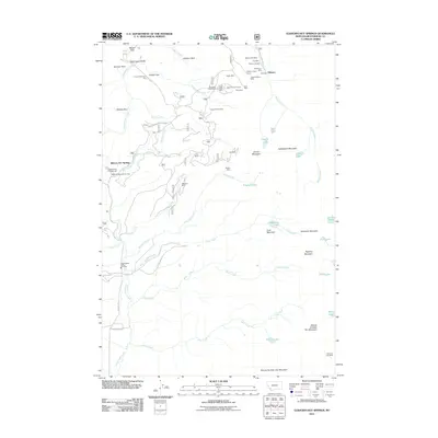
 1988 Elkhorn Hot Springs1989 Print · USGSBeaverhead County mining and mountain life are captured here in the late eighties, centered on the thermal waters of Elkhorn Hot Springs. Trace the Old Railroad Grade to Coolidge or locate high-altitude operations like the Magna Mine and Park Mine.
 - 1997 Map of Elkhorn Hot Springs, 2002 Print
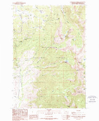
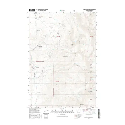
 1997 Elkhorn Hot Springs2002 Print · USGSBeaverhead County’s high Pioneer Mountains are captured here in the late 1990s as a landscape of historic mining and modern recreation. Researchers can trace the layout of the Old Elkhorn Mine, the settlement at Coolidge, and the alpine waters of Sawtooth Lake.
 - 2005 Map of Elkhorn Hot Springs
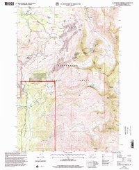
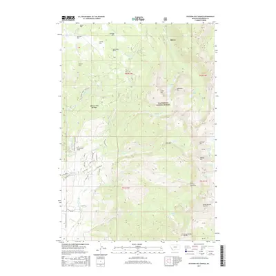
 2005 Elkhorn Hot Springs2005 Print · USGSBeaverhead County was a center for high-altitude mining and early forest management at the start of the twenty-first century. Researchers can trace the legacy of the silver and lead era through the Old Elkhorn Mine, Magna Mine, and the site of Coolidge.
 - 2011 Map of Elkhorn Hot Springs, 2011 Print
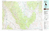
 2011 Elkhorn Hot Springs2011 Print · USGSCovers Elkhorn Hot Springs, including Elkhorn, Beaverhead County, and other nearby areas
 - 2014 Map of Elkhorn Hot Springs, 2014 Print
 2014 Elkhorn Hot Springs2014 Print · USGSCovers Elkhorn Hot Springs, including Elkhorn, Beaverhead County, and other nearby areas
 - 2017 Map of Elkhorn Hot Springs, 2017 Print
 2017 Elkhorn Hot Springs2017 Print · USGSCovers Elkhorn Hot Springs, including Elkhorn, Beaverhead County, and other nearby areas
 - 2020 Map of Elkhorn Hot Springs, 2020 Print
 2020 Elkhorn Hot Springs2020 Print · USGSCovers Elkhorn Hot Springs, including Elkhorn, Beaverhead County, and other nearby areas
 - 2024 Map of Elkhorn Hot Springs, 2024 Print
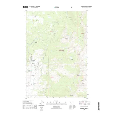
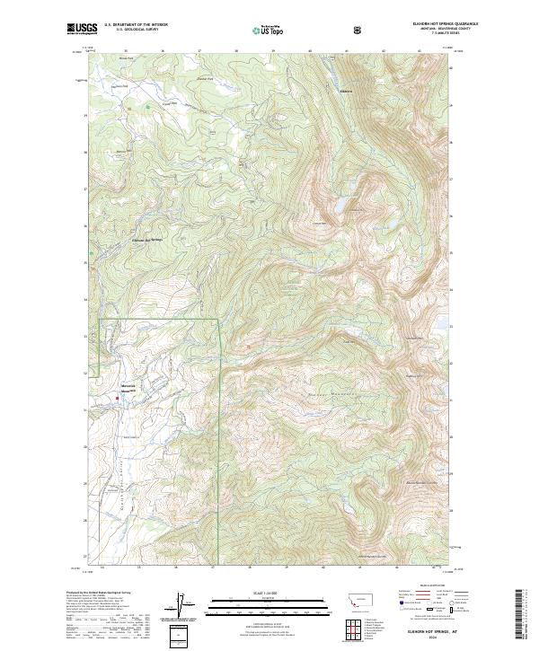 2024 Elkhorn Hot Springs2024 Print · USGSThe Pioneer Mountains are seen here in the 2020s, showcasing a landscape of high-altitude hot springs and winter recreation. Researchers can trace the roads and trails serving Elkhorn Hot Springs, Maverick Mountain, and Crystal Park.
End of results
Showing maps 1-15 of 15
Top cities near Elkhorn Hot Springs
Frequently asked questions
- What are the different types of historical maps available for Elkhorn Hot Springs?
- What is the oldest map of Elkhorn Hot Springs?
- Where can I purchase historical maps of Elkhorn Hot Springs for my home or office?
- Where can I download high-res historical maps of Elkhorn Hot Springs?
- Are there historical topographic maps available for Elkhorn Hot Springs?
- Is there historical aerial imagery available for Elkhorn Hot Springs?
- Where are historical maps of Elkhorn Hot Springs sourced from?