2000s (21st Century) Maps of Elkhorn Hot Springs, Montana
Explore 6 historic maps of Elkhorn Hot Springs from the 2000s (21st Century). These maps offer a rare glimpse into what life looked like during the 2000s — showing old roads, neighborhoods, homes, and landmarks that have changed or disappeared over time.
Whether you're researching your family's past, planning a metal detecting trip, or studying how Elkhorn Hot Springs's landscape evolved across the 2000s, these high-resolution maps are a powerful tool for exploring the history of this region.
- Focus on a specific era: All maps on this page are from the 2000s, giving you a focused view of this time period.
- See what’s changed: Compare century-old streets, trails, and buildings to today's modern landscape using overlays and satellite layers.
- Research with precision: Use these maps for genealogy, historical research, land use analysis, or educational projects.
- View, download, or print: Maps are fully viewable online in high resolution, and can be downloaded or printed for your own records.
Start exploring Elkhorn Hot Springs's history through authentic maps from the 2000s. This is your window into the past.
Elkhorn Hot Springs, MT maps
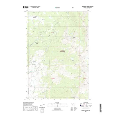
(6)- 2005 Map of Elkhorn Hot Springs
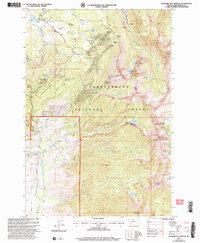 2005 Elkhorn Hot Springs2005 Print · USGSBeaverhead County was a center for high-altitude mining and early forest management at the start of the twenty-first century. Researchers can trace the legacy of the silver and lead era through the Old Elkhorn Mine, Magna Mine, and the site of Coolidge.
 - 2011 Map of Elkhorn Hot Springs, 2011 Print
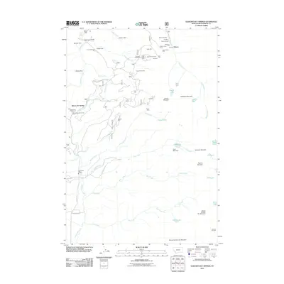 2011 Elkhorn Hot Springs2011 Print · USGSCovers Elkhorn Hot Springs, including Elkhorn, Beaverhead County, and other nearby areas
 - 2014 Map of Elkhorn Hot Springs, 2014 Print
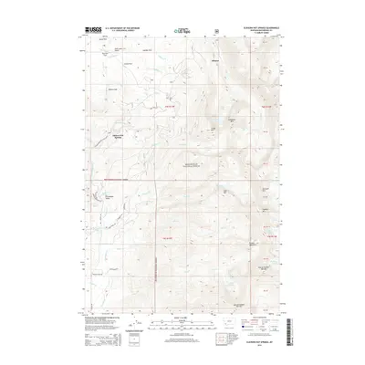 2014 Elkhorn Hot Springs2014 Print · USGSCovers Elkhorn Hot Springs, including Elkhorn, Beaverhead County, and other nearby areas
 - 2017 Map of Elkhorn Hot Springs, 2017 Print
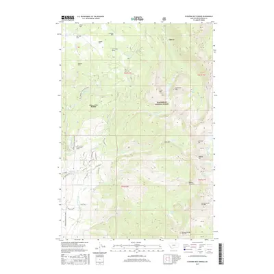 2017 Elkhorn Hot Springs2017 Print · USGSCovers Elkhorn Hot Springs, including Elkhorn, Beaverhead County, and other nearby areas
 - 2020 Map of Elkhorn Hot Springs, 2020 Print
 2020 Elkhorn Hot Springs2020 Print · USGSCovers Elkhorn Hot Springs, including Elkhorn, Beaverhead County, and other nearby areas
 - 2024 Map of Elkhorn Hot Springs, 2024 Print
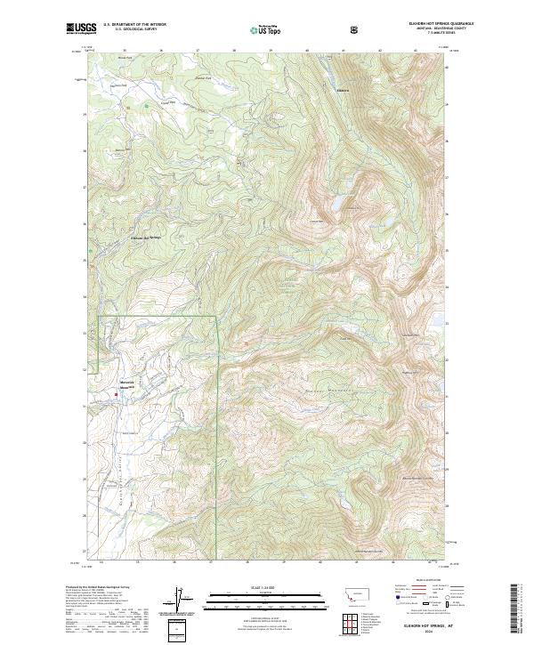 2024 Elkhorn Hot Springs2024 Print · USGSThe Pioneer Mountains are seen here in the 2020s, showcasing a landscape of high-altitude hot springs and winter recreation. Researchers can trace the roads and trails serving Elkhorn Hot Springs, Maverick Mountain, and Crystal Park.
End of results
Showing maps 1-6 of 6
Top cities near Elkhorn Hot Springs
Frequently asked questions
- What are the different types of historical maps available for Elkhorn Hot Springs?
- What is the oldest map of Elkhorn Hot Springs?
- Where can I purchase historical maps of Elkhorn Hot Springs for my home or office?
- Where can I download high-res historical maps of Elkhorn Hot Springs?
- Are there historical topographic maps available for Elkhorn Hot Springs?
- Is there historical aerial imagery available for Elkhorn Hot Springs?
- Where are historical maps of Elkhorn Hot Springs sourced from?