Old Maps of Kirby, Montana for Academic Research
Study the evolution of Kirby with 10 high-resolution historic maps. Whether you're teaching, researching, or modeling changes in land use, these maps provide essential visual documentation of urban, environmental, and geographic change.
- Analyze long-term change: Track patterns in development, transportation, and natural features.
- Ideal for environmental or urban studies: Support academic projects with primary historical map data.
- Use in the classroom or lab: Educators and researchers rely on these maps to bring historical context to life.
These maps are a powerful tool for teaching, research, and visualizing how Kirby has changed over the decades.
Kirby, MT maps
(10)- 1954 Map of Hardin, 1964 Print
 1954 Hardin1964 Print · USGSSoutheastern Montana is documented here during the mid-fifties, showing the vast tribal lands and historic battle sites before modern highway expansion. Researchers can trace the Chicago Burlington and Quincy rail line through Hardin or locate the Custer National Cemetery and Museum.2 unique versions available
 - 1957 Map of Hardin
 1957 Hardin1957 Print · USGSSoutheastern Montana in the mid-fifties reveals a landscape shaped by tribal lands and the historic Bighorn river valleys. Researchers can trace the Chicago Burlington and Quincy RR through Hardin and locate the National Cemetery and Custer Battlefield Monument.
 - 1958 Map of Hardin
 1958 Hardin1958 Print · USGSSoutheastern Montana in the mid-fifties presents a landscape defined by significant tribal lands and national monuments. Researchers can trace the geography of the Little Bighorn at Custer Battlefield National Monument and locate settlements like Lame Deer and Birney.
 - 1967 Map of Kirby, 1971 Print
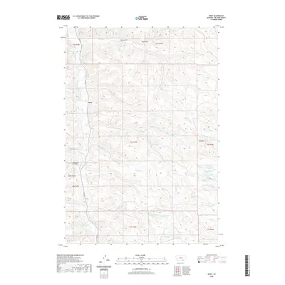
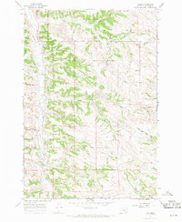 1967 Kirby1971 Print · USGSBig Horn County ranching and reservation lands are documented here during the late sixties. Genealogists and local historians can trace landmarks like St Francis Ch, the Log Sch, and the winding path of Rosebud Creek through the settlement of Kirby.2 unique versions available
 - 1980 Map of Birney
 1980 Birney1980 Print · USGSSoutheastern Montana enters a period of intensive energy development in the early 1980s as coal mines expand across the Big Horn County line. Researchers can trace the industrial footprints of the Spring Creek Mine and West Decker Mine or locate rural landmarks like the Birney Day School.
 - 2011 Map of Kirby, 2011 Print
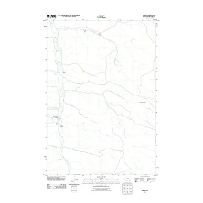 2011 Kirby2011 Print · USGSCovers Kirby, including Busby District, Big Horn County, and other nearby areas
 - 2014 Map of Kirby, 2014 Print
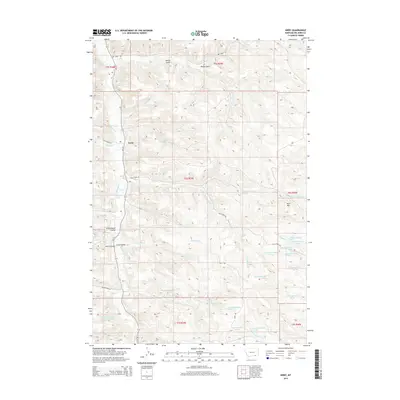 2014 Kirby2014 Print · USGSCovers Kirby, including Busby District, Big Horn County, and other nearby areas
 - 2017 Map of Kirby, 2017 Print
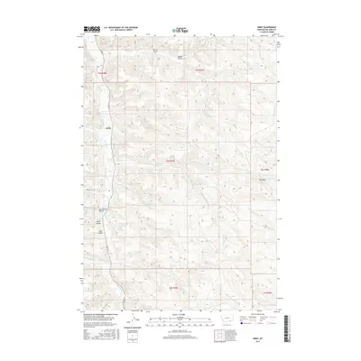 2017 Kirby2017 Print · USGSCovers Kirby, including Busby District, Big Horn County, and other nearby areas
 - 2020 Map of Kirby, 2020 Print
 2020 Kirby2020 Print · USGSCovers Kirby, including Busby District, Big Horn County, and other nearby areas
 - 2024 Map of Kirby, 2024 Print
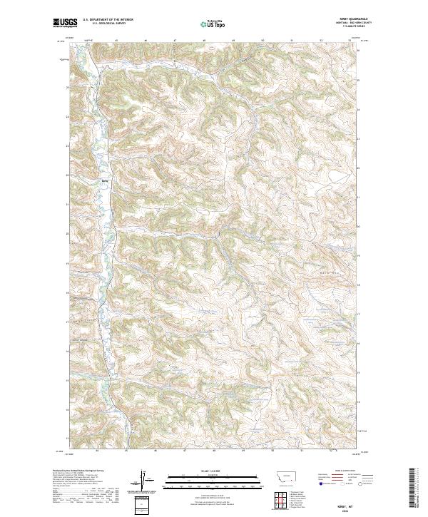 2024 Kirby2024 Print · USGSBig Horn County at the present day retains the rural character of its creek-side settlements and high-plateau terrain. Trace the ranching landscape around Kirby and Rosebud Creek, or locate local landmarks like Schoolhouse Coulee and Horn Mtn.
End of results
Showing maps 1-10 of 10
Top cities near Kirby
Frequently asked questions
- What are the different types of historical maps available for Kirby?
- What is the oldest map of Kirby?
- Where can I purchase historical maps of Kirby for my home or office?
- Where can I download high-res historical maps of Kirby?
- Are there historical topographic maps available for Kirby?
- Is there historical aerial imagery available for Kirby?
- Where are historical maps of Kirby sourced from?