Old Maps of Apgar, Montana for Metal Detecting
Plan your next treasure hunt with 12 historic maps of Apgar. Find old homesites, ghost towns, trails, and gathering spots that may be lost to time — perfect for identifying promising metal detecting locations.
- Locate forgotten sites: Uncover places like long-lost settlements, abandoned rail lines, or gathering spots.
- Plan better hunts: Use map overlays combined with LiDAR or satellite views to narrow in on historically rich areas.
- Made for detectorists: Thousands of hobbyists use these maps to discover relics, coins, and hidden history.
Use these historic maps to boost your research and find new opportunities beneath the surface of Apgar.
Apgar, MT maps
(12)- 1904 Map of Chief Mountain
 1904 Chief Mountain1904 Print · USGSThe northern Rockies at the dawn of the century were a rugged borderland of forest reserves and tribal lands. Researchers can trace early outposts like Kipps Cabin and Altyn, or locate family-named sites including Rogers Ranch and Geduhn's.8 unique versions available
 - 1938 Map of Chief Mountain, 1953 Print
 1938 Chief Mountain1953 Print · USGSGlacier National Park and the neighboring Blackfeet Indian Reservation are shown here during the late thirties as the modern highway system was taking shape. You can trace the early tourism and management landscape through Going-to-the-Sun Chalet, Many Glacier, and the remote Sperry Chalet.8 unique versions available
 - 1960 Map of Cut Bank, 1968 Print
 1960 Cut Bank1968 Print · USGSThe high peaks of the Rockies meet the eastern plains in the 1960s, showing the intersection of federal lands and the Blackfeet Indian Reservation. Trace the path of the Great Northern railway and find local landmarks like the Blackfoot Boarding School and Family Mission Cem.3 unique versions available
 - 1963 Map of Cut Bank
 1963 Cut Bank1963 Print · USGSNorthern Montana’s mountain passes and high plains are captured here in the early 1960s. Genealogists and historians can trace the Great Northern rail stops from Browning to Ethridge or locate the remote outposts at Polebridge and Babb.
 - 1964 Map of Cut Bank
 1964 Cut Bank1964 Print · USGSGlacier National Park and the Blackfeet Indian Reservation meet in the early sixties at the triple divide of North America. Researchers can trace the Great Northern Railway through mountain passes and locate local landmarks like the Blackfoot Boarding School and Apgar Village.
 - 1968 Map of Lake Mc Donald West, 1971 Print
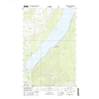
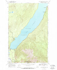 1968 Lake Mc Donald West1971 Print · USGSGlacier National Park in the late sixties reveals the early layout of park headquarters and the burgeoning tourism infrastructure around Apgar. Trace the iconic Glacier Route to the Sun, locate the Fish Creek Ranger Station, and follow the Burlington Northern line along the river.2 unique versions available
 - 1994 Map of Lake Mc Donald West, 1997 Print
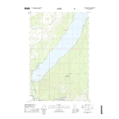
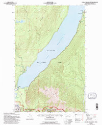 1994 Lake Mc Donald West1997 Print · USGSGlacier National Park's western gateway is captured in the mid-1990s, centering on the expanse of Mc Donald Lake. Trace the lakeside infrastructure from the Lake McDonald Hotel down to the historic village of Apgar and the Park Headquarters.
 - 2011 Map of Lake McDonald West, 2011 Print
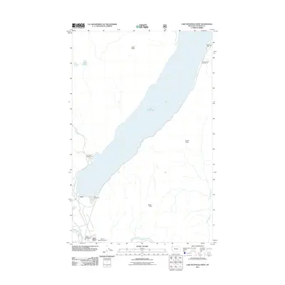 2011 Lake McDonald West2011 Print · USGSCovers Apgar, including Flathead County, United States, and other nearby areas
 - 2014 Map of Lake McDonald West, 2014 Print
 2014 Lake McDonald West2014 Print · USGSCovers Apgar, including Flathead County, United States, and other nearby areas
 - 2017 Map of Lake McDonald West, 2017 Print
 2017 Lake McDonald West2017 Print · USGSCovers Apgar, including Flathead County, United States, and other nearby areas
 - 2020 Map of Lake McDonald West, 2020 Print
 2020 Lake McDonald West2020 Print · USGSCovers Apgar, including Flathead County, United States, and other nearby areas
 - 2024 Map of Lake McDonald West, 2024 Print
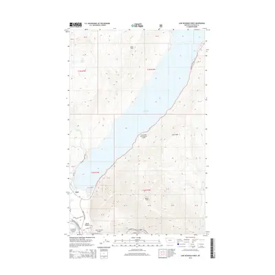
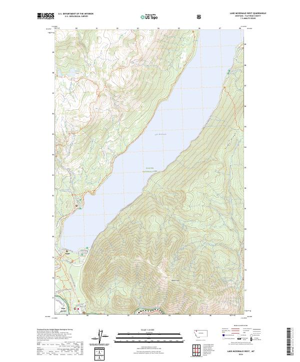 2024 Lake McDonald West2024 Print · USGSGlacier National Park's southwestern entrance comes into sharp focus in this modern survey of the Flathead River corridor. Trace the park's early infrastructure and modern trails around Apgar and West Glacier, or follow the iconic Going-to-the-Sun Road along Lake McDonald.
End of results
Showing maps 1-12 of 12
Top cities near Apgar
Frequently asked questions
- What are the different types of historical maps available for Apgar?
- What is the oldest map of Apgar?
- Where can I purchase historical maps of Apgar for my home or office?
- Where can I download high-res historical maps of Apgar?
- Are there historical topographic maps available for Apgar?
- Is there historical aerial imagery available for Apgar?
- Where are historical maps of Apgar sourced from?