1980s Maps of Garfield County, Montana
Explore 15 historic maps of Garfield County from the 1980s. These maps offer a rare glimpse into what life looked like during the 1980s — showing old roads, neighborhoods, homes, and landmarks that have changed or disappeared over time.
Whether you're researching your family's past, planning a metal detecting trip, or studying how Garfield County's landscape evolved across the 1980s, these high-resolution maps are a powerful tool for exploring the history of this region.
- Focus on a specific era: All maps on this page are from the 1980s, giving you a focused view of this time period.
- See what’s changed: Compare century-old streets, trails, and buildings to today's modern landscape using overlays and satellite layers.
- Research with precision: Use these maps for genealogy, historical research, land use analysis, or educational projects.
- View, download, or print: Maps are fully viewable online in high resolution, and can be downloaded or printed for your own records.
Start exploring Garfield County's history through authentic maps from the 1980s. This is your window into the past.
Garfield County, MT maps
(15)- 1983 Map of Flowing Well
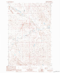
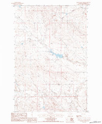
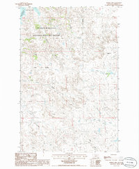
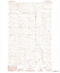 1983 Flowing Well1983 Print · USGSThe high plains of McCone and Garfield counties are captured here in the early 1980s, revealing a landscape shaped by water and isolation. Researchers can trace the drainage patterns of Patterson Coulee or locate the namesake Flowing Well settlement among the winding paths of Timber Creek and Crooked Creek.
 - 1983 Map of Jordan
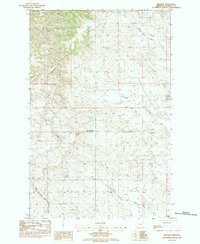
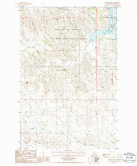
 1983 Jordan1983 Print · USGSGarfield County ranchlands and the high plains are captured here in the early eighties as the town of Jordan serves as the regional center. Genealogists and historians can trace family-named landmarks like Phillips Buttes or the remote settlement of Cohagen near Little Dry Creek.
 - 1983 Map of Forsyth
 1983 Forsyth1983 Print · USGSEastern Montana's high plains and river valleys come into focus in the early eighties as the rail-and-ranching economy centered on the Yellowstone River. Researchers can trace the development of small rail towns like Hysham, Angela, and Ingomar alongside the Burlington Northern line.
 - 1983 Map of Biscuit Butte, 1984 Print
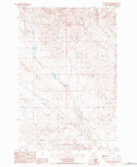
 1983 Biscuit Butte1984 Print · USGSGarfield County ranching lands in the early eighties are mapped here, showing the vital water infrastructure of the Montana plains. Researchers can locate family-named landmarks like Mc Krone Reservoir and prominent peaks such as Haystack Butte or Castle Butte.
 - 1983 Map of Steve Forks, 1984 Print
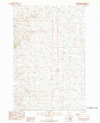
 1983 Steve Forks1984 Print · USGSGarfield County ranching country is captured here during the early eighties, showing the sparse settlement of the Montana high plains. Genealogists and researchers can locate the Steve Forks Cem and trace seasonal waterways like King Coulee and Wheatcroft Reservoir.
 - 1983 Map of Blackfoot School, 1984 Print
 1983 Blackfoot School1984 Print · USGSGarfield County's rural landscape is captured here in the early eighties, showcasing a remote Montana ranching district. Local historians can locate the Blackfoot Sch, the Blackfoot Ch, and the small settlement of Hazny near Chalk Butte.
 - 1983 Map of Smoky Butte, 1984 Print
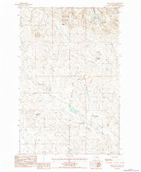
 1983 Smoky Butte1984 Print · USGSGarfield County, Montana, is shown here in the early 1980s as a landscape of wide-open ranch land and seasonal waterways. Researchers can locate family landmarks like the Hintner Cem and trace the drainage patterns of Big Dry Creek and Smoky Butte Creek.
 - 1983 Map of Brusett, 1984 Print
 1983 Brusett1984 Print · USGSBrusett and the surrounding Garfield County plains appear here in the early eighties as a dedicated ranching and farming landscape. Researchers can trace the exact locations of the Brusett Community Ch, old Grain Tanks, and the winding Smoky Butte Creek.
 - 1983 Map of Moonlight Creek, 1984 Print
 1983 Moonlight Creek1984 Print · USGSGarfield County ranchlands are captured here in the early eighties, showing the remote drainages and livestock infrastructure of the era. Genealogists can locate Butte Creek Cem while researchers trace the surroundings of Trumbo Ranch and Smoky Butte.
 - 1983 Map of Steve Forks SW, 1984 Print
 1983 Steve Forks SW1984 Print · USGSCentral Montana in the early eighties is captured here in a period of quiet transition. Researchers can trace the winding paths of Steve Forks and North Fork Lodgepole Creek or locate the path of the Wooden Pole Trans Line.
 - 1983 Map of Smoky Butte Creek, 1984 Print
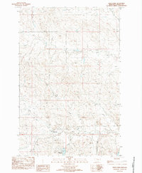
 1983 Smoky Butte Creek1984 Print · USGSGarfield County's high plains are captured in the early eighties, showcasing a remote landscape of winding coulees and drainage basins. Researchers can trace the rugged topography around Smoky Butte and follow water features like Steve Forks and Lone Tree Creek.
 - 1985 Map of Maloney Hill, 1986 Print
 1985 Maloney Hill1986 Print · USGSThe Missouri River Breaks of Garfield County are shown here in the mid-1980s, revealing the complex shoreline of Fort Peck Lake. Researchers can trace the drainages of Hell Creek and Two Deep Coulee or locate isolated water sources like Manaige Spring.
 - 1985 Map of Little Buffalo Hill, 1986 Print
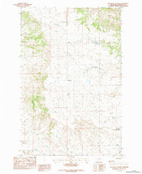
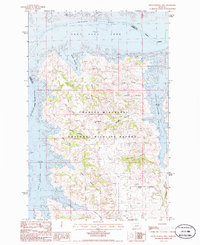 1985 Little Buffalo Hill1986 Print · USGSGarfield County, Montana, was a landscape of deep coulees and expansive reservoir waters in the mid-eighties. Trace the rugged drainages of Beebe Coulee Bay and Little Buffalo Hill within the Charles M Russell National Wildlife Refuge.
 - 1985 Map of Peterson Point, 1986 Print
 1985 Peterson Point1986 Print · USGSThe Missouri River Breaks in the mid-1980s are captured here as Fort Peck Lake fills the ancient valley. Researchers can trace the complex shoreline of Snow Creek Bay and locate landmarks like Peterson Point and the remote McKinnon Coulee.
 - 1986 Map of Buffalo Hill
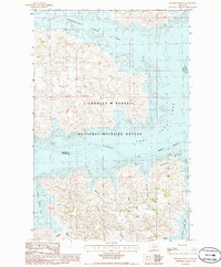
 1986 Buffalo Hill1986 Print · USGSGarfield County, Montana, was defined by its sprawling prairie and reservoir breaks during the mid-eighties. Researchers can trace the rugged topography of the Charles M Russell National Wildlife Refuge and locate landmarks like Buffalo Hill and Hell Creek Bay.
End of results
Showing maps 1-15 of 15
Top cities of Garfield County
Frequently asked questions
- What are the different types of historical maps available for Garfield County?
- What is the oldest map of Garfield County?
- Where can I purchase historical maps of Garfield County for my home or office?
- Where can I download high-res historical maps of Garfield County?
- Are there historical topographic maps available for Garfield County?
- Is there historical aerial imagery available for Garfield County?
- Where are historical maps of Garfield County sourced from?