1970s Maps of Garfield County, Montana
Explore 24 historic maps of Garfield County from the 1970s. These maps offer a rare glimpse into what life looked like during the 1970s — showing old roads, neighborhoods, homes, and landmarks that have changed or disappeared over time.
Whether you're researching your family's past, planning a metal detecting trip, or studying how Garfield County's landscape evolved across the 1970s, these high-resolution maps are a powerful tool for exploring the history of this region.
- Focus on a specific era: All maps on this page are from the 1970s, giving you a focused view of this time period.
- See what’s changed: Compare century-old streets, trails, and buildings to today's modern landscape using overlays and satellite layers.
- Research with precision: Use these maps for genealogy, historical research, land use analysis, or educational projects.
- View, download, or print: Maps are fully viewable online in high resolution, and can be downloaded or printed for your own records.
Start exploring Garfield County's history through authentic maps from the 1970s. This is your window into the past.
Garfield County, MT maps
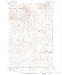
(24)- 1971 Map of Hell Hollow, 1974 Print
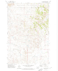 1971 Hell Hollow1974 Print · USGSThe Missouri River breaks of Garfield County come into focus during the early 1970s, highlighting the remote backcountry of the Charles M Russell National Wildlife Range. Researchers can trace the winding drainages of Snow Creek and locate landmarks like Baldy Butte and South Fork Hell Hollow.2 unique versions available
 - 1971 Map of Trumbo Ranch, 1974 Print
 1971 Trumbo Ranch1974 Print · USGSGarfield County ranchlands meet the Missouri River breaks in the early seventies, just as the regional wildlife range was being established. Researchers can trace the shoreline of Fort Peck Lake and locate isolated landmarks like Trumbo Ranch and Brownie Butte.2 unique versions available
 - 1971 Map of Wolfe Coulee, 1974 Print
 1971 Wolfe Coulee1974 Print · USGSThe Missouri River breaks of Valley and Garfield counties are captured here in the early seventies, detailing the winding shoreline of Fort Peck Lake. Researchers can trace the rugged drainage networks of Wolfe Coulee, Billy Creek, and the isolated Hell Hole Coulee.
 - 1971 Map of Wagon Coulee, 1974 Print
 1971 Wagon Coulee1974 Print · USGSThe Missouri River breaks of Valley and Garfield Counties are shown here in the early 1970s as the reservoir reshaped the plains. Researchers can locate remote outposts like Faranuf Ranch, prominent landforms such as Round Butte, and the waters of Fort Peck Lake.
 - 1971 Map of Harper Camp, 1974 Print
 1971 Harper Camp1974 Print · USGSThe Missouri River breaks of Valley and Garfield counties are captured here in the early seventies. Genealogists and researchers can trace the shoreline of Fort Peck Lake and find remote landmarks like Harper Camp and Harper Ridge.
 - 1971 Map of Sawmill Creek, 1974 Print
 1971 Sawmill Creek1974 Print · USGSGarfield County ranching and conservation land are captured here in the early 1970s. Trace local water sources and land use across the Charles M Russell National Wildlife Range, Wilson Ranch, and Fort Peck Lake.
 - 1971 Map of Chalk Butte, 1974 Print
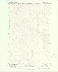
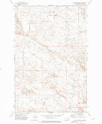
 1971 Chalk Butte1974 Print · USGSCentral Garfield County ranching country is captured here in the early 1970s, showcasing the high plains and coulees. Trace the livestock infrastructure around Brusett or the protected landscape of the Charles M Russell National Wildlife Range and Chalk Butte.2 unique versions available
 - 1971 Map of Swede Ridge, 1975 Print
 1971 Swede Ridge1975 Print · USGSThe Missouri River breaks of Montana are captured here during the 1970s, showing the intersection of three counties within the Charles M Russell National Wildlife Range. Researchers can trace the path of the Cart Trail or locate high-country landmarks like Rock Peak and Swede Ridge.
 - 1972 Map of Kester School, 1975 Print
 1972 Kester School1975 Print · USGSGarfield County ranching country is mapped here in the early 1970s, showcasing the isolated life of the Montana breaks. Genealogists and local historians can trace family-named sites like the Binion Ranch, the rural Kester School, and the path of the Haxby Road.
 - 1972 Map of Short Creek, 1975 Print
 1972 Short Creek1975 Print · USGSGarfield County ranching lands and the rugged breaks of the Missouri River are captured here in the early 1970s. Researchers can trace remote homesteading sites like Flint Ranch or map the complex shoreline of the Fort Dry Peck Lake Arm near Stubby Point.
 - 1972 Map of Gilbert Creek SE, 1975 Print
 1972 Gilbert Creek SE1975 Print · USGSGarfield County ranching country is captured here in the early 1970s, showing the vast drainage systems that define this part of the Big Sky state. Researchers can trace the path of Haxby Road past a local Landing Area and follow the courses of Woody Creek and Flat Creek.
 - 1972 Map of Flat Creek School, 1975 Print
 1972 Flat Creek School1975 Print · USGSGarfield County ranchlands and prairie drainages are captured here in the early 1970s. Researchers can locate the Flat Creek Sch, the Twitchell Ranch, and the winding paths of Green Coulee and Thompson Coulee.
 - 1972 Map of Spring Creek Bay, 1975 Print
 1972 Spring Creek Bay1975 Print · USGSThe Missouri River breaks of Eastern Montana are captured here in the early seventies as the reservoir reshapes the landscape. Map researchers can trace the intricate shoreline of Spring Creek Bay and locate recreation sites like Hell Creek State Park.
 - 1972 Map of Gilbert Creek, 1975 Print
 1972 Gilbert Creek1975 Print · USGSFort Peck Lake and the surrounding breaks of Garfield County are shown here in the early seventies as part of a sprawling wildlife range. Researchers can trace landforms like Square Butte, navigate Haxby Road, or follow the drainages of Gilbert Creek.
 - 1972 Map of Norville Creek, 1975 Print
 1972 Norville Creek1975 Print · USGSGarfield County in the early seventies shows a landscape defined by the waters of the Fort Peck Lake reservoir and its surrounding wildlife range. Researchers can trace the drainage patterns of Norville Creek or locate isolated landmarks like the Landing Strip and Drill Hole.
 - 1972 Map of Ash Creek East, 1975 Print
 1972 Ash Creek East1975 Print · USGSGarfield and McCone Counties are captured in the early seventies, showcasing the winding shoreline of the Missouri River breaks. Genealogists and researchers can trace the rugged drainages of Cat Creek, Jawbone Coulee, and the remote Daniels Point above Fort Peck Lake.
 - 1972 Map of Ash Creek West, 1975 Print
 1972 Ash Creek West1975 Print · USGSGarfield County's high plains are captured here in the early seventies, showing a sparsely settled landscape of grazing lands and wildlife conservation. Researchers can locate remote rural infrastructure like the Cat Creek Sch, the Haxby Road, and the sprawling Charles M Russell National Wildlife Range.
 - 1972 Map of York Island, 1975 Print
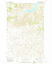
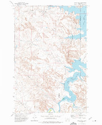
 1972 York Island1975 Print · USGSFort Peck Lake and the Missouri River corridor define this landscape in the early seventies as a hub for both conservation and recreation. Researchers can trace the shoreline of York Island, the reach of the Dry Arm, and facilities at Fort Peck Dam.
 - 1972 Map of Signal Butte, 1975 Print
 1972 Signal Butte1975 Print · USGSThe Missouri Breaks of Garfield and Valley counties are captured here in the early 1970s, as ranching outposts met federal conservation lands. Researchers can trace the remote Cole Ranch and topographic landmarks like Signal Butte and Swallow Nest Spring.
 - 1972 Map of Bobcat Creek, 1976 Print
 1972 Bobcat Creek1976 Print · USGSThe McCone County prairie meets the vast reach of the Missouri River reservoir in the early 1970s. Trace the intricate shoreline of Fort Peck Lake and find remote landmarks like the solitary Grave or the Bear Creek Recreation Area.
 - 1978 Map of Fort Peck Lake West
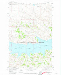
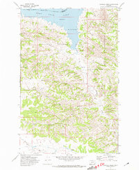
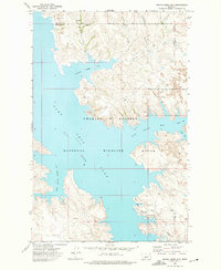
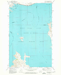
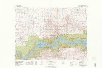 1978 Fort Peck Lake West1978 Print · USGSNorthern Montana plains and the Missouri River brakes are captured here in the late seventies. Researchers can trace remote outposts like Regina PO, the winding waters of Fort Peck Lake, and the solitary Coal Mine near the county line.2 unique versions available
 - 1978 Map of Fort Peck Lake East
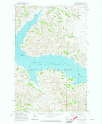
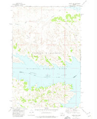
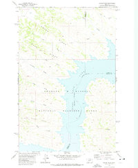
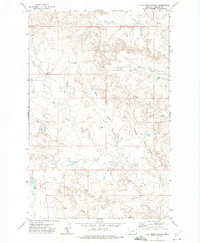
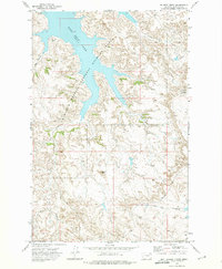
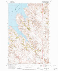
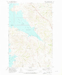
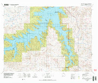 1978 Fort Peck Lake East1978 Print · USGSGarfield County, Montana, is shown here during the late 1970s as the rising waters of Fort Peck Lake reshaped the Missouri River breaks. Genealogists and local researchers can trace family-named sites like Collins Ranch, Keister School, and Rodgers Hall.2 unique versions available
 - 1979 Map of Melstone
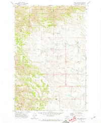
 1979 Melstone1979 Print · USGSThe ranching and rail corridors of central Montana are preserved in this late 1970s survey. Genealogists and historians can trace the Milwaukee Road through settlements like Melstone, Ingomar, and Sumatra along the Musselshell River.
 - 1979 Map of Angela
 1979 Angela1979 Print · USGSEastern Montana rangeland at the end of the seventies reveals a vast network of watercourses and isolated ranching outposts. Trace family land near Angela or locate remote landmarks like Steamboat Rock, Dinosaur Dam, and the intersection of four different county lines.
End of results
Showing maps 1-24 of 24
Top cities of Garfield County
Frequently asked questions
- What are the different types of historical maps available for Garfield County?
- What is the oldest map of Garfield County?
- Where can I purchase historical maps of Garfield County for my home or office?
- Where can I download high-res historical maps of Garfield County?
- Are there historical topographic maps available for Garfield County?
- Is there historical aerial imagery available for Garfield County?
- Where are historical maps of Garfield County sourced from?