Old Maps of Garfield County, Montana for Hiking & Exploration
Hike through history with 765 historic maps of Garfield County. Explore old trails, ghost towns, and forgotten backroads — perfect for outdoor adventurers and local explorers.
- Rediscover forgotten places: Map out old mining camps, roads, and footpaths that no longer exist on modern maps.
- Layer with modern tools: Combine with LiDAR or satellite views to plan hikes through historical terrain.
- Made for exploration: Popular among hikers, overlanders, and local history lovers.
Use these maps to find adventure and explore the hidden past of Garfield County.
Garfield County, MT maps
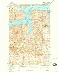
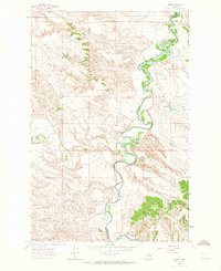
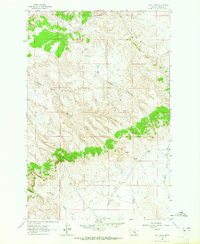
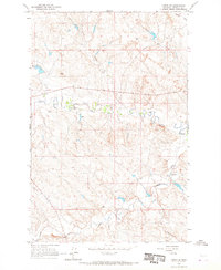
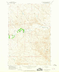
(765)- 1954 Map of Jordan, 1965 Print
 1954 Jordan1965 Print · USGSGarfield County in the mid-fifties is a land of expansive ranches and isolated prairie schoolhouses. Researchers can trace rural genealogy and land use through landmarks like Regina School, Robertson Brothers Ranch, and the Charles M Russell National Wildlife Range.2 unique versions available
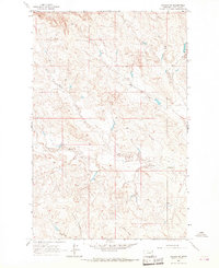
 - 1954 Map of Forsyth, 1966 Print
 1954 Forsyth1966 Print · USGSThe Yellowstone River valley and the northern high plains are captured here in the mid-1950s during a period of expanding energy and rail infrastructure. Genealogists and historians can trace rail sidings and cattle-country outposts like Ingomar, Vananda, and Angela.3 unique versions available
 - 1956 Map of Jordan
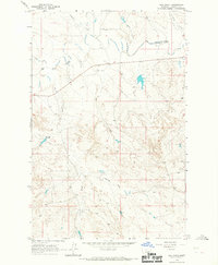
 1956 Jordan1956 Print · USGSCentral Montana ranching country and the massive Missouri River impoundment are captured here in the mid-fifties. Researchers can trace remote homesteading landmarks like Robertson Brothers Ranch and small rural hubs including Jordan, Brusett, and Cohagen.
 - 1957 Map of Forsyth
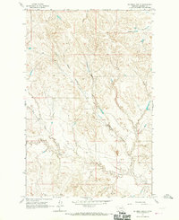
 1957 Forsyth1957 Print · USGSSouth-central Montana in the late fifties is captured here through its dual-river geography and emergent energy economy. Researchers can trace the path of the Northern Pacific through Forsyth, locate the Ragged Point Oil Field, and find early sidings like Ahles Siding.
 - 1958 Map of Jordan
 1958 Jordan1958 Print · USGSGarfield County and the Missouri River country are shown here in the late fifties as the regional geography adjusted to the massive new reservoir. Genealogists and local historians can trace isolated homesteads and numerous rural schoolhouses like Iler School, Brusett, and the Robertson Brothers Ranch.
 - 1958 Map of Forsyth
 1958 Forsyth1958 Print · USGSMid-century Montana comes alive along the Yellowstone River and the competing transcontinental rail lines. Local historians can trace the legacy of the Northern Pacific through Forsyth or explore early oil developments at the Ragged Point Oil Field.
 - 1958 Map of Maloney Hill, 1960 Print
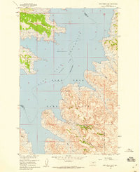
 1958 Maloney Hill1960 Print · USGSGarfield County, Montana, is depicted in the late fifties as the Missouri River Basin development transformed the landscape. You can trace the intricate shoreline of the Fort Peck Reservoir and locate landmarks like Peterson Point, Maloney Hill, and the Hell Creek Recreation Area.2 unique versions available
 - 1958 Map of Sage Creek Point, 1960 Print
 1958 Sage Creek Point1960 Print · USGSGarfield County, Montana, is captured during the late 1950s as the Fort Peck Reservoir transformed the Missouri River valley. Genealogists and local historians can locate the Cemetery near Sage Creek Point and trace the complex network of Embleton Coulee.2 unique versions available
 - 1958 Map of Seventh Point Buttes, 1960 Print
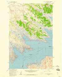 1958 Seventh Point Buttes1960 Print · USGSThe Missouri River breaks of Montana are captured here during the late fifties, showcasing the complex shoreline of the Fort Peck Reservoir. Trace the rugged topography of the Fort Peck Game Range and locate landmarks like Seventh Point Buttes and The Pines Recreation Area.2 unique versions available
 - 1958 Map of Skunk Coulee, 1960 Print
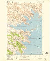 1958 Skunk Coulee1960 Print · USGSThe Montana shoreline of Valley and Garfield Counties is captured here in the late fifties as the Missouri River Basin project transformed the landscape. Researchers can trace the mid-century water levels of the Fort Peck Reservoir and explore landmarks like Skunk Coulee and the Fort Peck Game Range.
 - 1962 Map of Mosby, 1965 Print
 1962 Mosby1965 Print · USGSThe Musselshell River breaks and surrounding plains of Petroleum and Garfield counties are captured here in the early 1960s. Genealogists and historians can trace the remote settlement of Mosby and water features like Shaie Reservoir or Flatwillow Creek.2 unique versions available
 - 1962 Map of Maxwell Ranch, 1965 Print
 1962 Maxwell Ranch1965 Print · USGSThe high plains of Petroleum County are documented in the early sixties as cattle ranching and resource exploration defined the land. Researchers can trace the layout of the Maxwell Ranch, find early industrial marks like a Drill Hole, and follow the Musselshell River.2 unique versions available
 - 1962 Map of Kincheloe Ranch, 1965 Print
 1962 Kincheloe Ranch1965 Print · USGSThe ranchlands of Rosebud and Garfield counties are captured here in the early sixties. Researchers can trace the layout of the Kincheloe Ranch and the natural landmarks of Rattlesnake Buttes and Jacobsen Coulee that defined this Montana landscape.
 - 1962 Map of Mosby SE, 1965 Print
 1962 Mosby SE1965 Print · USGSThe Musselshell River country of central Montana is captured here in the early sixties, showing the river's dramatic meanders along the Rosebud County border. Genealogists and historians can trace the intricate drainages of Nineteen Coulee and Rattlesnake Creek near a prominent cross-country Pipeline.2 unique versions available
 - 1963 Map of Hill Ranch, 1965 Print
 1963 Hill Ranch1965 Print · USGSThe Montana ranchlands of Garfield County are captured here in the early sixties, showing a landscape defined by deep drainages and isolated homesteads. Researchers can trace family-named landmarks like Hill Ranch, Youderian Coulee, and Turner Coulee.2 unique versions available
 - 1963 Map of Mc Williams Springs, 1965 Print
 1963 Mc Williams Springs1965 Print · USGSGarfield County rangeland in the early sixties is characterized here by its intricate network of seasonal coulees and isolated water sources. Researchers can trace land features like Gumbo Ridge, the prominent Black Butte, and vital landmarks such as Mc Williams Springs.
 - 1963 Map of Dutton Ranch, 1965 Print
 1963 Dutton Ranch1965 Print · USGSRanching life in Garfield County comes into focus in the early sixties, showing a landscape defined by seasonal water and open range. Researchers can trace land use through Dutton Ranch and remote water sources like Mud Springs and Chalk Springs.2 unique versions available
 - 1963 Map of Regnal Coulee, 1965 Print
 1963 Regnal Coulee1965 Print · USGSRanching country on the border of Rosebud and Garfield counties comes into focus in the early sixties. Researchers can trace land use through features like Regnal Coulee, a Well, and Big Breed Creek as the area was first surveyed from the air.2 unique versions available
 - 1964 Map of Jordan
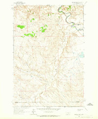
 1964 Jordan1964 Print · USGSGarfield County and the surrounding Montana prairie are captured in the mid-1950s as the Fort Peck Reservoir reshapes the northern landscape. Local historians can trace the locations of rural schoolhouses like South First Creek School and remote ranching outposts such as Brusett and Van Norman.
 - 1964 Map of Jordan SE, 1967 Print
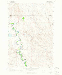
 1964 Jordan SE1967 Print · USGSGarfield County ranching country is captured here in the mid-1960s, showing the complex drainage systems of the Montana plains. Researchers can trace the paths of Big Dry Creek and find specific local landmarks like the Gaging Station and Flowing Well.
 - 1964 Map of Jordan NE, 1967 Print
 1964 Jordan NE1967 Print · USGSEastern Montana ranching country in the 1960s is mapped here in detail, showing a landscape defined by its vital water sources. Researchers can trace the courses of White Horse Creek and Little Wolf Creek or locate remote ranching infrastructure like wells.
 - 1964 Map of Ada Creek, 1967 Print
 1964 Ada Creek1967 Print · USGSGarfield County ranching country is captured here in the mid-sixties, showing a landscape defined by the winding Big Dry Creek. Trace family roots at the Mahoney Ranch or locate the old Viall Sch and the waters of Ada Creek.
 - 1964 Map of Bateman Coulee, 1967 Print
 1964 Bateman Coulee1967 Print · USGSCentral Montana rangeland in the mid-sixties reveals a landscape defined by the intricate drainage basins of Bateman Coulee and Redbank Coulee. Researchers can trace the remote network of stock ponds and windmills along Frazier Creek and Maban Coulee.
 - 1964 Map of Black John Coulee, 1967 Print
 1964 Black John Coulee1967 Print · USGSGarfield County's prairie landscape in the mid-1960s is captured here as a network of drainages feeding into the Big Dry Creek. Researchers can trace old fence lines and property boundaries across rugged terrain marked by Black John Coulee, Russian Coulee, and Longs Fork.
 - 1964 Map of Jordan NW, 1967 Print
 1964 Jordan NW1967 Print · USGSGarfield County's high plains and drainage breaks are captured in the mid-1960s, showing a land defined by its watercourses. Genealogists and researchers can trace the rugged contours of the White Horse Divide and the paths of Hogs Back Creek and Frazier Creek.
Showing maps 1-25 of 765
Top cities of Garfield County
Frequently asked questions
- What are the different types of historical maps available for Garfield County?
- What is the oldest map of Garfield County?
- Where can I purchase historical maps of Garfield County for my home or office?
- Where can I download high-res historical maps of Garfield County?
- Are there historical topographic maps available for Garfield County?
- Is there historical aerial imagery available for Garfield County?
- Where are historical maps of Garfield County sourced from?