
1962 Map of Mosby SE
USGS Topo · Published 1965About this map
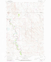
The Musselshell River carves a highly sinuous path through this early 1960s landscape, marking a series of tight oxbow bends and meanders across the Rosebud County line. The topography is defined by an intricate network of drainage channels, including Nineteen Coulee, Youderian Coulee, and Turner Coulee, which cut through the high plains toward the river valley. This survey area captures a point of convergence for four Montana counties, with the boundaries of Garfield, Petroleum, and Musselshell all meeting Rosebud County within this single quadrangle. A solitary industrial element, a Pipeline, traverses the northern sections, cutting a straight line across the natural drainages of Rattlesnake Creek and Cooper Coulee. The map illustrates a largely unpopulated terrain where the natural water systems remain the primary landmarks for navigation and land division.
Find a feature on this map
10 named features on this map. Tap any name to fly to it.
Don’t see what you’re looking for? This feature index may not catch every label — zoom into the map to look around manually.
Map Details
Editions of this 1962 Mosby SE Map
2 editions found
Other maps of this area

1954 · Forsyth
USGS Topo · 1:250,000

1957 · Forsyth
USGS Topo · 1:250,000

1958 · Forsyth
USGS Topo · 1:250,000

1962 · Mosby
USGS Topo · 1:24,000

1962 · Melstone NE
USGS Topo · 1:24,000

1962 · Maxwell Ranch
USGS Topo · 1:24,000

1962 · Melstone NW
USGS Topo · 1:24,000

1962 · Kincheloe Ranch
USGS Topo · 1:24,000

1962 · Grebe Ranch
USGS Topo · 1:24,000
1963 · Hill Ranch
USGS Topo · 1:24,000