
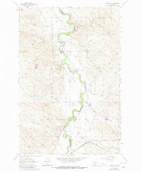
1962 Map of Melstone NE
USGS Topo · Published 1965About this map
The Musselshell River meanders sharply through this central Montana landscape, defining the boundary between Rosebud and Musselshell counties. In the early 1960s, the region’s economy was heavily tied to energy extraction, as evidenced by the concentration of petroleum infrastructure including the Ivanhoe Dome Oil Field, Stensvad Oil Field, and Keggy Coulee Oil Field. Numerous Oil Wells and a central Substation dot the terrain, linked by an extensive Pipeline network.
Find a feature on this map
27 named features on this map. Tap any name to fly to it.
Don’t see what you’re looking for? This feature index may not catch every label — zoom into the map to look around manually.
Map Details
Editions of this 1962 Melstone NE Map
2 editions found
Other maps of this area

1954 · Forsyth
USGS Topo · 1:250,000

1957 · Forsyth
USGS Topo · 1:250,000

1958 · Forsyth
USGS Topo · 1:250,000

1962 · Queens Point
USGS Topo · 1:24,000

1962 · Guthridge Ranch
USGS Topo · 1:24,000

1962 · Maxwell Ranch
USGS Topo · 1:24,000

1962 · Melstone NW
USGS Topo · 1:24,000

1962 · Kincheloe Ranch
USGS Topo · 1:24,000

1962 · Mosby SE
USGS Topo · 1:24,000

1962 · Grebe Ranch
USGS Topo · 1:24,000