
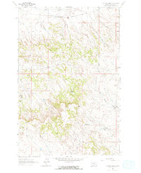
1962 Map of Guthridge Ranch
USGS Topo · Published 1965About this map
Guthridge Ranch occupies a central position in this Rosebud County landscape, illustrating the remote ranching operations characteristic of eastern Montana in the early 1960s. The northern edge of the territory is defined by the Chicago Milwaukee St Paul and Pacific railroad corridor, which follows the path of Home Creek. This vital rail link supported the movement of livestock and supplies through an area primarily shaped by its drainage networks, including Horse Creek and Third Creek.
Find a feature on this map
15 named features on this map. Tap any name to fly to it.
Don’t see what you’re looking for? This feature index may not catch every label — zoom into the map to look around manually.
Map Details
Editions of this 1962 Guthridge Ranch Map
2 editions found
Other maps of this area

1954 · Forsyth
USGS Topo · 1:250,000

1957 · Forsyth
USGS Topo · 1:250,000

1958 · Forsyth
USGS Topo · 1:250,000

1962 · Melstone NE
USGS Topo · 1:24,000

1962 · Sumatra
USGS Topo · 1:24,000

1962 · Grebe Ranch
USGS Topo · 1:24,000

1963 · Hecker Ranch
USGS Topo · 1:24,000

1963 · Melstone
USGS Topo · 1:24,000

1979 · Melstone
USGS Topo · 1:100,000

1979 · Hysham
USGS Topo · 1:100,000