
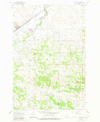
1963 Map of Melstone
USGS Topo · Published 1965About this map
The Musselshell River carves a winding path across this central Montana landscape, defining the boundary between Musselshell Co and Rosebud Co. This mid-century survey captures the community of Melstone as a vital rail point, anchored by the Chicago Milwaukee St Paul and Pacific railroad line. The settlement pattern here is tied closely to the water and the rails, with a Water Tank and several ditches indicating the infrastructure required to manage the semi-arid environment. To the east, the small siding of Bascom sits along the tracks, while the southern portion of the map transitions into more complex terrain characterized by Horse Creek and the notable elevations of Twin Tops. Local industry is evidenced by a Gravel Pit and scattered drill holes, suggesting the early exploration and resource extraction that supplemented the region's ranching economy.
Find a feature on this map
15 named features on this map. Tap any name to fly to it.
Don’t see what you’re looking for? This feature index may not catch every label — zoom into the map to look around manually.
Map Details
Editions of this 1963 Melstone Map
2 editions found
Other maps of this area

1954 · Forsyth
USGS Topo · 1:250,000

1957 · Forsyth
USGS Topo · 1:250,000

1958 · Forsyth
USGS Topo · 1:250,000

1962 · Queens Point
USGS Topo · 1:24,000

1962 · Guthridge Ranch
USGS Topo · 1:24,000

1962 · Melstone NE
USGS Topo · 1:24,000

1962 · Melstone NW
USGS Topo · 1:24,000

1962 · Grebe Ranch
USGS Topo · 1:24,000

1979 · Melstone
USGS Topo · 1:100,000

1979 · Hysham
USGS Topo · 1:100,000