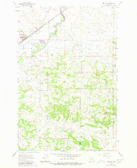
1963 Map of Melstone
USGS Topo · Published 1980About this map
Melstone serves as the primary hub of this Central Montana landscape, situated along the Chicago Milwaukee St Paul and Pacific railroad line. The town's layout and surrounding infrastructure, including a Water Tank and several Wells, reflect the vital importance of water management in this arid region. The winding Musselshell River dominates the northern portion of the map, fed by drainage systems like Wilson Coulee and Horse Creek. An intricate network of irrigation is evidenced by the Delphia Melstone Ditch, which follows the river's path to support local agriculture. Farther south, the terrain rises toward the distinct heights of Twin Tops, marking a transition from the river valley to higher rangeland. The boundary between Musselshell and Rosebud Counties cuts through the eastern portion of the sheet, while the small settlement of Bascom sits near the northeastern corner.
Find a feature on this map
17 named features on this map. Tap any name to fly to it.
Don’t see what you’re looking for? This feature index may not catch every label — zoom into the map to look around manually.
Map Details
Editions of this 1963 Melstone Map
2 editions found
Other maps of this area

1954 · Forsyth
USGS Topo · 1:250,000

1957 · Forsyth
USGS Topo · 1:250,000

1958 · Forsyth
USGS Topo · 1:250,000

1962 · Queens Point
USGS Topo · 1:24,000

1962 · Guthridge Ranch
USGS Topo · 1:24,000

1962 · Melstone NE
USGS Topo · 1:24,000

1962 · Melstone NW
USGS Topo · 1:24,000

1962 · Grebe Ranch
USGS Topo · 1:24,000

1963 · Melstone
USGS Topo · 1:24,000

1979 · Melstone
USGS Topo · 1:100,000