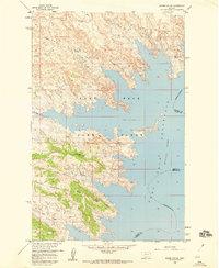
1958 Map of Skunk Coulee
USGS Topo · Published 1960About this map
Fort Peck Reservoir dominates this 1958 topographic landscape, where the waters of the Missouri River meet the intricate breaks of Valley and Garfield Counties. Part of a Department of the Interior program for the development of the Missouri River Basin, this sheet documents the shoreline of the reservoir at a normal pool elevation of 2176 feet. The surrounding terrain is characterized by a series of parallel landforms including Second Ridge and Third Ridge, punctuated by deep incisions like Skunk Coulee and Third Coulee. To the north, drainage patterns from Mud Creek and the North Fork Duck Creek flow toward the rising water level. Much of the southern portion of the quadrangle is protected within the Fort Peck Game Range, showing the intersection of federal conservation efforts and large-scale water management in the mid-20th century Montana backcountry.
Find a feature on this map
12 named features on this map. Tap any name to fly to it.
Don’t see what you’re looking for? This feature index may not catch every label — zoom into the map to look around manually.
Map Details
Editions of this 1958 Skunk Coulee Map
This is the sole edition of this map. No revisions or reprints were ever made.
Other maps of this area

1914 · Nashua
USGS Topo · 1:62,500

1916 · Nashua
USGS Topo · 1:62,500

1943 · Glasgow
USGS Topo · 1:125,000

1954 · Jordan
USGS Topo · 1:250,000

1954 · Glasgow
USGS Topo · 1:250,000

1956 · Jordan
USGS Topo · 1:250,000

1957 · Glasgow
USGS Topo · 1:250,000

1958 · Glasgow
USGS Topo · 1:250,000

1958 · Jordan
USGS Topo · 1:250,000

1958 · Lewis Reservoir
USGS Topo · 1:24,000