Old Maps of Barker, Montana for Academic Research
Study the evolution of Barker with 14 high-resolution historic maps. Whether you're teaching, researching, or modeling changes in land use, these maps provide essential visual documentation of urban, environmental, and geographic change.
- Analyze long-term change: Track patterns in development, transportation, and natural features.
- Ideal for environmental or urban studies: Support academic projects with primary historical map data.
- Use in the classroom or lab: Educators and researchers rely on these maps to bring historical context to life.
These maps are a powerful tool for teaching, research, and visualizing how Barker has changed over the decades.
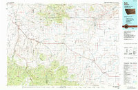
Barker, MT maps
(14)- 1890 Map of Fort Benton
 1890 Fort Benton1890 Print · USGSUpper Missouri river country was transforming in the late nineteenth century as rail lines and ranching settlements expanded across the plains. Genealogists and historians can trace early land routes between Fort Benton, Stanford, and the mining district around Clendenin.
 - 1892 Map of Fort Benton
 1892 Fort Benton1892 Print · USGSUpper Missouri River country in the late nineteenth century shows the transition from river commerce to the iron horse. Genealogists and historians can trace early settlements like Stanford and Fort Benton alongside the St Paul Minneapolis and Manitoba Railroad.
 - 1897 Map of Fort Benton
 1897 Fort Benton1897 Print · USGSUpper Missouri River territory is charted here during its transition from a river-based economy to a rail-and-ranching frontier. Researchers can trace the early layouts of Fort Benton and Stanford, or locate remote sites like Barker Mtn and Riceville.4 unique versions available
 - 1954 Map of Great Falls
 1954 Great Falls1954 Print · USGSThe Missouri River valley in the mid-1950s is shown at a time of significant industrial and military growth. Genealogists and historians can locate early schools and rail stops like Tiger Butte Community Center, Fort Benton, and the Anaconda Wire Plant.4 unique versions available
 - 1957 Map of Great Falls
 1957 Great Falls1957 Print · USGSMontana's central plains and mountain foothills are captured here in the mid-fifties, showing the hub of Great Falls and the surrounding grain-shipping towns. Genealogists can trace family roots through the rail sidings of the Great Northern and small rural communities like Sand Coulee or Fort Benton.
 - 1961 Map of Barker, 1964 Print
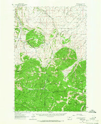
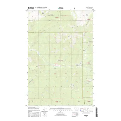
 1961 Barker1964 Print · USGSDeep in the Little Belt Mountains during the early sixties, this map captures the mining legacy of Barker and Hughesville. Researchers can trace old prospecting routes like the Sawmill Trail and locate early Mines near Barker Mountain.
 - 1961 Map of Barker, 1966 Print
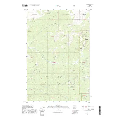
 1961 Barker1966 Print · USGSThe mining camps of Judith Basin are documented here in the early sixties, showing the remote peaks of the Little Belt Mountains. Genealogists and historians can trace the foundations of Barker and Hughesville, or find the Barker Cem and Chambers Mine.2 unique versions available
 - 1984 Map of Belt
 1984 Belt1984 Print · USGSCentral Montana's high peaks and ranching benches are captured here in the early 1980s, documenting the region's mining and rail heritage. Genealogists and historians can locate remote mining outposts like Hughesville and Barker, or trace the Burlington Northern Railroad through Belt and Stanford.
 - 1995 Map of Barker, 1997 Print
 1995 Barker1997 Print · USGSThe Little Belt Mountains during the mid-1990s reveal a landscape defined by mining history and forest management. Researchers can locate the mountain settlements of Hughesville and Barker, alongside the Barker Cem and various Mine sites.
 - 2011 Map of Barker, 2011 Print
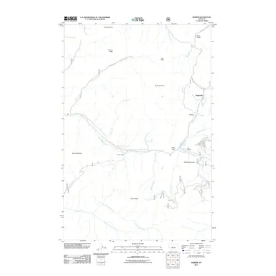 2011 Barker2011 Print · USGSCovers Barker, including Hughesville, Cascade County, and other nearby areas
 - 2014 Map of Barker, 2014 Print
 2014 Barker2014 Print · USGSCovers Barker, including Hughesville, Cascade County, and other nearby areas
 - 2017 Map of Barker, 2017 Print
 2017 Barker2017 Print · USGSCovers Barker, including Hughesville, Cascade County, and other nearby areas
 - 2020 Map of Barker, 2020 Print
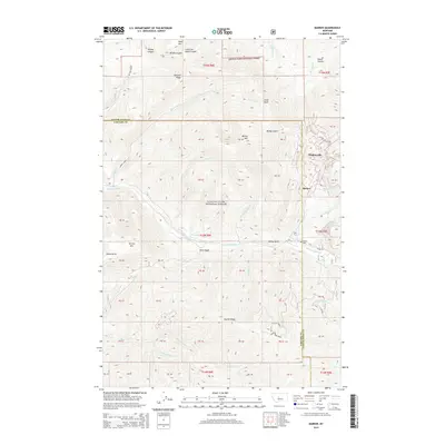
 2020 Barker2020 Print · USGSCovers Barker, including Hughesville, Cascade County, and other nearby areas
 - 2024 Map of Barker, 2024 Print
 2024 Barker2024 Print · USGSThe mining settlements of the Little Belt Mountains come to life in this contemporary survey of the Cascade and Judith Basin border. Researchers can trace historic family connections at Barker Cem or explore the rugged topography of Hughesville and Barker.
End of results
Showing maps 1-14 of 14
Top cities near Barker
Frequently asked questions
- What are the different types of historical maps available for Barker?
- What is the oldest map of Barker?
- Where can I purchase historical maps of Barker for my home or office?
- Where can I download high-res historical maps of Barker?
- Are there historical topographic maps available for Barker?
- Is there historical aerial imagery available for Barker?
- Where are historical maps of Barker sourced from?