Old Maps of Superior, Montana for Academic Research
Study the evolution of Superior with 17 high-resolution historic maps. Whether you're teaching, researching, or modeling changes in land use, these maps provide essential visual documentation of urban, environmental, and geographic change.
- Analyze long-term change: Track patterns in development, transportation, and natural features.
- Ideal for environmental or urban studies: Support academic projects with primary historical map data.
- Use in the classroom or lab: Educators and researchers rely on these maps to bring historical context to life.
These maps are a powerful tool for teaching, research, and visualizing how Superior has changed over the decades.
Superior, MT maps
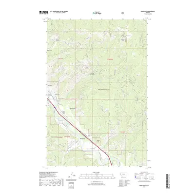
(17)- 1956 Map of Wallace, 1966 Print
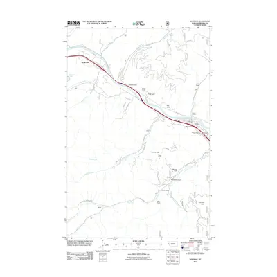
 1956 Wallace1966 Print · USGSWestern Montana and the Idaho panhandle meet in this mid-century survey of the Bitterroot and Cabinet Mountains. Genealogists and historians can trace the rail-and-river economy through the Northern Pacific line and settlements like Thompson Falls or St. Ignatius.3 unique versions available
 - 1960 Map of Wallace
 1960 Wallace1960 Print · USGSNorthwestern Montana and the Idaho panhandle are captured in the late fifties, showing the vast Flathead Indian Reservation and the mining districts of the Bitterroot Range. Researchers can trace the rail lines of the Northern Pacific or locate early sites like the Morning Mine and the National Bison Range.
 - 1960 Map of Superior, 1962 Print
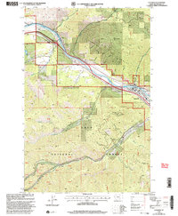
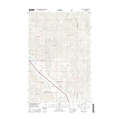
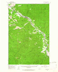 1960 Superior1962 Print · USGSThe Clark Fork valley in the early sixties was a rugged industrial corridor defined by the Northern Pacific and Milwaukee Road rail lines. Genealogists and historians can trace the foundations of Superior or locate remote mining sites like the Iron Mountain Mine and Old Mountain Mines.2 unique versions available
 - 1985 Map of Superior
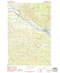 1985 Superior1985 Print · USGSMineral County in the mid-1980s reveals a mountain landscape centered on the Clark Fork river valley. Researchers can trace the layout of Superior and La Vista, or locate remote landmarks like Chimney Rock and Thompson Peak within the Lolo National Forest.
 - 1985 Map of Idaho Gulch
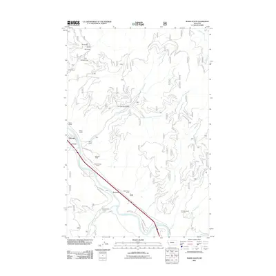
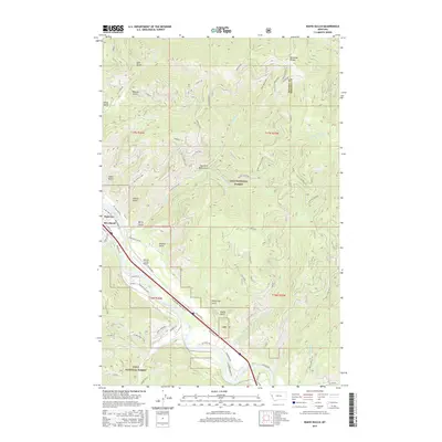
 1985 Idaho Gulch1985 Print · USGSThe Clark Fork River corridor in the mid-1980s reveals a landscape of high timberland and river-bottom settlement. Trace the mountain topography from the Ninemile Divide down to Oliverville and the County Airport along the canyon floor.
 - 1999 Map of Idaho Gulch, 2003 Print
 1999 Idaho Gulch2003 Print · USGSThe Clark Fork valley and the rugged Ninemile Divide define this part of Mineral County at the close of the twentieth century. Researchers can trace the boundaries of Lolo National Forest, locate the County Airport, and identify the settlement of Oliverville.
 - 1999 Map of Superior, 2003 Print
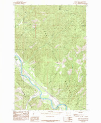
 1999 Superior2003 Print · USGSThe Clark Fork river valley and the town of Superior are captured here in the late nineties as centers of mountain recreation and forest management. Researchers can trace local landmarks like La Vista, the Cem, and the Superior Ranger District Office.
 - 2011 Map of Superior, 2011 Print
 2011 Superior2011 Print · USGSCovers Superior, including Riverview Trailer Park, Spring Gulch, and other nearby areas
 - 2011 Map of Idaho Gulch, 2011 Print
 2011 Idaho Gulch2011 Print · USGSCovers Superior, including Riverbend, Oliverville, and other nearby areas
 - 2014 Map of Superior, 2014 Print
 2014 Superior2014 Print · USGSCovers Superior, including Riverview Trailer Park, Spring Gulch, and other nearby areas
 - 2014 Map of Idaho Gulch, 2014 Print
 2014 Idaho Gulch2014 Print · USGSCovers Superior, including Riverbend, Oliverville, and other nearby areas
 - 2017 Map of Superior, 2017 Print
 2017 Superior2017 Print · USGSCovers Superior, including Riverview Trailer Park, Spring Gulch, and other nearby areas
 - 2017 Map of Idaho Gulch, 2017 Print
 2017 Idaho Gulch2017 Print · USGSCovers Superior, including Riverbend, Oliverville, and other nearby areas
 - 2020 Map of Superior, 2020 Print
 2020 Superior2020 Print · USGSCovers Superior, including Riverview Trailer Park, Spring Gulch, and other nearby areas
 - 2020 Map of Idaho Gulch, 2020 Print
 2020 Idaho Gulch2020 Print · USGSCovers Superior, including Riverbend, Oliverville, and other nearby areas
 - 2024 Map of Idaho Gulch, 2024 Print
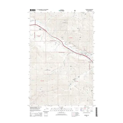
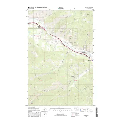
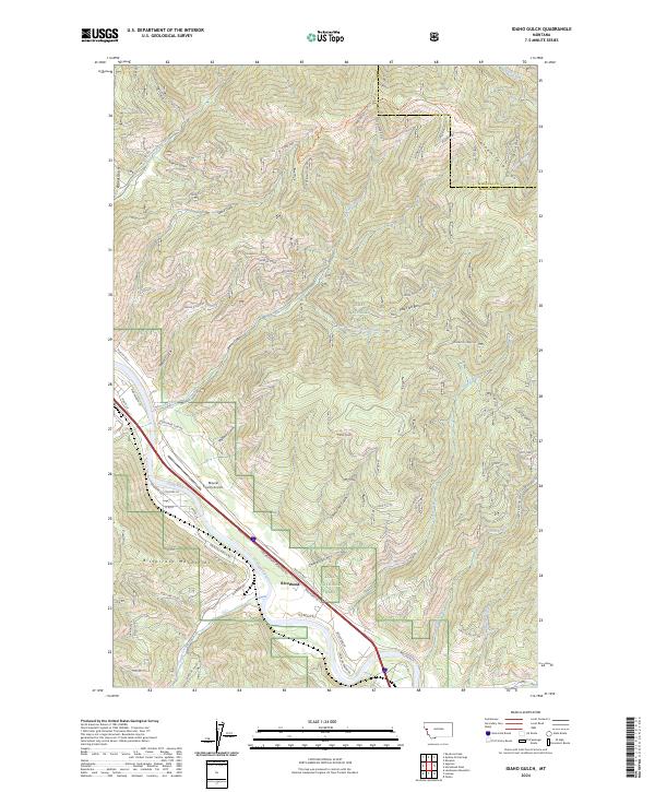 2024 Idaho Gulch2024 Print · USGSThe Clark Fork river corridor near the Montana-Idaho border comes into focus in this contemporary survey. Historians and researchers can trace local landmarks like Riverbend, the Mineral County Airport, and the high-country paths along Teddy Bear Ridge.
 - 2024 Map of Superior, 2024 Print
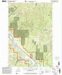
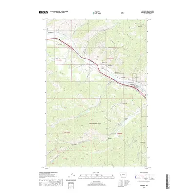
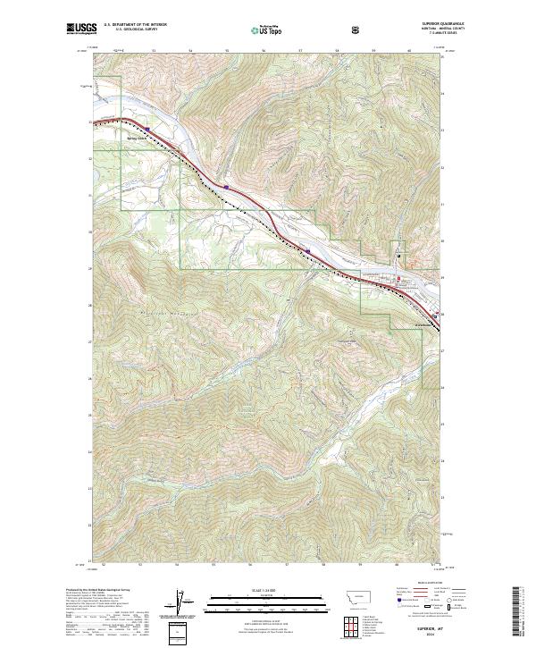 2024 Superior2024 Print · USGSThe Mineral County seat and the Clark Fork valley are documented here in the 2020s, showing the intersection of mountain geography and valley settlement. Researchers can trace historic routes like Mullan Rd and Old US Hwy 10 or locate the Mineral County Courthouse and the riverside community of Riverbend.
End of results
Showing maps 1-17 of 17
Top cities near Superior
Top neighborhoods of Superior
Frequently asked questions
- What are the different types of historical maps available for Superior?
- What is the oldest map of Superior?
- Where can I purchase historical maps of Superior for my home or office?
- Where can I download high-res historical maps of Superior?
- Are there historical topographic maps available for Superior?
- Is there historical aerial imagery available for Superior?
- Where are historical maps of Superior sourced from?