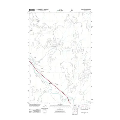
2011 Map of Idaho Gulch
USGS Topo · Published 2011About this map
The Clark Fork river valley in Mineral County defines this landscape, where early 21st-century infrastructure meets a legacy of resource extraction. Small riverside settlements like Riverbend and Cedars sit near the river's edge, while the upland terrain is marked by numerous drainage features such as Idaho Gulch and Siekrest Gulch. This area historically supported significant industrial activity, evidenced by the presence of the Iron Mountain Mine and the Iron Mountain Mill Mine in the northern hills, and the North Fork Second Creek Mine to the southeast.
Find a feature on this map
56 named features on this map. Tap any name to fly to it.
Don’t see what you’re looking for? This feature index may not catch every label — zoom into the map to look around manually.
Map Details
Editions of this 2011 Idaho Gulch Map
This is the sole edition of this map. No revisions or reprints were ever made.
Other maps of this area

1956 · Wallace
USGS Topo · 1:250,000

1959 · Tarkio
USGS Topo · 1:62,500

1959 · Perma
USGS Topo · 1:62,500

1959 · Plains
USGS Topo · 1:62,500

1960 · Wallace
USGS Topo · 1:250,000

1960 · Superior
USGS Topo · 1:62,500

1983 · Horsehead Peak
USGS Topo · 1:24,000
1983 · Tarkio
USGS Topo · 1:24,000
1984 · Knowles
USGS Topo · 1:24,000
1985 · Quinns Hot Springs
USGS Topo · 1:24,000