1900s (20th Century) Maps of BN Plaza, Missoula
Explore 10 historic maps of BN Plaza from the 1900s (20th Century). These maps offer a rare glimpse into what life looked like during the 1900s — showing old roads, neighborhoods, homes, and landmarks that have changed or disappeared over time.
Whether you're researching your family's past, planning a metal detecting trip, or studying how BN Plaza's landscape evolved across the 1900s, these high-resolution maps are a powerful tool for exploring the history of this region.
- Focus on a specific era: All maps on this page are from the 1900s, giving you a focused view of this time period.
- See what’s changed: Compare century-old streets, trails, and buildings to today's modern landscape using overlays and satellite layers.
- Research with precision: Use these maps for genealogy, historical research, land use analysis, or educational projects.
- View, download, or print: Maps are fully viewable online in high resolution, and can be downloaded or printed for your own records.
Start exploring BN Plaza's history through authentic maps from the 1900s. This is your window into the past.
BN Plaza, Missoula maps
(10)- 1903 Map of Bonner
 1903 Bonner1903 Print · USGSMissoula and the surrounding river canyons come to life in this turn-of-the-century survey during the height of early rail expansion. Trace the original path of the Northern Pacific through mountain passes and locate early settlements like Bonner, Potomac, and Clinton.4 unique versions available
 - 1947 Map of Butte, 1949 Print
 1947 Butte1949 Print · USGSWestern Montana at the peak of its rail-and-river era shows the vital connections between the mining and industrial centers of Butte and Helena. Researchers can trace the three major railroad lines serving mountain settlements like Garrison, Philipsburg, and Warm Springs.2 unique versions available
 - 1958 Map of Butte
 1958 Butte1958 Print · USGSWestern Montana's mining and rail corridors are captured in the late fifties, from the urban bustle of the Copper King cities to high mountain passes. Researchers can trace the path of the Milwaukee St Paul and Pacific through Deer Lodge and locate remote outposts like Potomac Post Office.5 unique versions available
 - 1960 Map of Butte
 1960 Butte1960 Print · USGSWestern Montana at the dawn of the sixties is defined by its industrial mining hubs and the railroads that connect them. Genealogists and historians can trace the routes of the Milwaukee Road through Butte or locate smaller settlements like Southern Cross and Bearmouth.
 - 1962 Map of Butte
 1962 Butte1962 Print · USGSWestern Montana in the early sixties remains a landscape of industrial muscle and high-mountain passes. Trace the rail lines of the Northern Pacific through Deer Lodge and the mining history around Anaconda and Philipsburg.
 - 1964 Map of Southeast Missoula, 1967 Print
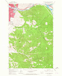 1964 Southeast Missoula1967 Print · USGSSoutheast Missoula and the Lolo National Forest are captured in the mid-1960s as the Interstate era begins to reshape the Clark Fork valley. Researchers can trace the growth of the University of Montana campus and locate early landmarks like the Milltown Dam and Hellgate High Sch.3 unique versions available
 - 1964 Map of Northeast Missoula, 1967 Print
 1964 Northeast Missoula1967 Print · USGSMissoula and its northeast foothills are captured in the mid-1960s, showing the city's reach toward the Lolo National Forest. Local historians can trace the early residential limits near St Mary Cem, the rural character of Bandmann Flats, and old irrigation works like Williams Ditch.3 unique versions available
 - 1984 Map of Missoula East
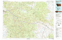 1984 Missoula East1984 Print · USGSThe Clark Fork valley and the Garnet Range are shown here in the mid-1980s as the region's timber and rail heritage remained prominent. Researchers can trace the Burlington Northern line and locate old mining sites like Garnet and the Copper Cliff Mine.
 - 1999 Map of Southeast Missoula, 2003 Print
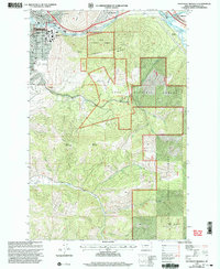 1999 Southeast Missoula2003 Print · USGSThe eastern edge of Missoula and the lower Clark Fork valley are captured here at the turn of the millennium. Researchers can trace the university campus, locate Milltown Dam, and find early local landmarks like Prescott Sch and Mount Sentinel.
 - 1999 Map of Northeast Missoula, 2003 Print
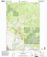 1999 Northeast Missoula2003 Print · USGSMissoula’s northeastern corridor at the close of the century shows a unique mix of wild forest boundaries and riverfront growth. Researchers can trace historic landmarks like St Mary Cem, the Marshall Ski Area, and the early settlement at East Missoula.
End of results
Showing maps 1-10 of 10
Frequently asked questions
- What are the different types of historical maps available for BN Plaza?
- What is the oldest map of BN Plaza?
- Where can I purchase historical maps of BN Plaza for my home or office?
- Where can I download high-res historical maps of BN Plaza?
- Are there historical topographic maps available for BN Plaza?
- Is there historical aerial imagery available for BN Plaza?
- Where are historical maps of BN Plaza sourced from?