1960s Maps of Turah, Montana
Explore 3 historic maps of Turah from the 1960s. These maps offer a rare glimpse into what life looked like during the 1960s — showing old roads, neighborhoods, homes, and landmarks that have changed or disappeared over time.
Whether you're researching your family's past, planning a metal detecting trip, or studying how Turah's landscape evolved across the 1960s, these high-resolution maps are a powerful tool for exploring the history of this region.
- Focus on a specific era: All maps on this page are from the 1960s, giving you a focused view of this time period.
- See what’s changed: Compare century-old streets, trails, and buildings to today's modern landscape using overlays and satellite layers.
- Research with precision: Use these maps for genealogy, historical research, land use analysis, or educational projects.
- View, download, or print: Maps are fully viewable online in high resolution, and can be downloaded or printed for your own records.
Start exploring Turah's history through authentic maps from the 1960s. This is your window into the past.
Turah, MT maps
(3)- 1960 Map of Butte
 1960 Butte1960 Print · USGSWestern Montana at the dawn of the sixties is defined by its industrial mining hubs and the railroads that connect them. Genealogists and historians can trace the routes of the Milwaukee Road through Butte or locate smaller settlements like Southern Cross and Bearmouth.
 - 1962 Map of Butte
 1962 Butte1962 Print · USGSWestern Montana in the early sixties remains a landscape of industrial muscle and high-mountain passes. Trace the rail lines of the Northern Pacific through Deer Lodge and the mining history around Anaconda and Philipsburg.
 - 1965 Map of Bonner, 1967 Print
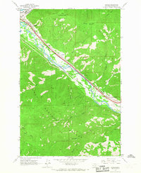 1965 Bonner1967 Print · USGSThe Missoula County timber and rail corridor comes alive in the mid-sixties, showing the industry and settlements along the river. Trace the parallel routes of the Northern Pacific and the Milwaukee Road through Piltzville, Turah, and the lumber hub of Bonner.2 unique versions available
End of results
Showing maps 1-3 of 3
Top cities near Turah
Frequently asked questions
- What are the different types of historical maps available for Turah?
- What is the oldest map of Turah?
- Where can I purchase historical maps of Turah for my home or office?
- Where can I download high-res historical maps of Turah?
- Are there historical topographic maps available for Turah?
- Is there historical aerial imagery available for Turah?
- Where are historical maps of Turah sourced from?