Old Maps of Oswego District, Montana for Metal Detecting
Plan your next treasure hunt with 109 historic maps of Oswego District. Find old homesites, ghost towns, trails, and gathering spots that may be lost to time — perfect for identifying promising metal detecting locations.
- Locate forgotten sites: Uncover places like long-lost settlements, abandoned rail lines, or gathering spots.
- Plan better hunts: Use map overlays combined with LiDAR or satellite views to narrow in on historically rich areas.
- Made for detectorists: Thousands of hobbyists use these maps to discover relics, coins, and hidden history.
Use these historic maps to boost your research and find new opportunities beneath the surface of Oswego District.
Oswego District, MT maps
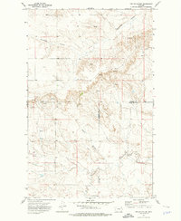
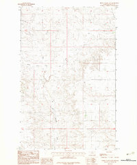
(109)- 1910 Map of Todd Lakes, 1975 Print
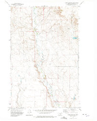
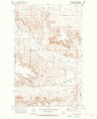
 1910 Todd Lakes1975 Print · USGSNortheastern Montana before the Great War is captured here as a sprawling expanse of the Fort Peck Indian Reservation. Trace the intricate drainage of Wolf Creek and locate the natural basins of Todd Lakes in this early ranching-era landscape.2 unique versions available
 - 1915 Map of Frazer
 1915 Frazer1915 Print · USGSThe Missouri River valley in the years before the Great War shows a burgeoning rail corridor through the Fort Peck Indian Reservation. Trace the early tracks of the Great Northern and find the small stops at Frazer and Kintyre.3 unique versions available
 - 1915 Map of Oswego
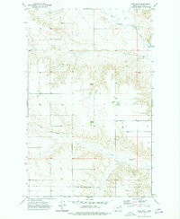
 1915 Oswego1915 Print · USGSNortheast Montana at the height of the homesteading era centers on the Oswego rail stop and the wide Missouri River. Genealogists and historians can trace early land patterns across the Fort Peck Indian Reservation and locate landmarks like Three Buttes and the Great Northern rail line.2 unique versions available
 - 1915 Map of Todd Lakes
 1915 Todd Lakes1915 Print · USGSNortheastern Montana lands within the Fort Peck Indian Reservation appear here during the early twentieth century. Researchers can trace the original Valley Sheridan county line and the winding courses of Wolf Creek and Little Porcupine Creek.
 - 1915 Map of Spring Creek
 1915 Spring Creek1915 Print · USGSNortheast Montana’s high plains are captured here in the years following the turn of the century. Genealogists and local historians can trace the course of Porcupine Cr and find the location of the Tomato Can drainage within the Fort Peck Indian Reservation.2 unique versions available
 - 1954 Map of Wolf Point, 1967 Print
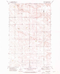
 1954 Wolf Point1967 Print · USGSNortheastern Montana and the North Dakota borderlands are shown here in the mid-fifties, dominated by the Missouri River and the Fort Peck Indian Reservation. Genealogists and historians can trace the Great Northern rail line through river towns like Poplar and Culbertson or locate northern border outposts like the U S Custom Office at Raymond.2 unique versions available
 - 1954 Map of Glasgow, 1967 Print
 1954 Glasgow1967 Print · USGSNortheastern Montana is shown during the mid-fifties as the rail-and-river economy shaped the plains. Trace family roots and vanished landmarks from the Wendell Post Office to the Great Northern sidings at Ashfield and Hinsdale.2 unique versions available
 - 1957 Map of Glasgow
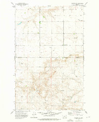
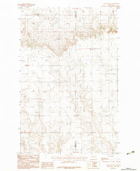
 1957 Glasgow1957 Print · USGSNortheastern Montana during the late 1950s shows a landscape shaped by the Milk River and the expanding influence of the Fort Peck Lake reservoir. Genealogists and historians can trace the Great Northern rail stops from Malta to Glasgow, including old sidings like Kintyre Siding and rural centers like Opheim.
 - 1958 Map of Wolf Point
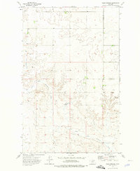
 1958 Wolf Point1958 Print · USGSNortheastern Montana is shown during the mid-fifties, featuring the extensive Fort Peck Indian Reservation and the Missouri River valley. Researchers can trace the Great Northern railroad through Wolf Point or locate sites like Slab Crossing and the Coal Mine near Medicine Lake.
 - 1958 Map of Glasgow
 1958 Glasgow1958 Print · USGSNortheastern Montana comes to life in this mid-century survey of the Milk River valley and the Great Northern rail corridor. Researchers can trace the rise and fall of work camps like New Deal and Wheeler alongside remote landmarks like the Wendell Post Office.2 unique versions available
 - 1972 Map of Flynn Creek North, 1975 Print
 1972 Flynn Creek North1975 Print · USGSThe Fort Peck Indian Reservation in the early 1970s was a landscape defined by the winding drainages of Wolf Creek and Flynn Creek. Researchers can trace the Valley and Roosevelt County boundary through Badger Hole and across the East Fork Flynn Creek.
 - 1972 Map of Dubbe Reservoir, 1975 Print
 1972 Dubbe Reservoir1975 Print · USGSIn the early seventies, this portion of Valley County was a landscape of essential water management and isolated agricultural outposts. Genealogists and researchers can trace local landmarks like Dubbe Reservoir, Johnson Coulee, and the West Fork Charley Creek.
 - 1972 Map of Flynn Creek South, 1975 Print
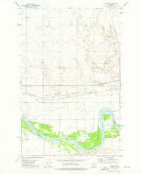
 1972 Flynn Creek South1975 Print · USGSThe Missouri River valley at the Fort Peck Indian Reservation is shown here in the 1970s, as the river snakes between multiple county lines. Local researchers can locate the Oswego Ch, a local Cem, and the tracks of the Burlington Northern railroad.2 unique versions available
 - 1972 Map of Oswego NW, 1975 Print
 1972 Oswego NW1975 Print · USGSValley County, Montana, is shown here in the early 1970s within the boundaries of the Fort Peck Indian Reservation. Local researchers can trace family-named water sources and landmarks like Three Buttes, Badger Hole Coulee, and Oswego Creek.
 - 1972 Map of Oswego, 1976 Print
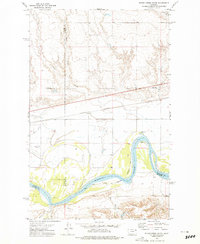
 1972 Oswego1976 Print · USGSThe Missouri River valley in Northeast Montana is captured here in the early 1970s, showing a landscape of rail transit and irrigation. Researchers can trace the Burlington Northern line through Oswego, locate the Cem, and see the Main Canal system.
 - 1973 Map of West Fork NE, 1976 Print
 1973 West Fork NE1976 Print · USGSThe Fort Peck Indian Reservation boundary meets the winding waters of northeastern Montana in the early seventies. Researchers can trace the course of the West Fork Poplar River and find landmarks like Hell Creek and Shipstead Coulee.2 unique versions available
 - 1973 Map of Johnnys Hill, 1976 Print
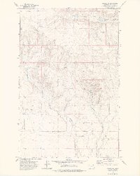
 1973 Johnnys Hill1976 Print · USGSIn the early 1970s, this area of northeastern Montana was a landscape of remote upland mines and reservation borders. Genealogists and researchers can locate the Blackhawk settlement and trace operations at the Kleppen Mine and Sioux City Mine.
 - 1973 Map of Haugens Hill, 1976 Print
 1973 Haugens Hill1976 Print · USGSThe Montana plains north of the Fort Peck Indian Reservation come into focus during the early 1970s. Trace local agricultural landmarks like Pleasant View Community Center, the Landing Strip, and grain Storage Bins.
 - 1973 Map of Blink Springs, 1976 Print
 1973 Blink Springs1976 Print · USGSThe high plains along the Valley and Daniels county line are captured here in the early 1970s. Trace local landmarks like Our Saviors Ch, the namesake Blink Springs, and the meandering East Fork Little Porcupine Creek.
 - 1973 Map of Poplar Coulee, 1976 Print
 1973 Poplar Coulee1976 Print · USGSNortheast Montana ranching country is captured here in the early seventies, spanning a corner of the Fort Peck Indian Reservation. Trace the rugged drainage of Shipstead Coulee and locate specific water sources like Cottonwood Creek and various Springs.2 unique versions available
 - 1973 Map of West Fork, 1977 Print
 1973 West Fork1977 Print · USGSThe northern Daniels County landscape comes into focus during the early 1970s, showing the intersection of the Fort Peck Indian Reservation Boundary and the West Fork Poplar River. Researchers can locate the settlement of West Fork and remote landmarks like Walters Spring or Hell Creek.
 - 1983 Map of Todd Lakes NE
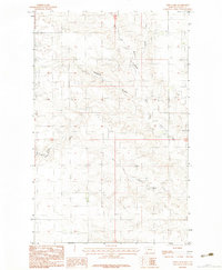
 1983 Todd Lakes NE1983 Print · USGSThe high plains of the Fort Peck Indian Reservation are captured here in the early 1980s as the landscape remained defined by its drainages and boundary lines. Researchers can trace the path of Cottonwood Creek or locate a remote Airstrip situated between Valley and Roosevelt counties.
 - 1983 Map of Todd Lakes
 1983 Todd Lakes1983 Print · USGSValley County, Montana, is seen here in the early eighties as a landscape of prairie coulees and cattle ranges within the Fort Peck Indian Reservation. Researchers can trace the drainage patterns of Todd Lakes and the branching networks of Wolf Creek and Thiessen Coulee.2 unique versions available
 - 1983 Map of Spring Valley East
 1983 Spring Valley East1983 Print · USGSValley County, Montana, is captured in the early eighties as a landscape of wide-open range and essential watercourses. Researchers can trace the drainage patterns of Little Porcupine Creek or locate the isolated Airstrip used for regional transport.
 - 1983 Map of Lustre
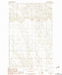 1983 Lustre1983 Print · USGSThe northeastern Montana plains come to life in the early 1980s, showing a landscape defined by seasonal drainages and section lines. Researchers can trace the paths of West Fork Wolf Creek, Middle Fork Wolf Creek, and Tree Coulee.
Showing maps 1-25 of 109
Top cities near Oswego District
Top neighborhoods of Oswego District
Frequently asked questions
- What are the different types of historical maps available for Oswego District?
- What is the oldest map of Oswego District?
- Where can I purchase historical maps of Oswego District for my home or office?
- Where can I download high-res historical maps of Oswego District?
- Are there historical topographic maps available for Oswego District?
- Is there historical aerial imagery available for Oswego District?
- Where are historical maps of Oswego District sourced from?