Old Maps of East Malta Hutterite Colony, Montana for Academic Research
Study the evolution of East Malta Hutterite Colony with 11 high-resolution historic maps. Whether you're teaching, researching, or modeling changes in land use, these maps provide essential visual documentation of urban, environmental, and geographic change.
- Analyze long-term change: Track patterns in development, transportation, and natural features.
- Ideal for environmental or urban studies: Support academic projects with primary historical map data.
- Use in the classroom or lab: Educators and researchers rely on these maps to bring historical context to life.
These maps are a powerful tool for teaching, research, and visualizing how East Malta Hutterite Colony has changed over the decades.
East Malta Hutterite Colony, MT maps
(11)- 1905 Map of Bowdoin
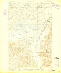 1905 Bowdoin1905 Print · USGSValley County at the start of the century shows a landscape being transformed by the railroad and irrigation. Genealogists and historians can locate early settlements like Ashfield and Bradys Ranch along the Great Northern line.2 unique versions available
 - 1954 Map of Glasgow, 1967 Print
 1954 Glasgow1967 Print · USGSNortheastern Montana is shown during the mid-fifties as the rail-and-river economy shaped the plains. Trace family roots and vanished landmarks from the Wendell Post Office to the Great Northern sidings at Ashfield and Hinsdale.2 unique versions available
 - 1957 Map of Glasgow
 1957 Glasgow1957 Print · USGSNortheastern Montana during the late 1950s shows a landscape shaped by the Milk River and the expanding influence of the Fort Peck Lake reservoir. Genealogists and historians can trace the Great Northern rail stops from Malta to Glasgow, including old sidings like Kintyre Siding and rural centers like Opheim.
 - 1958 Map of Glasgow
 1958 Glasgow1958 Print · USGSNortheastern Montana comes to life in this mid-century survey of the Milk River valley and the Great Northern rail corridor. Researchers can trace the rise and fall of work camps like New Deal and Wheeler alongside remote landmarks like the Wendell Post Office.2 unique versions available
 - 1984 Map of Pinks
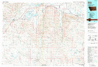
 1984 Pinks1984 Print · USGSPhillips County was a landscape of managed water and sharp terrain contrasts during the 1980s. Researchers can trace irrigation infrastructure like the Bowdoin Canal and locate family-named landmarks including Gilbertson Coulee and Pinks.
 - 1984 Map of Malta
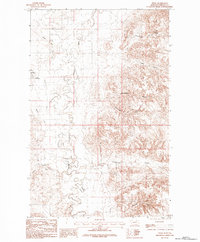
 1984 Malta1984 Print · USGSNorthern Montana's river and rail corridor is meticulously detailed in the mid-1980s, centered on the Milk River and Malta. Researchers can trace the Burlington Northern line through historic stops like Hinsdale, Ashfield, and Beaverton.
 - 2011 Map of Pinks, 2011 Print
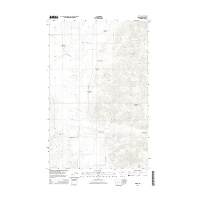
 2011 Pinks2011 Print · USGSCovers East Malta Hutterite Colony, including Phillips County, United States, and other nearby areas
 - 2014 Map of Pinks, 2014 Print
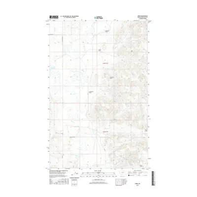
 2014 Pinks2014 Print · USGSCovers East Malta Hutterite Colony, including Phillips County, United States, and other nearby areas
 - 2017 Map of Pinks, 2017 Print
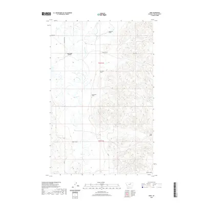
 2017 Pinks2017 Print · USGSCovers East Malta Hutterite Colony, including Phillips County, United States, and other nearby areas
 - 2020 Map of Pinks, 2020 Print
 2020 Pinks2020 Print · USGSCovers East Malta Hutterite Colony, including Phillips County, United States, and other nearby areas
 - 2024 Map of Pinks, 2024 Print
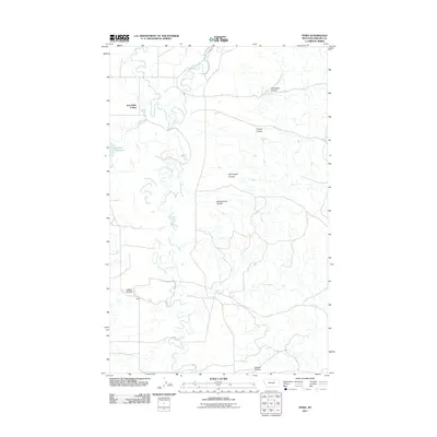
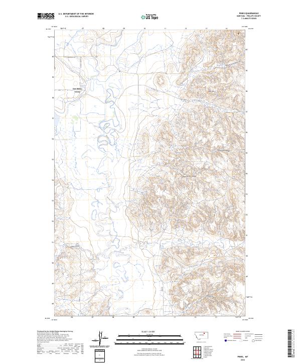 2024 Pinks2024 Print · USGSPhillips County in the 2020s remains a land of expansive prairie and deep-cut drainages east of Malta. Researchers can trace the layout of the East Malta Colony and navigate family-named landmarks like Abrahamson Coulee and LeNoir Coulee.
End of results
Showing maps 1-11 of 11
Frequently asked questions
- What are the different types of historical maps available for East Malta Hutterite Colony?
- What is the oldest map of East Malta Hutterite Colony?
- Where can I purchase historical maps of East Malta Hutterite Colony for my home or office?
- Where can I download high-res historical maps of East Malta Hutterite Colony?
- Are there historical topographic maps available for East Malta Hutterite Colony?
- Is there historical aerial imagery available for East Malta Hutterite Colony?
- Where are historical maps of East Malta Hutterite Colony sourced from?