1970s Maps of Richland County, Montana
Explore 22 historic maps of Richland County from the 1970s. These maps offer a rare glimpse into what life looked like during the 1970s — showing old roads, neighborhoods, homes, and landmarks that have changed or disappeared over time.
Whether you're researching your family's past, planning a metal detecting trip, or studying how Richland County's landscape evolved across the 1970s, these high-resolution maps are a powerful tool for exploring the history of this region.
- Focus on a specific era: All maps on this page are from the 1970s, giving you a focused view of this time period.
- See what’s changed: Compare century-old streets, trails, and buildings to today's modern landscape using overlays and satellite layers.
- Research with precision: Use these maps for genealogy, historical research, land use analysis, or educational projects.
- View, download, or print: Maps are fully viewable online in high resolution, and can be downloaded or printed for your own records.
Start exploring Richland County's history through authentic maps from the 1970s. This is your window into the past.
Richland County, MT maps
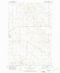
(22)- 1972 Map of Butler Table, 1975 Print
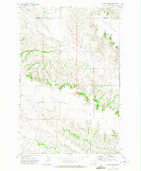 1972 Butler Table1975 Print · USGSDawson and Richland counties are captured in the early 1970s, showcasing a landscape of high plateaus and carved coulees. Researchers can trace the rugged drainage patterns of North Fork Burns Creek or the prominent elevation of Butler Table.
 - 1972 Map of Brorson, 1975 Print
 1972 Brorson1975 Print · USGSRichland County at the start of the 1970s shows a landscape transitioning between remote ranching and active energy production. Researchers can trace rural life through the Brorson Sch, Midway Community Center, and the extensive Brorson Oil Field.
 - 1972 Map of Girard, 1975 Print
 1972 Girard1975 Print · USGSRichland County, Montana, is captured here in the early 1970s as a landscape of prairie drainages and emerging energy development. Genealogists and historians can trace the rural layout around Girard and locate early industrial sites like the Oil Well and Gravel Pit.
 - 1972 Map of Clay Butte, 1975 Print
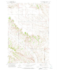
 1972 Clay Butte1975 Print · USGSDawson and Richland counties in the early 1970s remained a landscape of wide-open rangeland and intricate drainage basins. Researchers can trace the winding paths of South Fork Lisk Creek and North Fork Buffalo Creek as they wrap around the slopes of Clay Butte.
 - 1972 Map of Fairview, 1975 Print
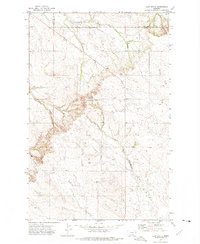
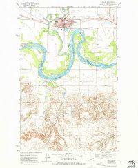
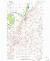
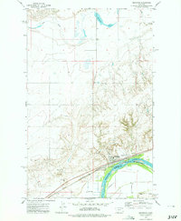
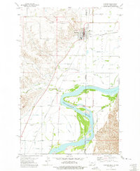 1972 Fairview1975 Print · USGSThe border towns of Fairview and East Fairview are captured here in the early 1970s, showcasing a landscape shaped by the Yellowstone River. Genealogists can locate family landmarks like Pioneer Cem, Estes Sch, and the old rail siding at Ridgelawn.
 - 1972 Map of Fairview NW, 1975 Print
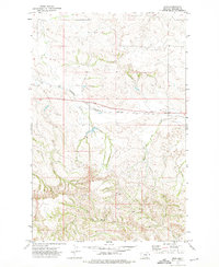
 1972 Fairview NW1975 Print · USGSRichland County, Montana, was undergoing an industrial shift in the early seventies as energy exploration expanded across the high plains. Researchers can locate the Fourmile Cem and trace early resource development at the Gas Plant and various Oil Well sites.
 - 1972 Map of Blue Hill, 1975 Print
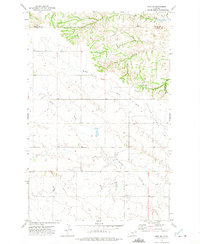
 1972 Blue Hill1975 Print · USGSEastern Montana ranching country comes into focus in the early seventies, showcasing a landscape of winding creeks and isolated landmarks. Genealogists can locate Lone Butte Cem and rural educational sites like Doran School or Cherry Creek Sch.
 - 1972 Map of Sioux Pass, 1975 Print
 1972 Sioux Pass1975 Print · USGSRichland County, Montana, is captured in the early 1970s as a landscape of rural homesteads and winding coulees. Genealogists and local historians can trace the community around Sioux Pass, including the Town Hall, St Peters Ch, and the outlying area of Jackson.
 - 1972 Map of Poplar, 1975 Print
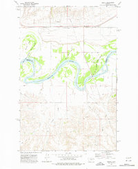
 1972 Poplar1975 Print · USGSThe confluence of the Missouri and Poplar Rivers is captured in the early seventies, centered on the hub of Poplar within the reservation. Trace the Burlington Northern rail line and local landmarks like the Arthur Sch and the Poplar Airport.2 unique versions available
 - 1972 Map of Fox Lake, 1975 Print
 1972 Fox Lake1975 Print · USGSEastern Montana prairie life and infrastructure are captured in the early 1970s as the rail and resource economy shaped the landscape. Researchers can trace the path of the Burlington Northern railroad past Fox Lake and locate several early Well sites.
 - 1972 Map of Sidney SE, 1975 Print
 1972 Sidney SE1975 Print · USGSThe borderlands between Montana and North Dakota are meticulously recorded in the early seventies, centered on the meeting point of Richland and McKenzie counties. Genealogists and researchers can trace local watercourses like Bennie Peer Creek and Alkali Creek alongside several sites marked as well.
 - 1972 Map of Frog Coulee, 1975 Print
 1972 Frog Coulee1975 Print · USGSThe Missouri River breaks the high plains in the early seventies, marking the edge of the Fort Peck Indian Reservation. Genealogists and local historians can locate remote landmarks like St Bernards Ch, Lynn Cem, and Land Promised Coulee.2 unique versions available
 - 1972 Map of Mortarstone Bluff, 1975 Print
 1972 Mortarstone Bluff1975 Print · USGSThe Missouri River breaks through the high plains of eastern Montana in the early 1970s, marking the edge of the Fort Peck Indian Reservation. Local researchers can trace the tracks of the Burlington Northern and find specific community sites like Riverside Ch and the Fisher Cem.2 unique versions available
 - 1972 Map of Enid SE, 1975 Print
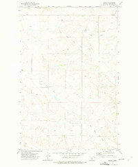
 1972 Enid SE1975 Print · USGSThe high plains along the Richland and Dawson county line appear here in the early seventies, showing a landscape defined by prairie watercourses. Researchers can locate remote community landmarks like Kiempel Cem, Bethlehem Ch, and the Eastern Montana Bible Camp.
 - 1972 Map of Kuester Lake, 1975 Print
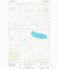
 1972 Kuester Lake1975 Print · USGSRichland and Dawson Counties meet in the Montana plains during the early seventies, where rail lines and energy infrastructure define the land. Researchers can trace the Burlington Northern route and locate water features like Kuester Lake and Redwater Creek.
 - 1972 Map of Fairview SW, 1975 Print
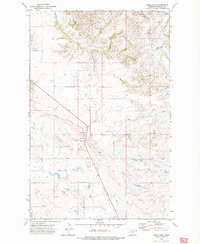
 1972 Fairview SW1975 Print · USGSEastern Montana rangeland and irrigation systems are documented in the early seventies, showing a landscape defined by hay creek forks and energy development. Trace early oil exploration at Oil Wells or locate water resources like the Main Canal and Spring.
 - 1972 Map of Lambert, 1975 Print
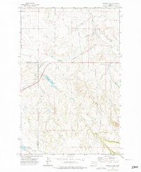
 1972 Lambert1975 Print · USGSLambert appears at a moment of transition in the 1970s, as the railroad and prairie roads define this Richland County landscape. Trace the town's layout near the Burlington Northern line, the local Cem, and the winding path of Fox Creek.
 - 1972 Map of Mc Cone Heights, 1975 Print
 1972 Mc Cone Heights1975 Print · USGSEastern Montana ranching country is shown in detail during the early 1970s as it straddles the Richland and Dawson county lines. Researchers can trace the rugged drainage of North Fork Burns Creek or locate landmarks like Chimney Rock and Butler Table.
 - 1972 Map of Brockton, 1975 Print
 1972 Brockton1975 Print · USGSBrockton and the Missouri River corridor are captured here during the 1970s, showcasing the town's agricultural and rail infrastructure. Genealogists and local historians can locate specific landmarks like the Ruffatto Sch, Twomile Hall, and the town's original Rodeo Ground.2 unique versions available
 - 1972 Map of Enid, 1975 Print
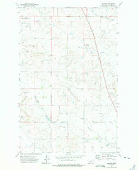
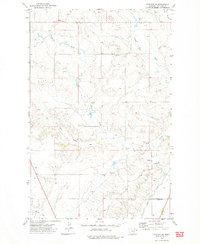
 1972 Enid1975 Print · USGSThe Richland County plains in the early 1970s are defined by the tracks of the Burlington Northern railroad. Researchers can trace the small settlement at Enid and the winding paths of East Redwater Creek and Fox Creek.
 - 1972 Map of Sprole, 1976 Print
 1972 Sprole1976 Print · USGSThe Missouri River valley at the Roosevelt and Richland county line is captured here in the early 1970s. Trace the rural rail-and-river economy through landmarks like the Sprole Storage Bins, the Burlington Northern line, and White Shield Island.2 unique versions available
 - 1974 Map of Skaar NE, 1977 Print
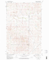 1974 Skaar NE1977 Print · USGSThe high plains of the Montana-North Dakota border come into focus in the mid-1970s, showing a sparsely populated ranching landscape. Researchers can trace rural landmarks like Shadwell Sch, Grace Ch, and the local Scoria Pit near Bull Butte.2 unique versions available
End of results
Showing maps 1-22 of 22
Top cities of Richland County
Frequently asked questions
- What are the different types of historical maps available for Richland County?
- What is the oldest map of Richland County?
- Where can I purchase historical maps of Richland County for my home or office?
- Where can I download high-res historical maps of Richland County?
- Are there historical topographic maps available for Richland County?
- Is there historical aerial imagery available for Richland County?
- Where are historical maps of Richland County sourced from?