Old Maps of Richland County, Montana for Genealogy
Trace your family roots with 382 historic maps of Richland County. These high-res maps reveal old neighborhoods, homesites, landmarks, and streets — helping you uncover where your ancestors lived and how the area evolved over time.
- Explore historic neighborhoods: Identify where your relatives may have lived in the 1800s or 1900s.
- Compare maps over time: Trace the changes in streets, buildings, and landmarks for multi-generational research.
- Perfect for genealogy & ancestry research: Used by family historians and researchers to map out lineage and migration.
These maps are an incredible resource for exploring your personal connection to Richland County's past.
Richland County, MT maps
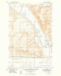
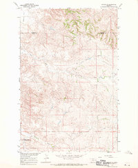
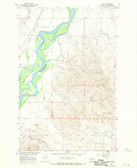
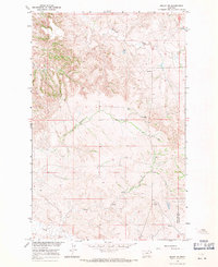
(382)- 1909 Map of Glendive
 1909 Glendive1909 Print · USGSThe confluence of the Missouri and Yellowstone rivers in the first decade of the twentieth century shows a region of scattered ranches and emerging river towns. Genealogists can trace family landmarks like Cavanaughs Ranch or Nortons Ranch and find early resource sites like the Coal Mine.
 - 1912 Map of Poplar
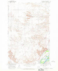
 1912 Poplar1912 Print · USGSThe High Plains of northeastern Montana are captured here just before the first World War, centered on the confluence of two major waterways. Genealogists and historians can trace early railroad siding stops like Sprole and Arthur along the Great Northern line and through the Fort Peck Indian Reservation.
 - 1914 Map of Brockton
 1914 Brockton1914 Print · USGSNortheastern Montana ranching and rail life are frozen in time just before the First World War. Trace the early layout of Brockton and find local landmarks like Armstrongs Ranch, Schoolhouse Coulee, and the path of the Great Northern R R.3 unique versions available
 - 1948 Map of Fort Kipp, 1989 Print
 1948 Fort Kipp1989 Print · USGSThe Missouri River Basin development era is captured here on the plains of the Fort Peck Indian Reservation. Researchers can trace the local landscape through the streets of Fort Kipp, the rural Freidens Ch, and the winding path of Big Muddy Creek.
 - 1949 Map of Fort Kipp
 1949 Fort Kipp1949 Print · USGSRoosevelt County in the late 1940s reveals a landscape defined by the Great Northern railroad and the Fort Peck Indian Reservation. Genealogists and historians can locate early landmarks like Freidens Cem, Blair, and the community of Fort Kipp.2 unique versions available
 - 1950 Map of Calais, 1952 Print
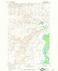
 1950 Calais1952 Print · USGSNortheastern Montana's river valley and high plains come into focus at mid-century, where the reservation meets the winding Missouri. Genealogists and historians can trace the Great Northern rail line through Calais or locate the Alton Mine and Bertino Res.2 unique versions available
 - 1954 Map of Glendive, 1967 Print
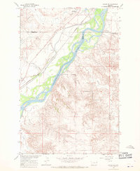
 1954 Glendive1967 Print · USGSEastern Montana at mid-century shows a landscape of river-valley commerce and remote prairie ranching. Researchers can trace the legacy of rural education and transport through sites like Prairie Elk School, the Great Northern rail lines, and Circle.2 unique versions available
 - 1954 Map of Wolf Point, 1967 Print
 1954 Wolf Point1967 Print · USGSNortheastern Montana and the North Dakota borderlands are shown here in the mid-fifties, dominated by the Missouri River and the Fort Peck Indian Reservation. Genealogists and historians can trace the Great Northern rail line through river towns like Poplar and Culbertson or locate northern border outposts like the U S Custom Office at Raymond.2 unique versions available
 - 1957 Map of Glendive
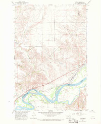
 1957 Glendive1957 Print · USGSEastern Montana in the mid-1950s is defined by its deep river valleys and a sprawling network of rural school districts. You can trace the path of the Great Northern railroad and locate vanished local landmarks like Breezy Flat School and Newton Junction.
 - 1958 Map of Wolf Point
 1958 Wolf Point1958 Print · USGSNortheastern Montana is shown during the mid-fifties, featuring the extensive Fort Peck Indian Reservation and the Missouri River valley. Researchers can trace the Great Northern railroad through Wolf Point or locate sites like Slab Crossing and the Coal Mine near Medicine Lake.
 - 1958 Map of Glendive
 1958 Glendive1958 Print · USGSEastern Montana and the North Dakota borderlands come alive in the late fifties, showing the agricultural heart of the Yellowstone valley. Trace the legacy of rural education through Kimmel School and Ridgelawn School or locate rail hubs in Glendive and Sidney.
 - 1966 Map of Savage, 1970 Print
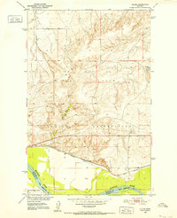
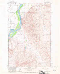
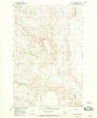
 1966 Savage1970 Print · USGSRichland County at the edge of the river bottom in the mid-sixties shows a landscape defined by irrigation and early frontier trails. Genealogists and historians can trace the foundations of Savage, locate the Riverview Cem, and follow the historic Lewis and Clark Trail.2 unique versions available
 - 1966 Map of Crane NE, 1970 Print
 1966 Crane NE1970 Print · USGSRichland County, Montana, was a landscape of high plains ranching and vital rail transport during the mid-sixties. Researchers can trace the path of the Great Northern railway as it skirts Fox Creek or locate local landmarks like the Natural Corral and Vaux Reservoir No 2.
 - 1966 Map of Savage SE, 1970 Print
 1966 Savage SE1970 Print · USGSEastern Montana's high plains and deep coulees are captured in this mid-century survey of Wibaux County. Researchers can trace the rugged drainage patterns of Dry Creek and Devils Canyon or locate local landmarks like Valentine Flat.
 - 1966 Map of Crane NW, 1970 Print
 1966 Crane NW1970 Print · USGSRichland County, Montana, is captured in the mid-sixties as a landscape of remote ranchlands and critical water sources. Trace the local geography through family-named landmarks and infrastructure like Getty, the Gravel Pit, and the winding Great Northern Creek.
 - 1966 Map of Savage SW, 1970 Print
 1966 Savage SW1970 Print · USGSThe Yellowstone River corridor in eastern Montana is captured here in the mid-1960s, showing the intersection of Dawson and Richland counties. Trace the historic Lewis and Clark Trail, the Northern Pacific railroad, and the Main Pacific Canal.
 - 1966 Map of Intake, 1970 Print
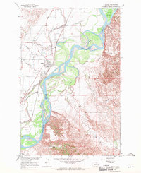
 1966 Intake1970 Print · USGSThe Yellowstone River valley in the mid-1960s shows a landscape of coordinated irrigation and rail transport. Researchers can trace the Lewis and Clark Trail past the Diversion Dam and the settlement of Intake.
 - 1966 Map of Piche, 1970 Print
 1966 Piche1970 Print · USGSRichland County, Montana, is shown here in the mid-1960s as the Yellowstone River valley supports a rail-and-canal economy. Researchers can trace the Northern Pacific line through Piché or explore the river islands and Main Canal.
 - 1966 Map of Knife River Mine, 1970 Print
 1966 Knife River Mine1970 Print · USGSRichland County, Montana, was a landscape of industrial energy and river-valley agriculture in the mid-1960s. Genealogists and historians can trace the lignite operations at the Knife River Mine and follow the rail corridor through Peabody to the Yellowstone River at Valentine Flat.2 unique versions available
 - 1966 Map of Crane, 1970 Print
 1966 Crane1970 Print · USGSThe Yellowstone River valley is captured here in the mid-1960s, showing a landscape defined by irrigation and river transport. Trace the historic Lewis and Clark Trail and local landmarks like Crane Cem, Log Ch, and the community of Hoffmanville.
 - 1966 Map of Sidney NE, 1970 Print
 1966 Sidney NE1970 Print · USGSThe Montana and North Dakota border comes alive in the mid-1960s as the Yellowstone River carves through the high plains. Researchers can trace the Great Northern rail line or locate industrial markers like the Thief Mine and McGlynn Dam.2 unique versions available
 - 1966 Map of Skaar NW, 1971 Print
 1966 Skaar NW1971 Print · USGSEastern Montana ranching country is captured here just before the 1970s, right along the NORTH DAKOTA STATE LINE. Genealogists and historians can locate the Clark Sch and trace local water sources like Shadwell Creek and Elm Coulee.
 - 1966 Map of Sidney, 1971 Print
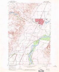 1966 Sidney1971 Print · USGSSidney and the surrounding Richland County plains are captured in the mid-1960s as a thriving rail and agricultural hub. Trace the development of local institutions from St Philomena Sch and the County Fairground to the Newlon Cem.2 unique versions available
 - 1966 Map of Allard Ranch, 1971 Print
 1966 Allard Ranch1971 Print · USGSEastern Montana rangeland near the Dawson and Richland county line is captured here in the mid-sixties. Researchers can trace the development of Allard Ranch and locate specific water sources like Burns Creek and various Spring sites.
 - 1966 Map of Larson School, 1971 Print
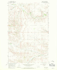
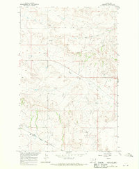
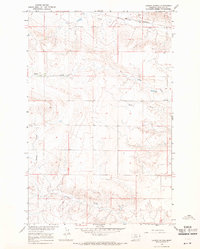 1966 Larson School1971 Print · USGSRichland County's high plains are captured in the mid-1960s, showing a landscape shaped by ranching and rail. Researchers can locate Larson Sch, trace the Great Northern tracks, and follow watercourses like Fox Creek and Crane Creek.
Showing maps 1-25 of 382
Top cities of Richland County
Frequently asked questions
- What are the different types of historical maps available for Richland County?
- What is the oldest map of Richland County?
- Where can I purchase historical maps of Richland County for my home or office?
- Where can I download high-res historical maps of Richland County?
- Are there historical topographic maps available for Richland County?
- Is there historical aerial imagery available for Richland County?
- Where are historical maps of Richland County sourced from?