1980s Maps of Sheridan County, Montana
Explore 30 historic maps of Sheridan County from the 1980s. These maps offer a rare glimpse into what life looked like during the 1980s — showing old roads, neighborhoods, homes, and landmarks that have changed or disappeared over time.
Whether you're researching your family's past, planning a metal detecting trip, or studying how Sheridan County's landscape evolved across the 1980s, these high-resolution maps are a powerful tool for exploring the history of this region.
- Focus on a specific era: All maps on this page are from the 1980s, giving you a focused view of this time period.
- See what’s changed: Compare century-old streets, trails, and buildings to today's modern landscape using overlays and satellite layers.
- Research with precision: Use these maps for genealogy, historical research, land use analysis, or educational projects.
- View, download, or print: Maps are fully viewable online in high resolution, and can be downloaded or printed for your own records.
Start exploring Sheridan County's history through authentic maps from the 1980s. This is your window into the past.
Sheridan County, MT maps
(30)- 1982 Map of Culbertson, 1983 Print
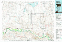 1982 Culbertson1983 Print · USGSNortheastern Montana at the start of the 1980s reveals a high-plains landscape defined by the Missouri River and the rail lines that served its valley. Genealogists and researchers can trace the townships surrounding Culbertson, Bainville, and the Fort Union Trading Post.
 - 1983 Map of Plentywood NW
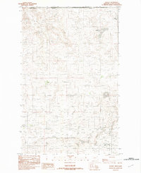
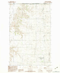
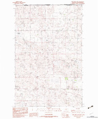
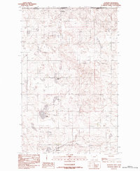
 1983 Plentywood NW1983 Print · USGSSheridan County, Montana, sits along the Canadian border in the early eighties, capturing a remote prairie landscape of ranching and drainage. Researchers can trace the winding course of Plentywood Creek and locate a rural Air Strip north of the creek beds.
 - 1983 Map of Dooley
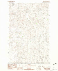
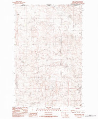
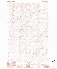
 1983 Dooley1983 Print · USGSSheridan County sits along the international border in the early eighties, where the high plains meet the Canadian line. Genealogists and researchers can locate the settlement of Dooley and trace the northern boundary alongside Johnson Lake and Brightsmen Lake.
 - 1983 Map of Tadpole Lake
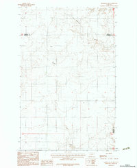
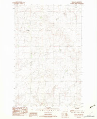
 1983 Tadpole Lake1983 Print · USGSNorthern Montana prairie life in the early eighties is defined by water and land use in this Sheridan County quadrangle. Researchers can trace the location of a rural Cem and essential agricultural landmarks like Tadpole Lake and various Tanks.
 - 1983 Map of Daleview
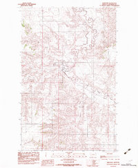
 1983 Daleview1983 Print · USGSThe Montana-Saskatchewan border comes into focus in the early eighties, centered on the drainage of Big Muddy Creek. Genealogists and researchers can trace the vicinity of Daleview and the winding paths of Whitetail Creek and Beaver Creek.
 - 1983 Map of Homestead NW
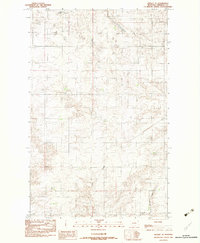
 1983 Homestead NW1983 Print · USGSSheridan and Roosevelt counties meet in this corner of Northeast Montana during the early eighties, where the high plains landscape is dotted with farm infrastructure. Researchers can locate grain storage clusters like Grain Bins and family-history sites such as the local Cem near Irish Coulee.2 unique versions available
 - 1983 Map of Outlook
 1983 Outlook1983 Print · USGSThe high plains of Sheridan County meet the Canadian border in the early 1980s. Local researchers can trace the townsite of Outlook and follow the courses of Muddy Creek and Plentywood Creek as they wind through the international boundary region.
 - 1983 Map of Dooley SW
 1983 Dooley SW1983 Print · USGSSheridan County, Montana, is captured in the early eighties as a landscape of remote farmsteads and prairie drainage systems. Genealogists can locate a small Cem and trace land holdings near Boxelder Creek or Storage Bins.
 - 1983 Map of Redstone
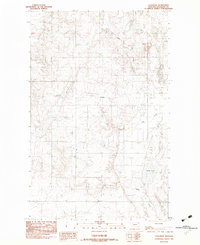
 1983 Redstone1983 Print · USGSRedstone sits at the heart of a complex drainage network in Sheridan County during the late seventies. Genealogists and local historians can pinpoint the town center, its local Cem, and nearby landmarks like the Landing Strip and Big Muddy Creek.
 - 1983 Map of Kisler Butte
 1983 Kisler Butte1983 Print · USGSSheridan County is seen here in the early eighties as a wide landscape of open plains and reservation lands. Researchers can trace the path of the Fort Peck Indian Reservation Boundary or locate landmarks like Kisler Butte and Crazy Horse Creek.
 - 1983 Map of Dooley SE
 1983 Dooley SE1983 Print · USGSSheridan County's high plains are captured in the early eighties, showing a landscape of quiet drainage basins and surveyed ranch lands. Local historians can trace family markers like the Cem and prominent landmarks including a Radio Tower and Antelope Creek.
 - 1983 Map of Flagstaff Hill
 1983 Flagstaff Hill1983 Print · USGSSheridan County, Montana, is documented in the early 1980s during a period of transition for its high plains landscape. Genealogists and historians can trace the topography around Rock Springs and the industrial footprint of the local Strip Mine.
 - 1983 Map of Lone Tree Lake
 1983 Lone Tree Lake1983 Print · USGSSheridan County, Montana, sits along the Canadian border in the early eighties, showing a landscape of prairie sloughs and remote settlements. Genealogists can locate Comertown and its nearby Cem, or trace the seasonal waters of Lone Tree Lake.
 - 1983 Map of Coalridge
 1983 Coalridge1983 Print · USGSSheridan County's high plains are captured in the late seventies, showing a landscape shaped by coal extraction and prairie agriculture. Genealogists and researchers can locate the Coalridge town site, a local Cem, and the industrial footprint of a Strip Mine.
 - 1983 Map of Smoke Creek NE
 1983 Smoke Creek NE1983 Print · USGSNortheastern Montana is shown during the early 1980s in this detailed record of the Fort Peck Indian Reservation. Researchers can trace the winding path of Smoke Creek and locate Burshia Coulee in this quiet corner of Roosevelt Co.
 - 1983 Map of Soo NW
 1983 Soo NW1983 Print · USGSNortheastern Montana's high plains are captured here in the early 1980s, revealing the rural landscape near the Sheridan Co line. You can trace the Fort Peck Indian Reservation Boundary and the winding paths of Redstone Creek and Wolf Creek.
 - 1983 Map of Park Lake
 1983 Park Lake1983 Print · USGSThe Montana-Saskatchewan borderlands come into focus in the early 1980s, revealing a landscape of prairie potholes and scattered settlements. Genealogists and historians can trace the roads around Comertown and locate the local Cem or the waters of Park Lake.
 - 1983 Map of Archer
 1983 Archer1983 Print · USGSSheridan County ranch lands and the small settlement of Archer are captured here during the late 1970s. Researchers can trace the winding course of Big Muddy Creek and Plentywood Creek, alongside the local Levee system.
 - 1983 Map of Plentywood
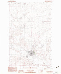 1983 Plentywood1983 Print · USGSPlentywood is shown as a thriving prairie hub in the early eighties, centered on the confluence of several vital creeks. You can trace local landmarks like the Drive-In Theater, the Rodeo Ground, and the Sher-Wood Airport.
 - 1983 Map of Raymond
 1983 Raymond1983 Print · USGSThe international border between Montana and Saskatchewan comes into focus in this early 1980s survey of the plains. Researchers can trace the layout of Raymond and the Raymond Port of Entry while locating local water features like Lochin Slough and McCoy Creek.
 - 1983 Map of Reserve NE
 1983 Reserve NE1983 Print · USGSSheridan County ranching country is captured here during the late 1970s and early 1980s. Local researchers can trace the drainages of Antelope Creek and the South Fork or locate the rural Cem in this remote prairie landscape.
 - 1983 Map of Thornwood Ranch
 1983 Thornwood Ranch1983 Print · USGSNortheastern Montana ranching country is captured here in the early 1980s, showing the intersection of remote landscapes and high plains agriculture. Researchers can trace the drainage of Wolf Creek or locate the namesake Thornwood Ranch and Burshia Coulee.
 - 1983 Map of Soo NE
 1983 Soo NE1983 Print · USGSSheridan County's high prairie comes into focus in this late twentieth-century survey of the Soo NE region. Researchers can trace the Fort Peck Indian Reservation Boundary and the winding course of Wolf Creek.
 - 1983 Map of Plentywood SW
 1983 Plentywood SW1983 Print · USGSSheridan County's high plains are mapped in the late seventies and early eighties, documenting the rural landscape of northeastern Montana. Genealogists and researchers can trace the winding paths of Big Muddy Creek, Plentywood Creek, and Ford Creek.
 - 1983 Map of Soo
 1983 Soo1983 Print · USGSNortheastern Montana's high plains are documented here in the early 1980s at the junction of three counties. Genealogists and researchers can trace the roads near the settlement of Soo and follow the natural paths of Smoke Creek and Burshia Coulee.
Showing maps 1-25 of 30
Top cities of Sheridan County
- Plentywood historical maps
- Medicine Lake historical maps
- Westby historical maps
- Outlook historical maps
Frequently asked questions
- What are the different types of historical maps available for Sheridan County?
- What is the oldest map of Sheridan County?
- Where can I purchase historical maps of Sheridan County for my home or office?
- Where can I download high-res historical maps of Sheridan County?
- Are there historical topographic maps available for Sheridan County?
- Is there historical aerial imagery available for Sheridan County?
- Where are historical maps of Sheridan County sourced from?