Old Maps of Sheridan County, Montana for Metal Detecting
Plan your next treasure hunt with 270 historic maps of Sheridan County. Find old homesites, ghost towns, trails, and gathering spots that may be lost to time — perfect for identifying promising metal detecting locations.
- Locate forgotten sites: Uncover places like long-lost settlements, abandoned rail lines, or gathering spots.
- Plan better hunts: Use map overlays combined with LiDAR or satellite views to narrow in on historically rich areas.
- Made for detectorists: Thousands of hobbyists use these maps to discover relics, coins, and hidden history.
Use these historic maps to boost your research and find new opportunities beneath the surface of Sheridan County.
Sheridan County, MT maps
(270)- 1909 Map of Smoke Creek, 1964 Print
 1909 Smoke Creek1964 Print · USGSNortheastern Montana was still an expansive frontier at the turn of the century, dominated by the Fort Peck Indian Reservation. Researchers can trace early land use and water sources through the West Ranch and the winding course of Smoke Creek.
 - 1912 Map of Smoke Creek
 1912 Smoke Creek1912 Print · USGSThe eastern reaches of the Fort Peck Indian Reservation are captured here in the years following the turn of the century. Genealogists and researchers can trace the early livestock era at Wests Ranch or the natural hydrology of Smoke Creek and Manning Lake.
 - 1914 Map of Homestead
 1914 Homestead1914 Print · USGSNortheastern Montana ranching country comes into focus in this early twentieth-century survey of the Big Muddy Creek valley. Genealogists can trace the location of the Le Clair School and pioneer outposts like Scott Ranch and Walker's Ranch along the rail line.
 - 1946 Map of Brush Lake, 1955 Print
 1946 Brush Lake1955 Print · USGSThe Montana and North Dakota borderlands come alive in the mid-1940s, showing a landscape of prairie potholes and remote homesteads. Genealogists can locate the St Olaf Cem and rural landmarks like Brush Lake Resort or Liberty Sch.3 unique versions available
 - 1946 Map of Dagmar, 1976 Print
 1946 Dagmar1976 Print · USGSSheridan County farming communities are captured here in the mid-1940s, highlighting a landscape of rural schoolhouses and water conservation. Genealogists can trace family footprints near Dagmar or locate landmarks like Hans Christian Andersen Sch and Volmer Ch.2 unique versions available
 - 1947 Map of Capeneys Lake, 1989 Print
 1947 Capeneys Lake1989 Print · USGSSheridan and Roosevelt counties are defined by the expansive wetlands of the High Plains shortly after the mid-century. Genealogists and historians can locate rural landmarks such as Hammond Sch, the Lookout Tower, and the natural narrows of Gaffney Pass.
 - 1947 Map of Homestead, 1989 Print
 1947 Homestead1989 Print · USGSNortheastern Montana ranching and rail life are detailed here in the late Forties, showing the intersection of the Missouri River country and the Great Plains. You can trace the small-town layouts of Homestead and McCabe near the shores of Medicine Lake and the winding Big Muddy Creek.
 - 1948 Map of Homestead
 1948 Homestead1948 Print · USGSNortheastern Montana's high plains are captured here just after the war, showing the vital intersection of rail and water near the Fort Peck Indian Reservation. Researchers can trace the Great Northern rail line through the settlements of Homestead and McCabe alongside the waters of Big Muddy Creek.2 unique versions available
 - 1948 Map of Capeneys Lake
 1948 Capeneys Lake1948 Print · USGSNortheastern Montana's high plains and vital wetlands are captured here in the late 1940s as the regional waterfowl refuge system was being established. Researchers can locate rural landmarks like Beverly Sch, Hammond Sch, and the remote Rock Crossing along the shores of Capeneys Lake.2 unique versions available
 - 1948 Map of Dagmar
 1948 Dagmar1948 Print · USGSSheridan County, Montana, was a landscape of prairie schools and migratory wetlands in the years following World War II. Local researchers can pinpoint the exact locations of rural landmarks like Volmer Ch, Dagmar, and the Hans Christian Andersen Sch.
 - 1948 Map of Brush Lake
 1948 Brush Lake1948 Print · USGSThe high plains of Sheridan County meet the North Dakota border in the late 1940s, revealing a landscape of prairie lakes and isolated schoolhouses. Trace local history at the St Olaf Cem or the lakeside Brush Lake Resort.
 - 1948 Map of Reserve SE, 1959 Print
 1948 Reserve SE1959 Print · USGSSheridan County's high prairie and marshlands are documented here in the late Forties, just as the Missouri River Basin development program was underway. Researchers can locate several community pillars including the Eden Valley Cem, the Dagmar Ch, and the defunct Richwine Sch (Aban'd).2 unique versions available
 - 1948 Map of Sunnyhill School, 1976 Print
 1948 Sunnyhill School1976 Print · USGSSheridan and Roosevelt counties are captured in the late 1940s, showcasing a landscape of complex coulees and rural school districts. Genealogists and historians can locate the Sunnyhill Sch and trace the winding paths of Sand Creek and Cottonwood Creek.
 - 1948 Map of Medicine Lake, 1976 Print
 1948 Medicine Lake1976 Print · USGSSheridan County's high plains were undergoing significant federal management in the late 1940s as the Medicine Lake National Wildlife Refuge was documented. Genealogists and local historians can locate early landmarks like Medicine Lake Cem, the Zich Sch, and family-named features like Umbrights Hill.3 unique versions available
 - 1948 Map of Reserve, 1976 Print
 1948 Reserve1976 Print · USGSSheridan County's high plains are documented here in the late 1940s as the rail-side economy of Reserve thrived along the Great Northern line. Genealogists can trace early homestead-era landmarks like the Cem, Eden Valley Sch, and the local Coal Mine.2 unique versions available
 - 1948 Map of Alkali Coulee, 1977 Print
 1948 Alkali Coulee1977 Print · USGSSheridan County's high plains come into focus shortly after the war, showing the vital connection between the railway and the land. Researchers can trace the path of the Great Northern into Medicine Lake or locate landmarks like the Rose Valley Sch and a local Coal Mine.3 unique versions available
 - 1948 Map of Antelope, 1989 Print
 1948 Antelope1989 Print · USGSSheridan County's high plains are captured here in the mid-twentieth century as the Missouri River Basin development program was underway. Researchers can trace the SOO LINE rail corridor through Antelope and locate historical sites like the Cem and McLaughlin near the Fort Peck Indian Reservation.
 - 1949 Map of Reserve SE
 1949 Reserve SE1949 Print · USGSSheridan County's prairie landscape is captured here in the late 1940s as rural shifts were already underway. Genealogists and local historians can trace the locations of Eden Valley Cem, Dagmar Ch, and several abandoned schoolhouses like Richwine Sch.
 - 1949 Map of Sunnyhill School
 1949 Sunnyhill School1949 Print · USGSThe Montana high plains of the late 1940s are revealed here as a landscape of remote farmsteads and shifting creek beds. Researchers can trace the rugged coulees of Sand Creek and locate the historic Sunnyhill School near the county line.
 - 1949 Map of Reserve
 1949 Reserve1949 Print · USGSSheridan County and the northeastern corner of the Fort Peck Indian Reservation are captured here just after the war. Local historians can trace the Great Northern rail corridor through Reserve or locate school sites like Eden Valley Sch and Smith Sch (Aban'd).
 - 1949 Map of Antelope
 1949 Antelope1949 Print · USGSSheridan County is captured in the late 1940s as the rail-side community of Antelope serves the surrounding plains. Genealogists and researchers can trace the course of Big Muddy Creek or locate local landmarks like the Cem and the Great Northern tracks.2 unique versions available
 - 1949 Map of Alkali Coulee
 1949 Alkali Coulee1949 Print · USGSSheridan County's high plains and reservation lands are captured here in the late Forties, showing a landscape defined by rail and water. Genealogists and researchers can trace the Great Northern tracks into Medicine Lake or locate the rural Rose Valley Sch.
 - 1949 Map of Medicine Lake
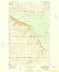 1949 Medicine Lake1949 Print · USGSNortheastern Montana's prairie wetlands were under careful management in the late 1940s as this survey of the Medicine Lake National Wildlife Refuge was completed. Researchers can locate the Medicine Lake Cem, trace the Refuge Patrol Trail, or find the old Zieh Sch.
 - 1950 Map of Shippe Canyon, 1952 Print
 1950 Shippe Canyon1952 Print · USGSSheridan County's high plains and river breaks are captured here in the early fifties, showing the northern reaches of the Fort Peck Indian Reservation. Researchers can locate several Coal Mines (inactive) and follow the drainage of Big Muddy Creek and Richardson Coulee.2 unique versions available
 - 1954 Map of Wolf Point, 1967 Print
 1954 Wolf Point1967 Print · USGSNortheastern Montana and the North Dakota borderlands are shown here in the mid-fifties, dominated by the Missouri River and the Fort Peck Indian Reservation. Genealogists and historians can trace the Great Northern rail line through river towns like Poplar and Culbertson or locate northern border outposts like the U S Custom Office at Raymond.2 unique versions available
Showing maps 1-25 of 270
Top cities of Sheridan County
- Plentywood historical maps
- Medicine Lake historical maps
- Westby historical maps
- Outlook historical maps
Frequently asked questions
- What are the different types of historical maps available for Sheridan County?
- What is the oldest map of Sheridan County?
- Where can I purchase historical maps of Sheridan County for my home or office?
- Where can I download high-res historical maps of Sheridan County?
- Are there historical topographic maps available for Sheridan County?
- Is there historical aerial imagery available for Sheridan County?
- Where are historical maps of Sheridan County sourced from?