
1948 Map of Reserve SE
USGS Topo · Published 1959About this map
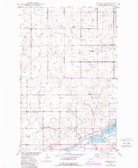
Medicine Lake National Wildlife Refuge anchors the southern portion of this Sheridan County landscape, where the waters of Sand Creek and Cottonwood Creek meet the protected marshlands. This post-war survey by the Department of the Interior reflects a shifting rural education system, noting several decommissioned schoolhouses such as Hawthorne Sch (Aban'd), Richwine Sch (Aban'd), and Griffin Sch (Aban'd). These rural landmarks, alongside the Dagmar Ch and its neighboring Cem, suggest a tight-knit prairie community during an era of regional consolidation. The terrain north of the refuge is marked by a scattering of small dams and a Gravel Pit, pointing to local efforts in water management and road development. Genealogists may find value in the location of the Eden Valley Cem, which sits isolated on the high ground in the northwestern corner of the quadrangle.
Find a feature on this map
14 named features on this map. Tap any name to fly to it.
Don’t see what you’re looking for? This feature index may not catch every label — zoom into the map to look around manually.
Map Details
Editions of this 1948 Reserve SE Map
2 editions found
Other maps of this area

1946 · Dagmar
USGS Topo · 1:24,000

1947 · Capeneys Lake
USGS Topo · 1:24,000

1948 · Capeneys Lake
USGS Topo · 1:24,000

1948 · Dagmar
USGS Topo · 1:24,000

1948 · Sunnyhill School
USGS Topo · 1:24,000

1948 · Medicine Lake
USGS Topo · 1:24,000

1948 · Reserve
USGS Topo · 1:24,000

1948 · Antelope
USGS Topo · 1:24,000

1949 · Reserve SE
USGS Topo · 1:24,000

1949 · Sunnyhill School
USGS Topo · 1:24,000