Old Maps of Blackleaf, Montana for Metal Detecting
Plan your next treasure hunt with 12 historic maps of Blackleaf. Find old homesites, ghost towns, trails, and gathering spots that may be lost to time — perfect for identifying promising metal detecting locations.
- Locate forgotten sites: Uncover places like long-lost settlements, abandoned rail lines, or gathering spots.
- Plan better hunts: Use map overlays combined with LiDAR or satellite views to narrow in on historically rich areas.
- Made for detectorists: Thousands of hobbyists use these maps to discover relics, coins, and hidden history.
Use these historic maps to boost your research and find new opportunities beneath the surface of Blackleaf.
Blackleaf, MT maps
(12)- 1914 Map of Heart Butte, 1959 Print
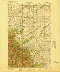
 1914 Heart Butte1959 Print · USGSThe foothills and plains of Pondera and Teton Counties are captured here in the early 1900s as the wilderness was being organized by early forestry and ranching. Genealogists can trace early homestead life via the Terryman School, Family, and the Blackleaf Ranger Station.
 - 1918 Map of Heart Butte
 1918 Heart Butte1918 Print · USGSThe northern Montana plains meet the high Divide in the early twentieth century, showing the interface of the Blackfeet Indian Reservation and the national forest. Genealogists and historians can locate early rural schools like Jensen School and frontier outposts such as Hagans Crossing and the Blackleaf Ranger Station.3 unique versions available
 - 1960 Map of Cut Bank, 1968 Print
 1960 Cut Bank1968 Print · USGSThe high peaks of the Rockies meet the eastern plains in the 1960s, showing the intersection of federal lands and the Blackfeet Indian Reservation. Trace the path of the Great Northern railway and find local landmarks like the Blackfoot Boarding School and Family Mission Cem.3 unique versions available
 - 1963 Map of Cut Bank
 1963 Cut Bank1963 Print · USGSNorthern Montana’s mountain passes and high plains are captured here in the early 1960s. Genealogists and historians can trace the Great Northern rail stops from Browning to Ethridge or locate the remote outposts at Polebridge and Babb.
 - 1964 Map of Cut Bank
 1964 Cut Bank1964 Print · USGSGlacier National Park and the Blackfeet Indian Reservation meet in the early sixties at the triple divide of North America. Researchers can trace the Great Northern Railway through mountain passes and locate local landmarks like the Blackfoot Boarding School and Apgar Village.
 - 1968 Map of Blackleaf, 1972 Print
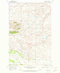 1968 Blackleaf1972 Print · USGSThe Teton County foothills in the late sixties reveal a landscape of deep coulees and mountain-fed streams near the Front Range. Researchers can trace the small settlement at Blackleaf and follow the winding courses of Blackleaf Creek and the Marias River.
 - 1984 Map of Valier
 1984 Valier1984 Print · USGSNorthwestern Montana in the mid-1980s reveals a unique landscape of Hutterite agricultural colonies and high mountain wilderness. Genealogists and historians can trace the irrigation networks and rail stops from Valier to Birch Creek Colony and the Kellogg Mine.
 - 2011 Map of Blackleaf, 2011 Print
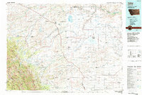
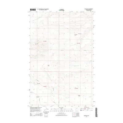
 2011 Blackleaf2011 Print · USGSCovers Blackleaf, including Teton County, United States, and other nearby areas
 - 2014 Map of Blackleaf, 2014 Print
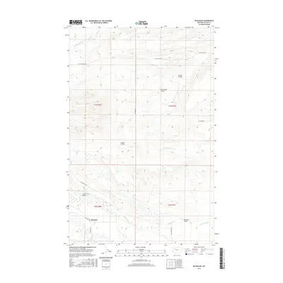
 2014 Blackleaf2014 Print · USGSCovers Blackleaf, including Teton County, United States, and other nearby areas
 - 2017 Map of Blackleaf, 2017 Print
 2017 Blackleaf2017 Print · USGSCovers Blackleaf, including Teton County, United States, and other nearby areas
 - 2020 Map of Blackleaf, 2020 Print
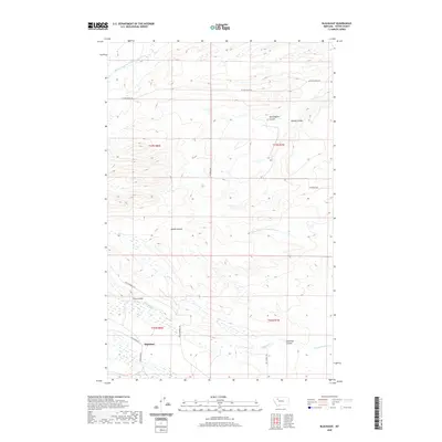 2020 Blackleaf2020 Print · USGSCovers Blackleaf, including Teton County, United States, and other nearby areas
 - 2024 Map of Blackleaf, 2024 Print
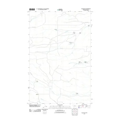
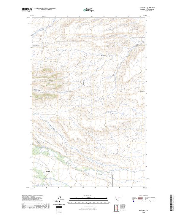 2024 Blackleaf2024 Print · USGSThe eastern edge of the Rocky Mountain Front comes into focus in this recent study of Teton County ranching country. Researchers can trace the drainage of Blackleaf Creek and identify landmarks like Ben English Coulee and Gansman Coulee.
End of results
Showing maps 1-12 of 12
Frequently asked questions
- What are the different types of historical maps available for Blackleaf?
- What is the oldest map of Blackleaf?
- Where can I purchase historical maps of Blackleaf for my home or office?
- Where can I download high-res historical maps of Blackleaf?
- Are there historical topographic maps available for Blackleaf?
- Is there historical aerial imagery available for Blackleaf?
- Where are historical maps of Blackleaf sourced from?