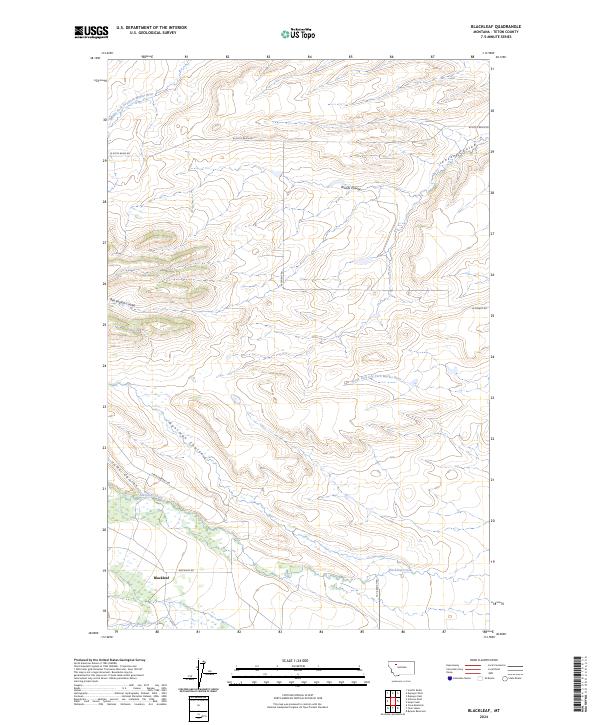
2024 Map of Blackleaf
USGS Topo · Published 2024About this map
Blackleaf sits at the base of the eastern Front, where the prairie begins its transition into the high foothills of the Rockies. This area is characterized by a network of drainage features including Middle Fork Dry Fork Marias River and the South Fork Dry Fork Marias River, which carve distinct paths through the landscape. Large portions of the territory are designated as the Blackfoot Valley Conservation Area, reflecting a landscape managed for habitat and open space.
Find a feature on this map
20 named features on this map. Tap any name to fly to it.
Don’t see what you’re looking for? This feature index may not catch every label — zoom into the map to look around manually.
Map Details
Editions of this 2024 Blackleaf Map
This is the sole edition of this map. No revisions or reprints were ever made.
Other maps of this area

1903 · Saypo
USGS Topo · 1:125,000

1914 · Heart Butte
USGS Topo · 1:125,000

1918 · Heart Butte
USGS Topo · 1:125,000

1920 · Choteau
USGS Topo · 1:125,000

1920 · Dupuyer
USGS Topo · 1:125,000

1936 · Pendroy
USGS Topo · 1:48,000

1941 · Pendroy
USGS Topo · 1:62,500

1955 · Choteau
USGS Topo · 1:250,000

1957 · Choteau
USGS Topo · 1:250,000

1958 · Choteau
USGS Topo · 1:250,000