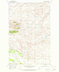
1968 Map of Blackleaf
USGS Topo · Published 1972About this map
Blackleaf sits near the base of the eastern Front Range in Teton County, where the plains meet the foothills. This 1968 field-checked survey illustrates a landscape of complex drainage systems, characterized by numerous coulees and the intricate forks of the Marias River. The small settlement of Blackleaf is positioned along the banks of Blackleaf Creek, an area where the terrain begins its sharp transition into higher elevations. A Gravel Pit near the creek indicates the small-scale extractive activity typical of this region's local economy during the late 1960s. The map reveals how the land is dissected by seasonal waterways such as Woods Coulee, Jensen Coulee, and English Coulee, which define the ranching and agricultural patterns of the area. Landforms like Swanson Ben provide distinct topographic markers in a territory otherwise dominated by the winding paths of the Middle Fork Dry Fork Marias River and the South Fork Dry Fork Marias River.
Find a feature on this map
15 named features on this map. Tap any name to fly to it.
Don’t see what you’re looking for? This feature index may not catch every label — zoom into the map to look around manually.
Map Details
Editions of this 1968 Blackleaf Map
This is the sole edition of this map. No revisions or reprints were ever made.
Other maps of this area

1903 · Saypo
USGS Topo · 1:125,000

1914 · Heart Butte
USGS Topo · 1:125,000

1918 · Heart Butte
USGS Topo · 1:125,000

1920 · Choteau
USGS Topo · 1:125,000

1920 · Dupuyer
USGS Topo · 1:125,000

1936 · Pendroy
USGS Topo · 1:48,000

1941 · Pendroy
USGS Topo · 1:62,500

1955 · Choteau
USGS Topo · 1:250,000

1957 · Choteau
USGS Topo · 1:250,000

1958 · Choteau
USGS Topo · 1:250,000