Old Maps of Wheatland County, Montana for Metal Detecting
Plan your next treasure hunt with 278 historic maps of Wheatland County. Find old homesites, ghost towns, trails, and gathering spots that may be lost to time — perfect for identifying promising metal detecting locations.
- Locate forgotten sites: Uncover places like long-lost settlements, abandoned rail lines, or gathering spots.
- Plan better hunts: Use map overlays combined with LiDAR or satellite views to narrow in on historically rich areas.
- Made for detectorists: Thousands of hobbyists use these maps to discover relics, coins, and hidden history.
Use these historic maps to boost your research and find new opportunities beneath the surface of Wheatland County.
Wheatland County, MT maps
(278)- 1886 Map of Little Belt Mts.
 1886 Little Belt Mts.1886 Print · USGSCentral Montana territory during the mid-1880s is captured here, showing the region's early mining camps and ranching hubs. Researchers can trace the early layouts of White Sulphur Spring and Neihart or locate landmarks like Copperopolis and Crazy Peak.
 - 1889 Map of Big Snowy Mountain
 1889 Big Snowy Mountain1889 Print · USGSCentral Montana in the late 1880s was a land of critical mountain passes and emerging frontier outposts. You can trace early settlement patterns and cattle country geography through historic sites like Ubet, Bercail, and Melville near the Musselshell River.
 - 1893 Map of Big Snowy Mountain
 1893 Big Snowy Mountain1893 Print · USGSCentral Montana in the late frontier era reveals a landscape shaped by the massive Big Snowy Mountain and the headwaters of major rivers. Researchers can trace early settlements and transit points like Ubet, Judith Gap, and the remote outpost of Bercail.4 unique versions available
 - 1894 Map of Little Belt Mts.
 1894 Little Belt Mts.1894 Print · USGSCentral Montana in the late nineteenth century is a land of emerging mining camps and river valley outposts. Historians can trace the early footprints of White Sulphur Spring, the copper prospects at Copperopolis, and the mountain terrain of Neihart.2 unique versions available
 - 1897 Map of Little Belt Mts.
 1897 Little Belt Mts.1897 Print · USGSMeagher County and the central Montana high country are captured here in the 1890s, when mining camps and early ranching outposts were first being established. Researchers can trace the early layout of White Sulphur Springs and locate now-quiet sites like the Sapphire Mine or Copperopolis.
 - 1898 Map of Little Belt Mts.
 1898 Little Belt Mts.1898 Print · USGSCentral Montana in the late nineteenth century is a landscape of mountain mining camps and early ranching outposts. Genealogists and historians can trace the pioneer footprints of White Sulphur Springs, the operations at Sapphire Mine, and the route of Sixteenmile Creek.
 - 1902 Map of Little Belt Mts.
 1902 Little Belt Mts.1902 Print · USGSMeagher County at the close of the nineteenth century is a landscape of mountain mining camps and riverside settlements. Researchers can trace early industry and family roots near the Sapphire Mine, the town of White Sulphur Springs, and the camp at Neihart.3 unique versions available
 - 1948 Map of White Sulphur Springs, 1951 Print
 1948 White Sulphur Springs1951 Print · USGSMontana's capital and the high country of the Big Belt Mountains come alive in this mid-century survey. Trace the early hydroelectric developments at Canyon Ferry Dam or follow the historic rail lines through Ringling and Townsend.
 - 1954 Map of Roundup, 1966 Print
 1954 Roundup1966 Print · USGSCentral Montana in the mid-1960s showcases a landscape of high-plains agriculture and vital rail connections. Researchers can trace historic routes through Harlowton and Roundup while locating landmarks like Judith Cemetery and Deadmans Basin Reservoir.2 unique versions available
 - 1958 Map of Roundup
 1958 Roundup1958 Print · USGSCentral Montana ranching and rail infrastructure are captured here in the late fifties as the Musselshell River valley thrived. Researchers can trace the Great Northern line through Harlowton or locate the Judith Cemetery and Gage Community.2 unique versions available
 - 1958 Map of White Sulphur Springs, 1968 Print
 1958 White Sulphur Springs1968 Print · USGSCentral Montana in the late fifties was a landscape of high-country mining and newly formed reservoirs. You can trace the rail-and-river economy of the era through sites like Canyon Ferry Lake, the East Pacific Mine, and the historic Fort Logan.3 unique versions available
 - 1961 Map of White Sulphur Springs
 1961 White Sulphur Springs1961 Print · USGSThe Missouri River valley and central Montana highlands are captured here during a period of significant hydroelectric and rail expansion. Genealogists and rail historians can trace the paths of the Northern Pacific and Chicago Milwaukee St Paul and Pacific through settlements like White Sulphur Springs and Townsend.
 - 1965 Map of White Sulphur Springs
 1965 White Sulphur Springs1965 Print · USGSCentral Montana in the late 1950s and early 60s reveals a rugged mountain landscape shaped by the Missouri River and the emergence of the Canyon Ferry Reservoir. Genealogists and local historians can trace legacy ranching sites, the Northern Pacific rail line, and remote schoolhouses like Cottonwood School and Spokane Creek School.
 - 1970 Map of Martin Coulee, 1973 Print
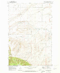 1970 Martin Coulee1973 Print · USGSThe Judith Basin and Wheatland county line was a landscape of remote drainages and high timber in the early seventies. Genealogists and historians can trace old resource extraction sites near Saager Canyon and follow a primitive Jeep Trail into the Lewis and Clark National Forest.
 - 1972 Map of Lebo Lake, 1975 Print
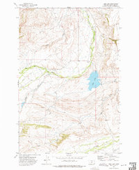 1972 Lebo Lake1975 Print · USGSWheatland County ranching country is documented here in the early seventies, centered on the waters of Lebo Lake. Researchers can trace old family operations like the C Bar J Ranch and find local landmarks such as the Cem and Big Elk Creek.
 - 1972 Map of Daisy Peak, 1975 Print
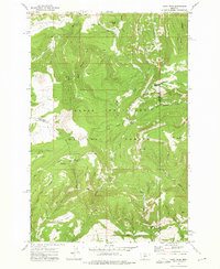 1972 Daisy Peak1975 Print · USGSThe high country of the Little Belt Mountains is captured here in the early seventies, spanning the borders of Judith Basin, Meagher, and Wheatland counties. Trace the locations of the Daisy Guard Sta (Site) and explore the route of the Smith Creek Pack Trail through Haymaker Park.
 - 1972 Map of Porcupine Butte, 1975 Print
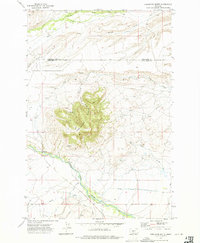 1972 Porcupine Butte1975 Print · USGSThe high ranchlands of Sweet Grass and Wheatland counties are captured here in the early 1970s. Trace the complex irrigation networks of the Hart Parker Ditch and the lonely Landing Strip near the base of Porcupine Butte.
 - 1972 Map of Mud Creek, 1975 Print
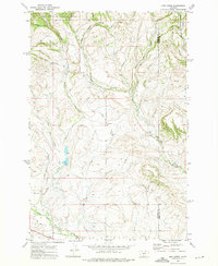 1972 Mud Creek1975 Print · USGSMeagher and Wheatland counties at the start of the 1970s show a landscape of mountain forests and river valleys. Researchers can trace land use along the North Fork Musselshell River and find remote access via Findon Lane and a secluded Landing Strip.
 - 1972 Map of Cinnamon Peak, 1975 Print
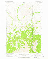 1972 Cinnamon Peak1975 Print · USGSThe Meagher County high country is documented here in the early 1970s, showing the intersection of ranching and national forest lands. Trace mountain drainages and early trails near Pump Ranch, Cinnamon Peak, and Station Creek.
 - 1972 Map of Martinsdale, 1976 Print
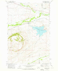 1972 Martinsdale1976 Print · USGSMartinsdale and the Musselshell River valley are captured here in the early 1970s, showing a landscape shaped by the railroad and irrigation. Researchers can trace the Milwaukee Road tracks, locate the Martinsdale Colony, and find family landmarks like Findon Lane.
 - 1972 Map of Jellison Place, 1976 Print
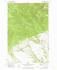 1972 Jellison Place1976 Print · USGSWheatland and Judith Basin counties are seen here in the early 1970s as high forest transitions to spring-fed ranchland. Researchers can trace water sources like Jellison Reservoir and Muir Spring near the namesake Jellison Place.
 - 1972 Map of Loco Mountain, 1976 Print
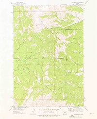 1972 Loco Mountain1976 Print · USGSThe Crazy Mountains of Montana come alive in the early 1970s, showcasing a high wilderness of overlapping national forests and county lines. Trace historical access routes via the Pack Trail and Jeep Trail near Lebo Peak and Elk Lake.
 - 1972 Map of Rein Lake, 1976 Print
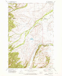 1972 Rein Lake1976 Print · USGSSweet Grass and Wheatland counties come together in the early 1970s, showcasing a landscape of high-country ranching and forest preserves. Genealogists and historians can locate the Hopkins Cem and trace early irrigation systems like the Tronrud Ditch near the American Fork Ranch.
 - 1972 Map of Haymaker Narrows, 1976 Print
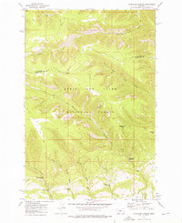 1972 Haymaker Narrows1976 Print · USGSIn the early 1970s, the high country along the Judith Basin and Wheatland county line remained a remote landscape of pack trails and springs. Researchers can locate specific water sources like Sixshooter Spring and landmarks such as Elephant Rock and Haymaker Dam.
 - 1972 Map of Cinnamon Spring, 1976 Print
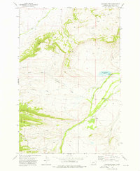 1972 Cinnamon Spring1976 Print · USGSWheatland County ranchlands and forest boundaries are captured here in the early 1970s. Local historians and land researchers can trace family-named sites like the McFarland-White Ranch and Top Hat Ranch or the waters of Big Elk Creek.
Showing maps 1-25 of 278
Top cities of Wheatland County
Frequently asked questions
- What are the different types of historical maps available for Wheatland County?
- What is the oldest map of Wheatland County?
- Where can I purchase historical maps of Wheatland County for my home or office?
- Where can I download high-res historical maps of Wheatland County?
- Are there historical topographic maps available for Wheatland County?
- Is there historical aerial imagery available for Wheatland County?
- Where are historical maps of Wheatland County sourced from?