Old Maps of Naper, Nebraska for Genealogy
Trace your family roots with 10 historic maps of Naper. These high-res maps reveal old neighborhoods, homesites, landmarks, and streets — helping you uncover where your ancestors lived and how the area evolved over time.
- Explore historic neighborhoods: Identify where your relatives may have lived in the 1800s or 1900s.
- Compare maps over time: Trace the changes in streets, buildings, and landmarks for multi-generational research.
- Perfect for genealogy & ancestry research: Used by family historians and researchers to map out lineage and migration.
These maps are an incredible resource for exploring your personal connection to Naper's past.
Naper, NE maps
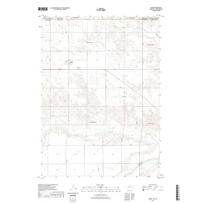
(10)- 1951 Map of Naper
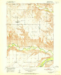 1951 Naper1951 Print · USGSNaper and the Boyd County ranchlands are captured here in the early fifties, showing a rural landscape defined by river valleys and the state line. Researchers can locate several country schoolhouses, from Basin Sch to Point Sch, and the local Knoll Crest Cem.2 unique versions available
 - 1955 Map of O'Neill, 1974 Print
 1955 O'Neill1974 Print · USGSNorth-central Nebraska in the 1950s reveals a vast cattle-ranching landscape transitioning from the Missouri River breaks to the iconic Sand Hills. Researchers can trace the path of the Chicago and North Western rail line and locate rural landmarks like the Dustin Post Office and St Johns Lake Ch.2 unique versions available
 - 1959 Map of O'Neill
 1959 O'Neill1959 Print · USGSNorth-central Nebraska in the late fifties is defined by the vast Sand Hills and the vital Chicago and North Western rail line. Genealogists and researchers can trace family roots through settlements like Atkinson, Bassett, and Stuart or follow the waters of the Niobrara River.2 unique versions available
 - 1969 Map of O'Neill
 1969 O'Neill1969 Print · USGSCentral Nebraska in the mid-fifties is defined here by the expansive Sand Hills and the winding Niobrara River. Trace the Chicago and North Western rail line through cattle towns like O'Neill and Ainsworth.
 - 1985 Map of Ainsworth
 1985 Ainsworth1985 Print · USGSThe Nebraska-South Dakota borderlands come into focus in the mid-1980s, documenting a landscape of river breaks and remote ranching hubs. Genealogists can trace the rural layout of Ainsworth, Bassett, and Springview or follow the Chicago and North Western rail line.2 unique versions available
 - 1989 Map of O'Neill
 1989 O'Neill1989 Print · USGSThe Nebraska-South Dakota borderlands are captured here in the late eighties, documenting the ranching and rail infrastructure of the High Plains. Genealogists and collectors can trace historic prairie towns like Monowi, Pishelville, and Santee along the Niobrara River.
 - 2011 Map of Naper, 2011 Print
 2011 Naper2011 Print · USGSCovers Naper, including Holt County, Boyd County, and other nearby areas
 - 2014 Map of Naper, 2014 Print
 2014 Naper2014 Print · USGSCovers Naper, including Holt County, Boyd County, and other nearby areas
 - 2017 Map of Naper, 2017 Print
 2017 Naper2017 Print · USGSCovers Naper, including Holt County, Boyd County, and other nearby areas
 - 2021 Map of Naper, 2021 Print
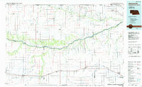
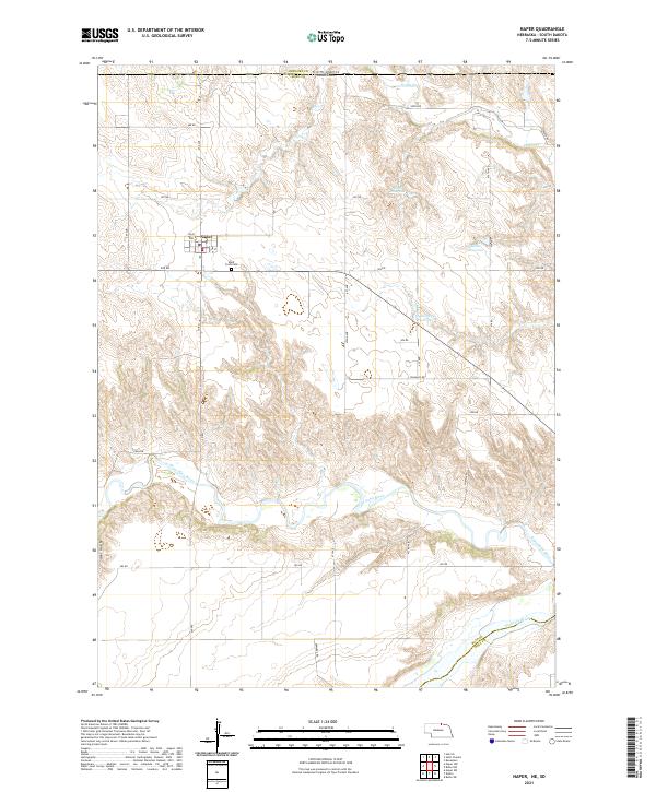 2021 Naper2021 Print · USGSThe Boyd County panhandle along the South Dakota border is shown here in the modern era, framed by the winding valleys of the northern plains. Researchers can locate the Naper townsite, the Knoll Crest Cem, and water features like Ponca Cr and the Niobrara River.
End of results
Showing maps 1-10 of 10
Top cities near Naper
- Burke historical maps
- Bonesteel historical maps
- Fairfax historical maps
- Herrick historical maps
- Dustin historical maps
Frequently asked questions
- What are the different types of historical maps available for Naper?
- What is the oldest map of Naper?
- Where can I purchase historical maps of Naper for my home or office?
- Where can I download high-res historical maps of Naper?
- Are there historical topographic maps available for Naper?
- Is there historical aerial imagery available for Naper?
- Where are historical maps of Naper sourced from?