
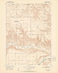
1951 Map of Naper
USGS Topo · Published 1951About this map
Naper stands at the heart of this mid-century landscape, positioned between the drainages of the Ponca Creek to the north and the Keya Paha River to the south. This 1951 record documents a rural Nebraska community where educational life was decentralized across numerous small district buildings, including Sunnyside Sch, Mt Zion Sch, and several numbered facilities such as School No 22. The geography is defined by the significant elevation changes of the central Basin area, dropping down toward the confluence area of the Niobrara River at the southern edge of the survey.
Find a feature on this map
18 named features on this map. Tap any name to fly to it.
Don’t see what you’re looking for? This feature index may not catch every label — zoom into the map to look around manually.
Map Details
Editions of this 1951 Naper Map
2 editions found
Other maps of this area

1951 · Butte NW
USGS Topo · 1:24,000

1951 · Butte SW
USGS Topo · 1:24,000

1951 · Dustin
USGS Topo · 1:24,000

1951 · Naper SW
USGS Topo · 1:24,000

1955 · Mitchell
USGS Topo · 1:250,000

1955 · O'Neill
USGS Topo · 1:250,000

1959 · O'Neill
USGS Topo · 1:250,000

1959 · Mitchell
USGS Topo · 1:250,000

1964 · St. Charles
USGS Topo · 1:24,000
1964 · Herrick
USGS Topo · 1:24,000