1900s (20th Century) Maps of Brainard, Nebraska
Explore 7 historic maps of Brainard from the 1900s (20th Century). These maps offer a rare glimpse into what life looked like during the 1900s — showing old roads, neighborhoods, homes, and landmarks that have changed or disappeared over time.
Whether you're researching your family's past, planning a metal detecting trip, or studying how Brainard's landscape evolved across the 1900s, these high-resolution maps are a powerful tool for exploring the history of this region.
- Focus on a specific era: All maps on this page are from the 1900s, giving you a focused view of this time period.
- See what’s changed: Compare century-old streets, trails, and buildings to today's modern landscape using overlays and satellite layers.
- Research with precision: Use these maps for genealogy, historical research, land use analysis, or educational projects.
- View, download, or print: Maps are fully viewable online in high resolution, and can be downloaded or printed for your own records.
Start exploring Brainard's history through authentic maps from the 1900s. This is your window into the past.
Brainard, NE maps
(7)- 1955 Map of Fremont, 1966 Print
 1955 Fremont1966 Print · USGSEastern Nebraska and the Missouri River border are captured during the mid-fifties, just as the interstate system began to emerge. Researchers can trace the development of Omaha, locate the sprawling Offutt Air Force Base, or study the river-bound ecology of the De Soto National Wildlife Refuge.3 unique versions available
 - 1957 Map of Fremont
 1957 Fremont1957 Print · USGSEastern Nebraska and western Iowa thrive along the Platte and Missouri rivers during the mid-fifties. Genealogists can locate small rural schools like Fairview School and tracing the paths of the Union Pacific through towns like Albion and Humphrey.
 - 1958 Map of Fremont
 1958 Fremont1958 Print · USGSEastern Nebraska in the late fifties is captured here as a thriving corridor of river-valley commerce and rail transport. Researchers can trace the development of Omaha and Fremont or locate local landmarks like Midland College and Offutt Air Force Base.
 - 1965 Map of Brainard, 1967 Print
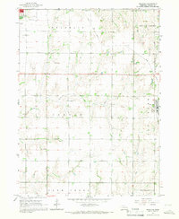 1965 Brainard1967 Print · USGSButler County farmland transitions from the outskirts of David City to the village of Brainard in the mid-sixties. Researchers can trace the Union Pacific line, find rural schools like Speedway Sch, and locate the St Marys Cem.
 - 1969 Map of Loma, 1971 Print
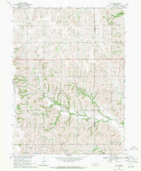 1969 Loma1971 Print · USGSAgricultural Butler County comes into focus in the late 1960s, showing the rural rhythm of the Nebraska plains. Genealogists can locate family landmarks like Holy Trinity Cem and Loma Cem or the rural La Cross Sch.
 - 1982 Map of Fremont
 1982 Fremont1982 Print · USGSEastern Nebraska in the early eighties exhibits a landscape of industrious rail towns and river-fed agriculture. Genealogists and historians can trace the development of Fremont, locate the National Cem, and find landmarks like the Todd Valley.2 unique versions available
 - 1985 Map of David City
 1985 David City1985 Print · USGSCentral Nebraska in the mid-eighties centers on the convergence of the Platte River and Loup River. Trace the rail-and-river economy through towns like Columbus, David City, and Stromsburg, or locate family sites near Swedehome and Surprise.2 unique versions available
End of results
Showing maps 1-7 of 7
Top cities near Brainard
- David City historical maps
- Valparaiso historical maps
- Prague historical maps
- Ulysses historical maps
- Staplehurst historical maps
- Dwight historical maps
See more
Frequently asked questions
- What are the different types of historical maps available for Brainard?
- What is the oldest map of Brainard?
- Where can I purchase historical maps of Brainard for my home or office?
- Where can I download high-res historical maps of Brainard?
- Are there historical topographic maps available for Brainard?
- Is there historical aerial imagery available for Brainard?
- Where are historical maps of Brainard sourced from?