1900s (20th Century) Maps of Glenvil, Nebraska
Explore 10 historic maps of Glenvil from the 1900s (20th Century). These maps offer a rare glimpse into what life looked like during the 1900s — showing old roads, neighborhoods, homes, and landmarks that have changed or disappeared over time.
Whether you're researching your family's past, planning a metal detecting trip, or studying how Glenvil's landscape evolved across the 1900s, these high-resolution maps are a powerful tool for exploring the history of this region.
- Focus on a specific era: All maps on this page are from the 1900s, giving you a focused view of this time period.
- See what’s changed: Compare century-old streets, trails, and buildings to today's modern landscape using overlays and satellite layers.
- Research with precision: Use these maps for genealogy, historical research, land use analysis, or educational projects.
- View, download, or print: Maps are fully viewable online in high resolution, and can be downloaded or printed for your own records.
Start exploring Glenvil's history through authentic maps from the 1900s. This is your window into the past.
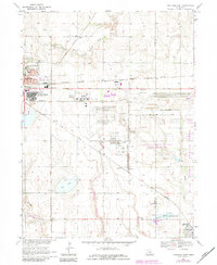
Glenvil, NE maps
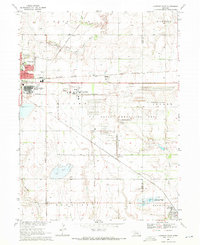
(10)- 1955 Map of Grand Island, 1967 Print
 1955 Grand Island1967 Print · USGSCentral Nebraska is seen here during a period of industrial and agricultural growth, centered on the vital Platte River corridor. Researchers can trace the mid-century footprints of the U S Naval Ammunition Depot and the Cornhusker Ordnance Plant.3 unique versions available
 - 1957 Map of Grand Island
 1957 Grand Island1957 Print · USGSCentral Nebraska and Northern Kansas are shown here during a period of massive hydraulic and military expansion in the mid-fifties. Researchers can trace the development of the Harlan County Reservoir and the massive wartime legacy of the Cornhusker Ordnance Plant.
 - 1958 Map of Grand Island
 1958 Grand Island1958 Print · USGSSouth-central Nebraska thrived as a rail and industrial hub during the late fifties, shaped by the braided Platte River. Genealogists and historians can trace rail lines like the Union Pacific RR through towns such as Kearney or locate the sprawling Cornhusker Ordnance Plant.
 - 1969 Map of Hastings East, 1971 Print
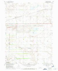
 1969 Hastings East1971 Print · USGSThe prairie east of Hastings in the late sixties is dominated by a sprawling defense landscape and rail corridors. Trace the infrastructure of the U S Naval Ammunition Depot (Abandoned) or locate family sites like St Pauls Ch and Inland Cem.
 - 1969 Map of Fairfield NW, 1971 Print
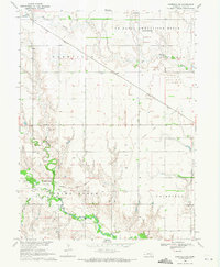 1969 Fairfield NW1971 Print · USGSClay County at the end of the sixties was a landscape of quiet prairie settlements and military remnants. Genealogists and historians can trace the Little Blue River past Spring Ranch Cem and explore the site of the U S Naval Ammunition Depot (Abandoned).
 - 1969 Map of Inland, 1971 Print
 1969 Inland1971 Print · USGSClay County at the end of the 1960s shows a landscape shaped by both agriculture and the massive U S Naval Ammunition Depot (Abandoned). Genealogists can locate several key burial sites including Inland Cem and Zion Cem, or trace the rail routes of the Burlington Northern.
 - 1969 Map of Pauline, 1972 Print
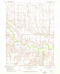 1969 Pauline1972 Print · USGSThe rural agricultural landscapes of south-central Nebraska are captured here in the late sixties, centered on the Little Blue River valley. Genealogists and local historians can trace the foundations of Pauline and locate landmarks like Hanover Ch and School No 75.
 - 1983 Map of Hastings East, 1984 Print
 1983 Hastings East1984 Print · USGSHastings and the Adams County countryside are captured here in the early eighties, showing a landscape defined by rail and military history. Genealogists and local historians can locate Mount Sinai Ch, Parkview Cem, and the small community of Glenville.
 - 1985 Map of Grand Island
 1985 Grand Island1985 Print · USGSThe Platte River valley in the mid-eighties shows a landscape of braided river channels and massive military-industrial sites. Trace the layout of the Cornhusker Ordnance Plant and find family landmarks like Parkview Cem or Good Samaritan Village.2 unique versions available
 - 1985 Map of Red Cloud
 1985 Red Cloud1985 Print · USGSSouth Central Nebraska and the Kansas borderlands appear in high detail during the mid-eighties as a landscape of river-fed agriculture and rail-connected prairie towns. Researchers can trace the Burlington Northern tracks through Red Cloud or locate the extensive Courtland Canal and Superior-Courtland Diversion Dam.2 unique versions available
End of results
Showing maps 1-10 of 10
Top cities near Glenvil
- Hastings historical maps
- Harvard historical maps
- Blue Hill historical maps
- Clay Center historical maps
- Blaine historical maps
- Fairfield historical maps
See more
Frequently asked questions
- What are the different types of historical maps available for Glenvil?
- What is the oldest map of Glenvil?
- Where can I purchase historical maps of Glenvil for my home or office?
- Where can I download high-res historical maps of Glenvil?
- Are there historical topographic maps available for Glenvil?
- Is there historical aerial imagery available for Glenvil?
- Where are historical maps of Glenvil sourced from?