1960s Maps of Cuming County, Nebraska
Explore 20 historic maps of Cuming County from the 1960s. These maps offer a rare glimpse into what life looked like during the 1960s — showing old roads, neighborhoods, homes, and landmarks that have changed or disappeared over time.
Whether you're researching your family's past, planning a metal detecting trip, or studying how Cuming County's landscape evolved across the 1960s, these high-resolution maps are a powerful tool for exploring the history of this region.
- Focus on a specific era: All maps on this page are from the 1960s, giving you a focused view of this time period.
- See what’s changed: Compare century-old streets, trails, and buildings to today's modern landscape using overlays and satellite layers.
- Research with precision: Use these maps for genealogy, historical research, land use analysis, or educational projects.
- View, download, or print: Maps are fully viewable online in high resolution, and can be downloaded or printed for your own records.
Start exploring Cuming County's history through authentic maps from the 1960s. This is your window into the past.
Cuming County, NE maps
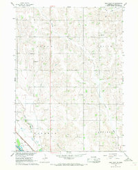
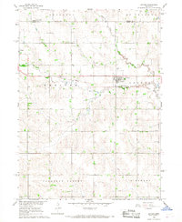
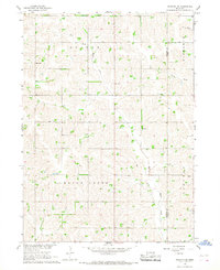
(20)- 1963 Map of Pilger, 1964 Print
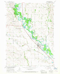
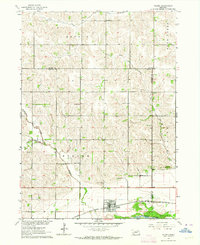 1963 Pilger1964 Print · USGSIn the early sixties, the Elkhorn River valley around Stanton County was a landscape of rail-served villages and a dense network of country school districts. Genealogists and local historians can trace the exact locations of School No 43, School No 7, and the Pilger Cem, alongside the Chicago and North Western rail corridor.
 - 1963 Map of Wisner, 1964 Print
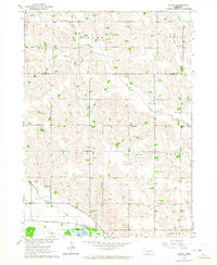
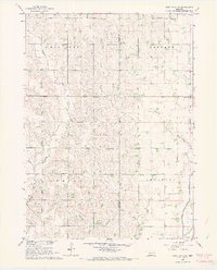
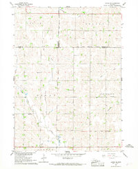
 1963 Wisner1964 Print · USGSCuming County farming life and rail transit are captured here in the early sixties, centered on the community of Wisner. Genealogists can locate family landmarks such as Salem Cem, St Johns Sch, and several rural schoolhouses across the Bismarck township.
 - 1963 Map of Altona, 1964 Print
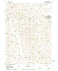
 1963 Altona1964 Print · USGSCuming and Wayne Counties in the early sixties reveal a landscape of disciplined prairie farming and local school districts. Researchers can trace the legacy of early settlers at the Norwegian Cem and locate many rural schoolhouses, from School No 32 to School No 17.
 - 1963 Map of Stanton NE, 1964 Print
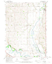
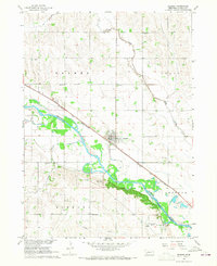
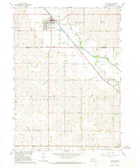
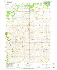 1963 Stanton NE1964 Print · USGSStanton and Cuming Counties are captured in the early sixties, showing a rural Nebraska landscape defined by the Elkhorn River and the Chicago and North Western rail line. Genealogists can locate specific landmarks like St Matthews Church, Clinton School, and Vogel School.
 - 1966 Map of West Point NW, 1967 Print
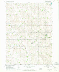
 1966 West Point NW1967 Print · USGSCuming County farming townships are frozen in time during the mid-1960s, showing a landscape defined by the Elkhorn River and the Chicago and North Western rail line. Genealogists can trace rural school districts like School No 25 and find local landmarks such as Dewitt Cem.
 - 1966 Map of West Point SE, 1967 Print
 1966 West Point SE1967 Print · USGSNortheastern Nebraska farmlands appear in detail in the mid-sixties, showcasing a landscape of section-line roads and family burial grounds. Local researchers can trace rural school districts like School No 81 and find historic sites such as Blomgren Cem or Salem Ch.
 - 1966 Map of Uehling, 1967 Print
 1966 Uehling1967 Print · USGSDodge and Cuming counties are shown here in the mid-sixties during a period of significant agricultural and rail activity. Genealogists and local historians can locate several numbered schoolhouses like School No 83 and historic rural churches such as St Johns Ch.
 - 1966 Map of Monterey, 1967 Print
 1966 Monterey1967 Print · USGSMid-century Cuming County is captured here during the development of the Missouri River Basin, showing a landscape of small parishes and rural schools. You can trace early family connections through local sites like St Boniface Cem, St Charles, and School No 41.
 - 1966 Map of Beemer, 1967 Print
 1966 Beemer1967 Print · USGSBeemer and the winding Elkhorn River valley are captured here in the mid-sixties during a period of steady rural development. Genealogists and local historians can locate early landmarks like Rock Creek Cem, Immanuel Sch, and the Chicago and North Western rail corridor.
 - 1966 Map of Snyder, 1967 Print
 1966 Snyder1967 Print · USGSDodge County during the mid-sixties reveals a well-ordered agricultural landscape organized by township lines and prairie creeks. Researchers can trace local heritage through the Bohemian Ch, School No 29, and the lingering path of an Old Railroad Grade.
 - 1966 Map of Aloys, 1967 Print
 1966 Aloys1967 Print · USGSCuming County farmland is captured here in the mid-1960s, showing a landscape defined by the winding branches of Pebble Creek. Local researchers can trace the old section roads to find St Peters Cem, Zion Sch, and the small settlement of Aloys.
 - 1966 Map of West Point NE, 1967 Print
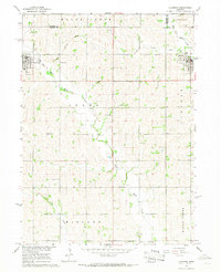
 1966 West Point NE1967 Print · USGSCuming and Burt Counties were defined by a grid of family farms and local school districts during the mid-sixties. Researchers can locate vanished rural landmarks like Townhall, School No 32, and St Josephs Cem across the Neligh and Everett townships.
 - 1966 Map of Scribner, 1967 Print
 1966 Scribner1967 Print · USGSDodge County and the Elkhorn River valley are seen here in the mid-1960s, showing a landscape defined by riverside settlements and the rail corridor. Genealogists can trace rural life through numbered schoolhouses like School No 24, Trinity Ch, and the Scribner Municipal Cem.
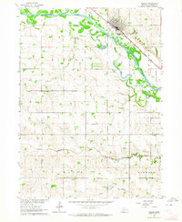
 - 1966 Map of West Point, 1968 Print
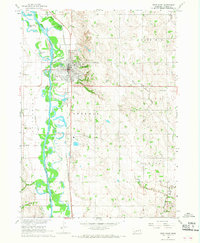 1966 West Point1968 Print · USGSMid-century Cuming County is captured here as the Chicago and North Western railway and Elkhorn River shape the growth of West Point. Researchers can trace rural landmarks from School No 10 to family burial sites at Mt Hope Cem.2 unique versions available
 - 1966 Map of Clarkson, 1968 Print
 1966 Clarkson1968 Print · USGSEastern Colfax County comes into focus in the mid-sixties, showing the settled prairie at a time of rural stability. Researchers can trace the Railroad Grade, locate old schoolhouses like School No 48, and find family sites near Heun.
 - 1966 Map of Bancroft, 1968 Print
 1966 Bancroft1968 Print · USGSBancroft and Rosalie are captured at the edge of the Omaha Indian Reservation in the mid-sixties. Genealogists and local historians can trace rural school locations like School No 10 and School No 72 or the path of the Chicago Burlington and Quincy rail line.
 - 1966 Map of Stanton SE, 1968 Print
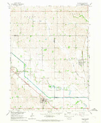
 1966 Stanton SE1968 Print · USGSStanton and Cuming Counties are shown during the mid-sixties as a network of creek-bottom farms and rural school districts. Genealogists can trace family footprints through sites like St Johns Ch, School No 51, and the Cem in the Bismarck area.
 - 1966 Map of Altona SE, 1968 Print
 1966 Altona SE1968 Print · USGSNortheast Nebraska in the mid-1960s shows a landscape defined by township lines and tribal boundaries across Wayne and Cuming counties. Genealogists can trace rural family sites near St Peters Ch and historic one-room schoolhouses like School No 4 and School No 66.
 - 1966 Map of Dodge, 1968 Print
 1966 Dodge1968 Print · USGSNortheastern Nebraska farming country is documented here in the mid-sixties, centered on the communities of Dodge and Howells. Genealogists can locate family landmarks like SS Peter & Paul Cem, Tabor Cem, and Sacred Heart Ch.
 - 1966 Map of Pender, 1968 Print
 1966 Pender1968 Print · USGSThurston County’s agricultural heartland and the Omaha Indian Reservation are captured here in the mid-1960s. Genealogists and local historians can trace rural roots through numerous schoolhouses like School No 53 and family landmarks such as Rosehill Cem.
End of results
Showing maps 1-20 of 20
Top cities of Cuming County
- West Point historical maps
- Wisner historical maps
- Beemer historical maps
- Bancroft historical maps
- Monterey historical maps
Frequently asked questions
- What are the different types of historical maps available for Cuming County?
- What is the oldest map of Cuming County?
- Where can I purchase historical maps of Cuming County for my home or office?
- Where can I download high-res historical maps of Cuming County?
- Are there historical topographic maps available for Cuming County?
- Is there historical aerial imagery available for Cuming County?
- Where are historical maps of Cuming County sourced from?