1980s Maps of Custer County, Nebraska
Explore 10 historic maps of Custer County from the 1980s. These maps offer a rare glimpse into what life looked like during the 1980s — showing old roads, neighborhoods, homes, and landmarks that have changed or disappeared over time.
Whether you're researching your family's past, planning a metal detecting trip, or studying how Custer County's landscape evolved across the 1980s, these high-resolution maps are a powerful tool for exploring the history of this region.
- Focus on a specific era: All maps on this page are from the 1980s, giving you a focused view of this time period.
- See what’s changed: Compare century-old streets, trails, and buildings to today's modern landscape using overlays and satellite layers.
- Research with precision: Use these maps for genealogy, historical research, land use analysis, or educational projects.
- View, download, or print: Maps are fully viewable online in high resolution, and can be downloaded or printed for your own records.
Start exploring Custer County's history through authentic maps from the 1980s. This is your window into the past.
Custer County, NE maps
(10)- 1985 Map of North Platte
 1985 North Platte1985 Print · USGSThe Platte River valley in the mid-1980s reveals a landscape of massive rail yards and vital irrigation works. Trace the Union Pacific lines through North Platte or locate family sites near Stapleton, Gandy, and Fort Mc Pherson National Cemetery.2 unique versions available
 - 1985 Map of Dismal River
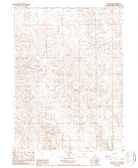
 1985 Dismal River1985 Print · USGSCentral Nebraska's sandhills and river valleys are captured here during the mid-1980s, showing a landscape defined by the Burlington Northern railroad. Researchers can trace rural settlement patterns through places like Thedford and Dunning or find family landmarks at Shimmins Lake and Shanklin Bluff.2 unique versions available
 - 1985 Map of Broken Bow
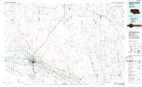
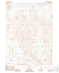
 1985 Broken Bow1985 Print · USGSCuster County in the mid-1980s displays a landscape of high tablelands and river valleys shaped by the reach of the railroad. Genealogists and researchers can trace the old rail stops along Mud Creek, from Berwyn to Litchfield, or locate land near Redfern Table and West Table.2 unique versions available
 - 1985 Map of Burwell
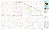
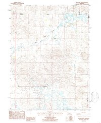
 1985 Burwell1985 Print · USGSCentral Nebraska in the mid-eighties reveals a landscape shaped by the Middle Loup River and the Burlington Northern rail line. Researchers can trace the layout of small towns like Sargent, Anselmo, and Burwell or locate New Helena and Victoria Springs State Recreation Area.
 - 1986 Map of Linscott NW
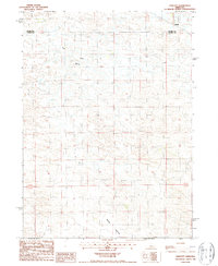
 1986 Linscott NW1986 Print · USGSThe Nebraska Sandhills near the border of Blaine and Custer counties are captured in the mid-1980s, showing a vast ranching landscape. Researchers can locate remote cattle infrastructure such as a Corral and follow the headwaters of Wild Horse Creek.
 - 1986 Map of Hoagland NE
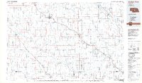
 1986 Hoagland NE1986 Print · USGSThe ranching country of central Nebraska is captured here in the mid-1980s, where the Logan County line meets Thomas and Blaine counties. Researchers can trace the heritage of local homesteads like McGooden Ranch and Schmidt Ranch across the Wild Horse Flats.
 - 1986 Map of Hoagland, 1987 Print
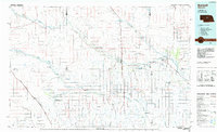
 1986 Hoagland1987 Print · USGSThe Nebraska Sandhills come into focus in the mid-1980s as ranching life centers around the South Fork Loup River. Genealogists and local historians can trace the precise locations of family operations like Collier Ranch, Stewart Ranch, and the settlement at Hoagland.
 - 1986 Map of Linscott, 1987 Print
 1986 Linscott1987 Print · USGSThe Nebraska Sandhills come into focus during the mid-1980s, detailing a remote ranching landscape along the Custer and Blaine county line. Researchers can locate the Linscott settlement area and trace the path of Rifle Creek near the McGinn Landing Strip.
 - 1986 Map of Linscott SW, 1987 Print
 1986 Linscott SW1987 Print · USGSCuster County, Nebraska, is documented in the mid-1980s just as modern surveying techniques were refining the mapping of the Sandhills. Researchers can locate land features like Judkins Table and site-specific ranching markers such as a Corral.
 - 1986 Map of Linscott SE, 1987 Print
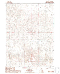 1986 Linscott SE1987 Print · USGSCuster County in the mid-1980s reveals a sparse but functional landscape of ranching and natural drainage. Genealogists and researchers can trace the contours of Sand Valley or locate a historical Well and the seasonal path of Dry Creek.
End of results
Showing maps 1-10 of 10
Top cities of Custer County
- Broken Bow historical maps
- Arnold historical maps
- Callaway historical maps
- Sargent historical maps
- Ansley historical maps
- Merna historical maps
See more
Frequently asked questions
- What are the different types of historical maps available for Custer County?
- What is the oldest map of Custer County?
- Where can I purchase historical maps of Custer County for my home or office?
- Where can I download high-res historical maps of Custer County?
- Are there historical topographic maps available for Custer County?
- Is there historical aerial imagery available for Custer County?
- Where are historical maps of Custer County sourced from?