1970s Maps of Custer County, Nebraska
Explore 10 historic maps of Custer County from the 1970s. These maps offer a rare glimpse into what life looked like during the 1970s — showing old roads, neighborhoods, homes, and landmarks that have changed or disappeared over time.
Whether you're researching your family's past, planning a metal detecting trip, or studying how Custer County's landscape evolved across the 1970s, these high-resolution maps are a powerful tool for exploring the history of this region.
- Focus on a specific era: All maps on this page are from the 1970s, giving you a focused view of this time period.
- See what’s changed: Compare century-old streets, trails, and buildings to today's modern landscape using overlays and satellite layers.
- Research with precision: Use these maps for genealogy, historical research, land use analysis, or educational projects.
- View, download, or print: Maps are fully viewable online in high resolution, and can be downloaded or printed for your own records.
Start exploring Custer County's history through authentic maps from the 1970s. This is your window into the past.
Custer County, NE maps
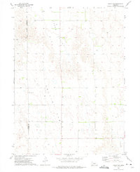
(10)- 1972 Map of Davenport Table, 1975 Print
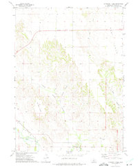 1972 Davenport Table1975 Print · USGSCuster County ranching and rail transport are captured here in the early seventies as the upland plateaus meet the river valley. Genealogists and local historians can trace the Union Pacific line near Wilhelm Cem and the settlement at Pleasant Hill.
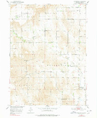
 - 1972 Map of Odencranze Table South, 1975 Print
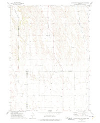 1972 Odencranze Table South1975 Print · USGSCuster County's high tablelands and deep valleys are documented in the early seventies as three Nebraska counties meet at this rural junction. Researchers can locate remote landmarks like Swedish Grove Cem, Linburg Cem, and School No 284 among the draws of Buffalo Creek.
 - 1972 Map of Murphy Table, 1975 Print
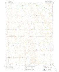 1972 Murphy Table1975 Print · USGSCuster County in the early seventies shows a landscape of expansive prairie tables and river valleys. Researchers can trace the Union Pacific corridor through Finchville and Milldale, or locate the Sand Valley Cem near Stop Table.
 - 1972 Map of Logan, 1975 Print
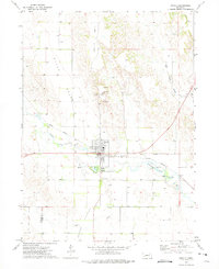
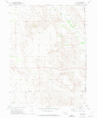 1972 Logan1975 Print · USGSCentral Nebraska rangeland and river valley life are captured here in the early 1970s. Trace the path of the Union Pacific rail line past Logan or locate rural landmarks like Garfield Ch and the high point at Kings Hill.
 - 1972 Map of Arnold, 1975 Print
 1972 Arnold1975 Print · USGSArnold and the South Loup River valley are captured in the early 1970s during a period of established rail and river reliance. Genealogists and local historians can locate Arnold Cem and Powell Canyon Cem or trace the Union Pacific rail line as it cuts through the prairie.
 - 1972 Map of Odencranze Table North, 1975 Print
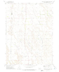 1972 Odencranze Table North1975 Print · USGSCuster and Lincoln counties appear here in the early 1970s, showing the high tablelands and rural cattle country of central Nebraska. Genealogists can locate family landmarks such as School No 153, Tallin Ch, and the small community of Etna.
 - 1972 Map of Roten Valley North, 1975 Print
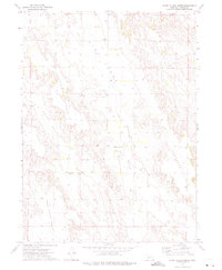 1972 Roten Valley North1975 Print · USGSCuster County ranching country is captured in the early seventies, showing the distinct plateau-and-valley geography of central Nebraska. Researchers can locate remote community markers like Morning Star Ch, Stop Table Cem, and Stump Ditch.
 - 1972 Map of Roten Valley South, 1975 Print
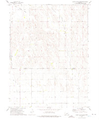 1972 Roten Valley South1975 Print · USGSCuster and Dawson counties in the early 1970s reveal a landscape of high tablelands and strategic water management. Genealogists and researchers can trace the agricultural footprint of the era through features like the Rock Island Table, Stump Ditch, and Buffalo Creek.
 - 1972 Map of Arnold SW, 1975 Print
 1972 Arnold SW1975 Print · USGSThe high plains of the Nebraska borderlands between Lincoln and Custer counties are captured here in the early 1970s. Researchers can locate remote community landmarks like the Tallin Sch, Kilmer Valley Cem, and the broad expanse of Tallin Table.
 - 1974 Map of Westerville, 1978 Print
 1974 Westerville1978 Print · USGSCuster County ranchlands and township centers are captured here during the mid-twentieth century as part of the Missouri River Basin development program. Genealogists can trace family footprints across numerous local sites like Westerville Cem, Pederson Ranch, and Allen Sch.
End of results
Showing maps 1-10 of 10
Top cities of Custer County
- Broken Bow historical maps
- Arnold historical maps
- Callaway historical maps
- Sargent historical maps
- Ansley historical maps
- Merna historical maps
See more
Frequently asked questions
- What are the different types of historical maps available for Custer County?
- What is the oldest map of Custer County?
- Where can I purchase historical maps of Custer County for my home or office?
- Where can I download high-res historical maps of Custer County?
- Are there historical topographic maps available for Custer County?
- Is there historical aerial imagery available for Custer County?
- Where are historical maps of Custer County sourced from?