2020s Maps of Lexington, Nebraska
Explore 3 historic maps of Lexington from the 2020s. These maps offer a rare glimpse into what life looked like during the 2020s — showing old roads, neighborhoods, homes, and landmarks that have changed or disappeared over time.
Whether you're researching your family's past, planning a metal detecting trip, or studying how Lexington's landscape evolved across the 2020s, these high-resolution maps are a powerful tool for exploring the history of this region.
- Focus on a specific era: All maps on this page are from the 2020s, giving you a focused view of this time period.
- See what’s changed: Compare century-old streets, trails, and buildings to today's modern landscape using overlays and satellite layers.
- Research with precision: Use these maps for genealogy, historical research, land use analysis, or educational projects.
- View, download, or print: Maps are fully viewable online in high resolution, and can be downloaded or printed for your own records.
Start exploring Lexington's history through authentic maps from the 2020s. This is your window into the past.
Lexington, NE maps
(3)- 2021 Map of Lexington East, 2021 Print
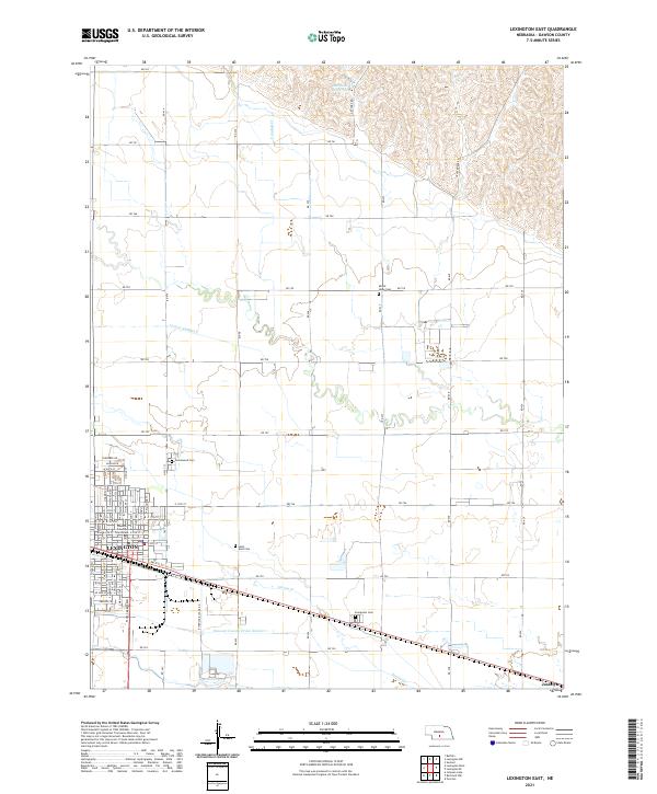 2021 Lexington East2021 Print · USGSThe Platte River valley in central Nebraska reveals its agricultural and civic character in the early 2020s. Researchers can locate family sites at Greenwood Cem or Evergreen Cem and trace irrigation routes like Lateral Number 2 near Lexington.
 - 2021 Map of Lexington West, 2021 Print
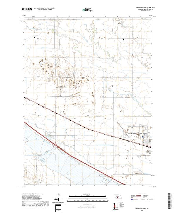 2021 Lexington West2021 Print · USGSDawson County agriculture and the western expansion of Lexington are documented in this recent survey of the Platte River Valley. Researchers can trace irrigation networks like the Cozad Canal or locate family sites at Grace Cem and Hewitt Cem.
 - 2021 Map of Bertrand NW, 2021 Print
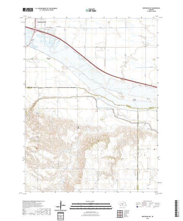 2021 Bertrand NW2021 Print · USGSThe braided Platte River dominates this Gosper and Dawson County borderland in the early twenty-first century. Researchers can trace the Phelps County Canal and Phillippi Reservoir or find local landmarks like Robb Cem and Jeffreys Island.
End of results
Showing maps 1-3 of 3
Top cities near Lexington
- Cozad historical maps
- Elwood historical maps
- Overton historical maps
- Westmark historical maps
- Smithfield historical maps
Top neighborhoods of Lexington
Frequently asked questions
- What are the different types of historical maps available for Lexington?
- What is the oldest map of Lexington?
- Where can I purchase historical maps of Lexington for my home or office?
- Where can I download high-res historical maps of Lexington?
- Are there historical topographic maps available for Lexington?
- Is there historical aerial imagery available for Lexington?
- Where are historical maps of Lexington sourced from?